“The whole range, seen from the plain, with the hot sun beating upon its southern slopes, wears a terribly forbidding aspect. There is nothing of the grandeur of snow, or glaciers, or deep forests, to excite curiosity or adventure; no trace of gardens or waterfalls. From base to summit all seems gray, barren, silent — dead, bleached bones of mountains, overgrown with scrubby bushes, like gray moss. But all mountains are full of hidden beauty” -John Muir (1918). Chapter 11: The San Gabriels. In Steep Trails.
Installment No. 3 of My PCT Journey
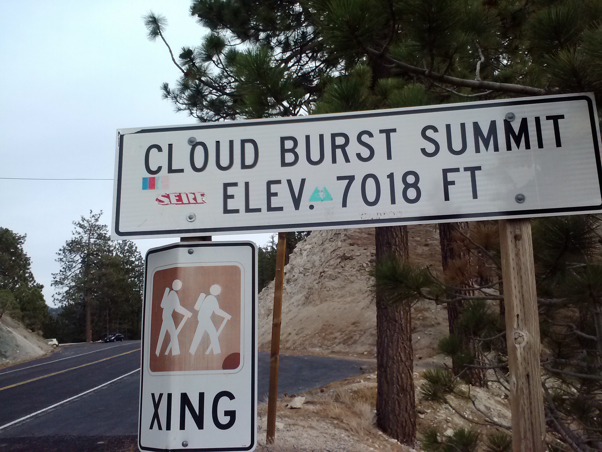
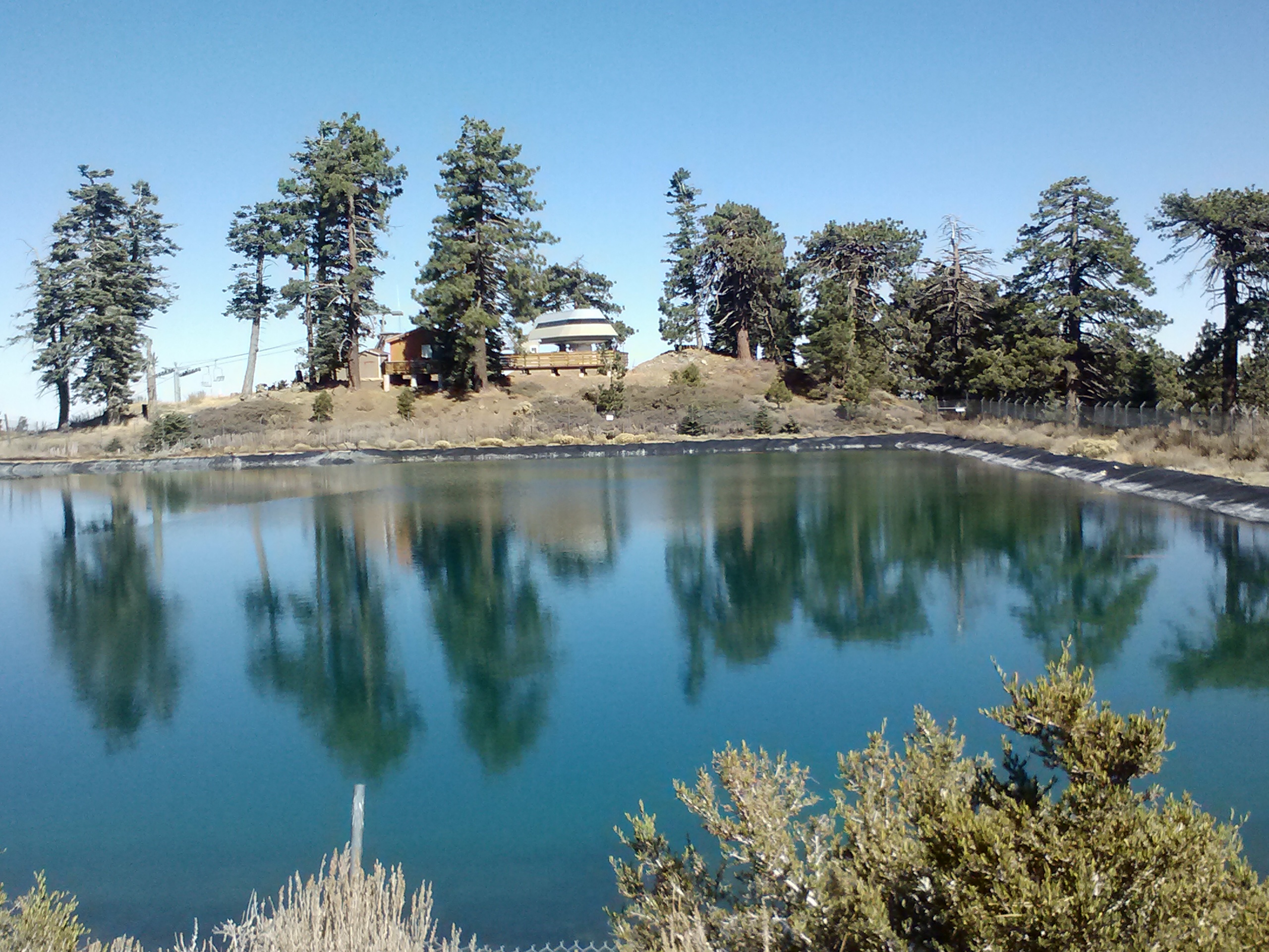
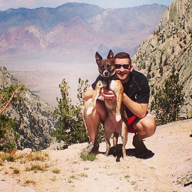
No. 3- Mill Creek Station to Cloudburst Summit, 2013
loading map - please wait...
Cloudburst Summit: 34.351391, -117.934735
Mill Creek Station: 34.391896, -118.081226
Hill Street Cafe: 34.204211, -118.200406
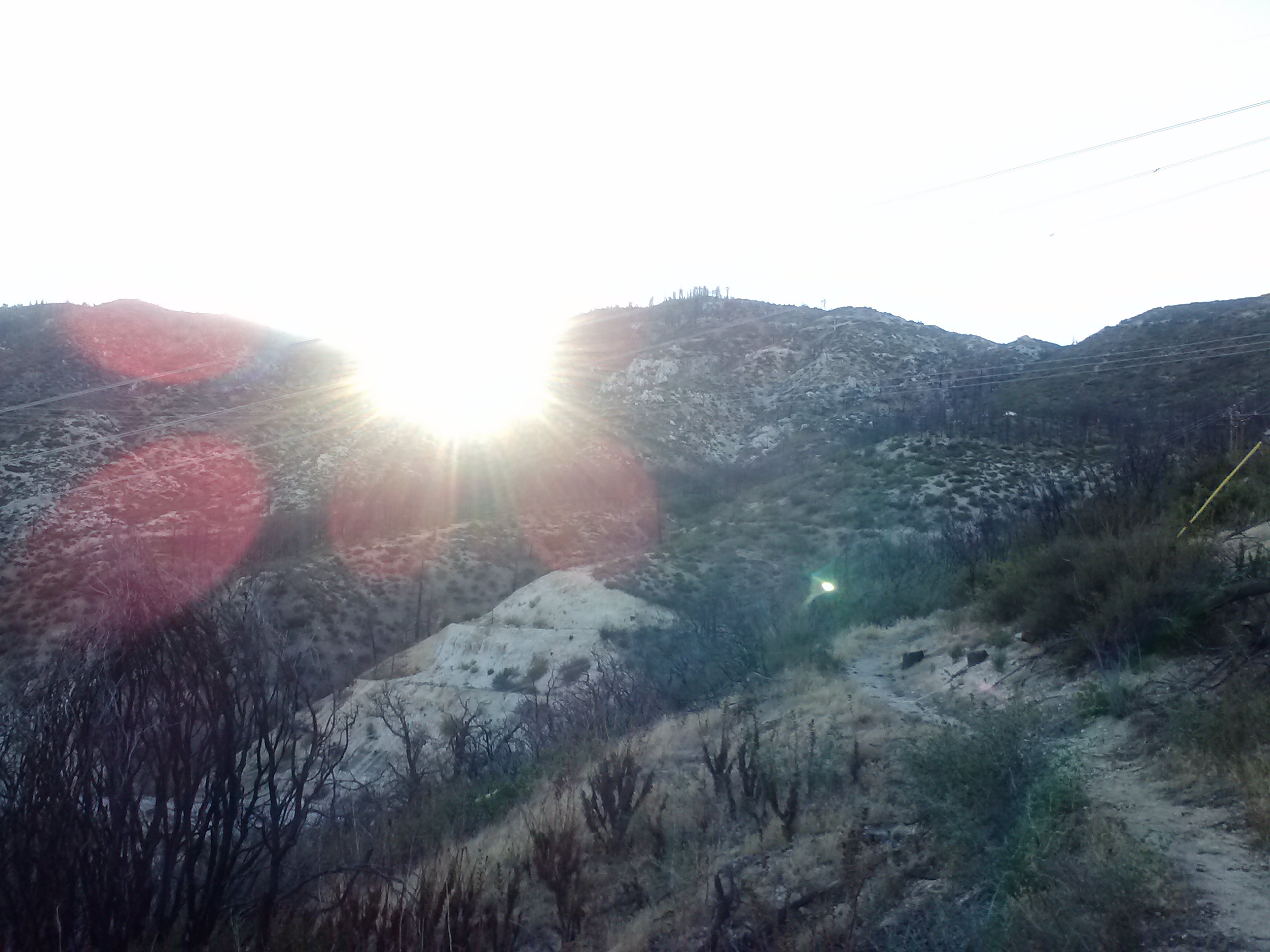
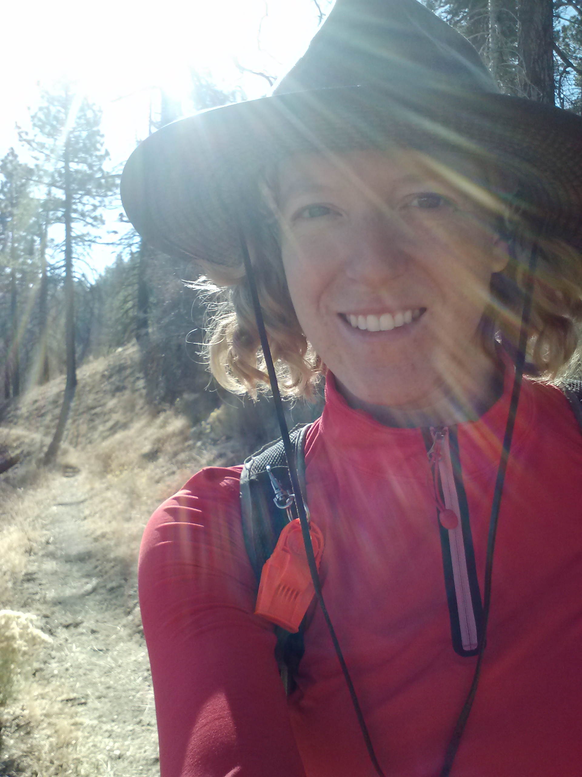
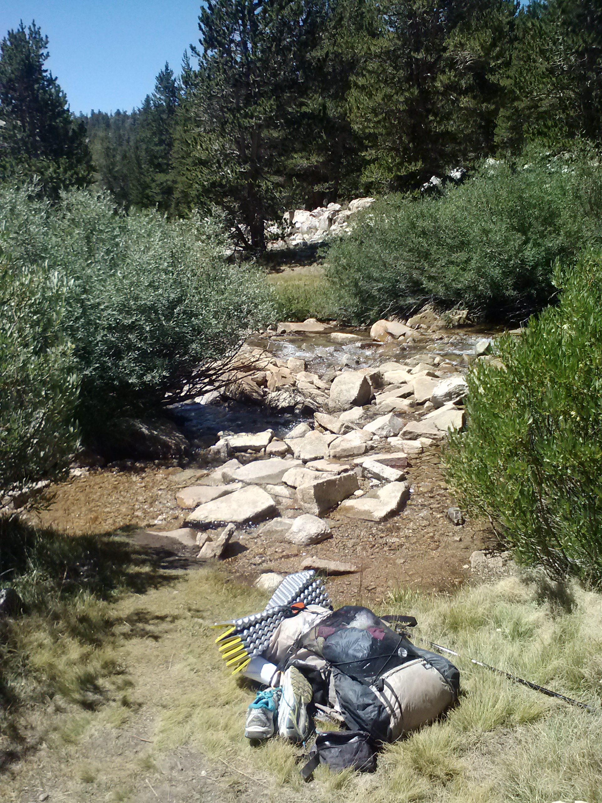
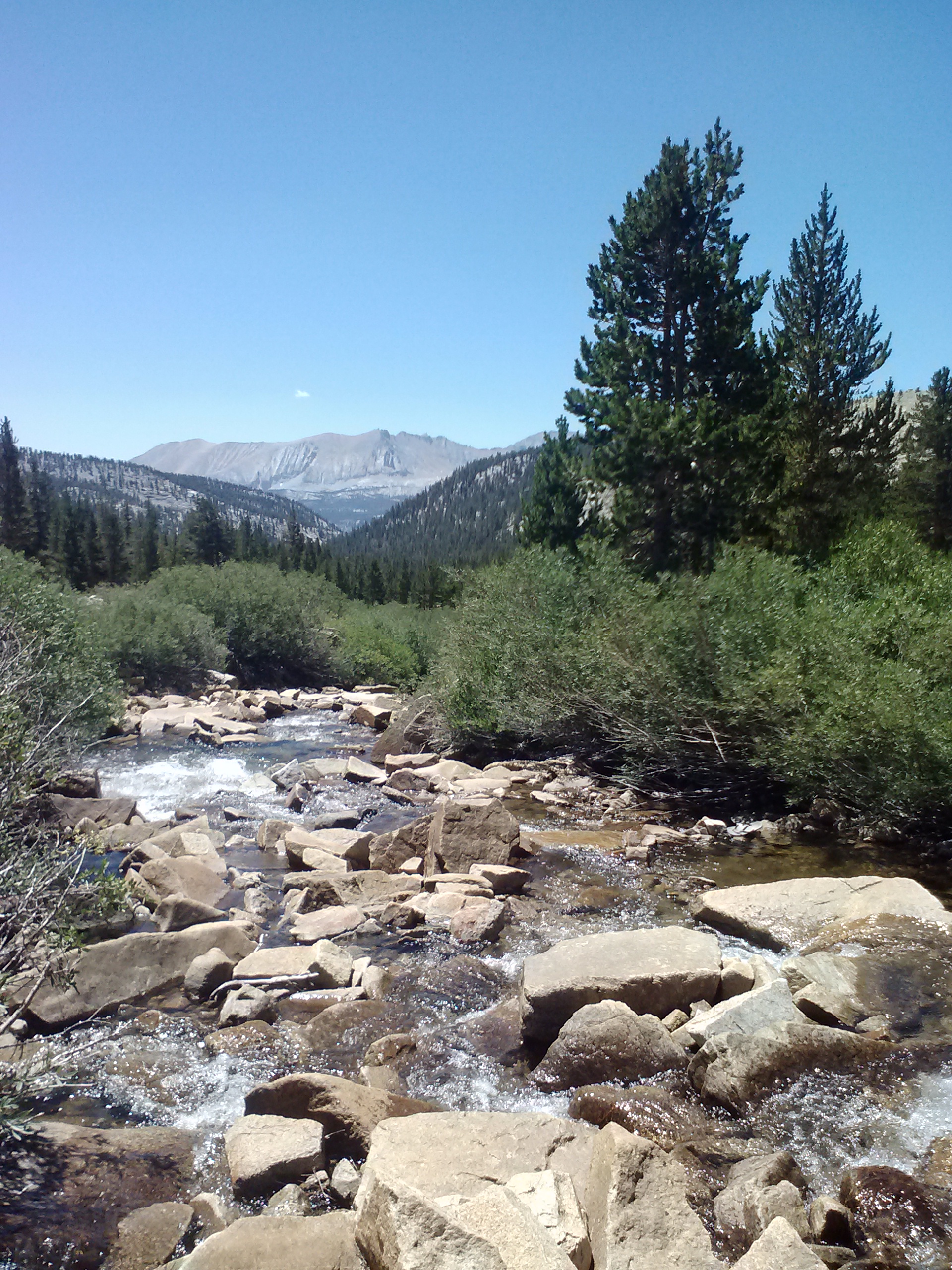
My next PCT journey took me again through Angeles National Forest and Section D of the PCT. This 20.5 mile day hike began with Sabrina, my personal trail angel, shuttling me from Cloudburst Summit down to Mill Creek Summit Station. With so many miles to put in and with daylight savings approaching, I started hiking just as the sun was coming up over the hill. It was beautiful to watch and great to hike in the morning shade.
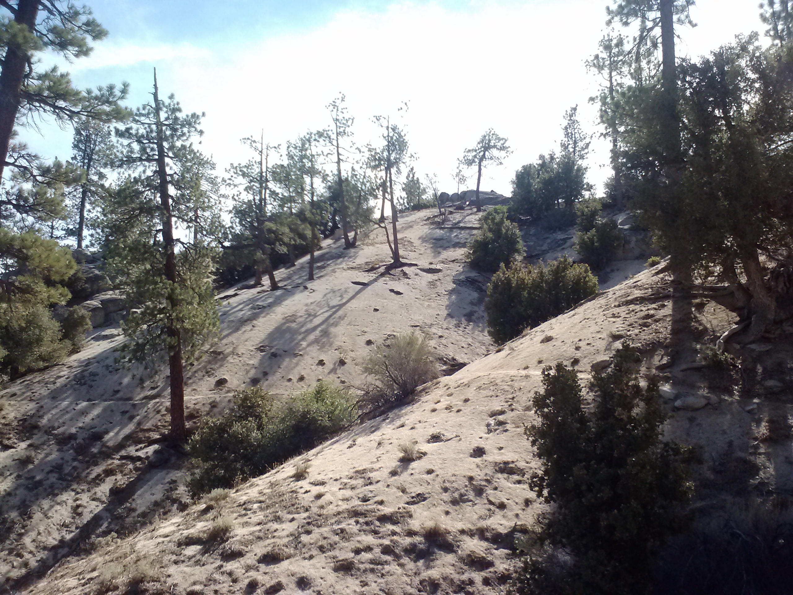
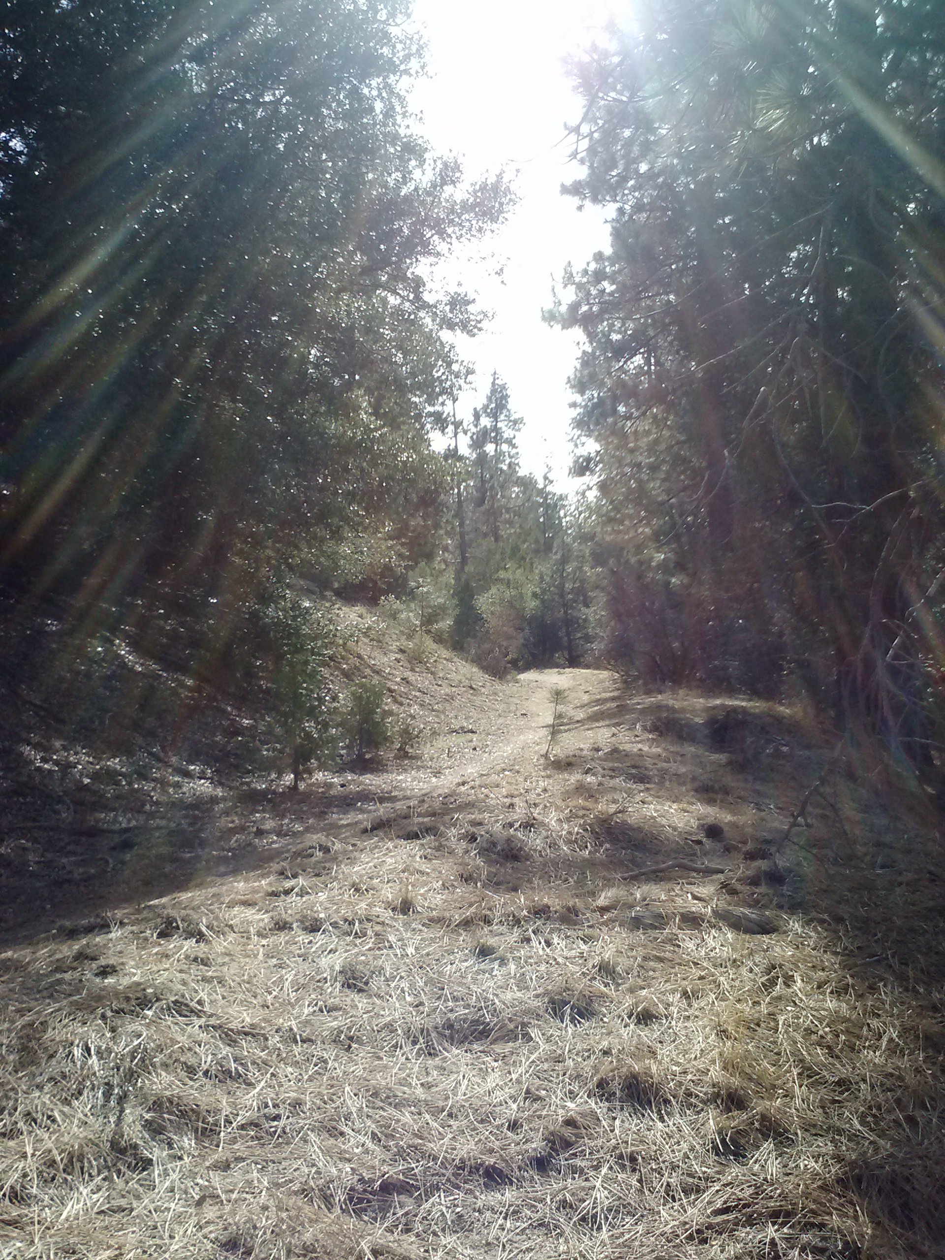
Heading up the trail from Mill Creek Summit Station
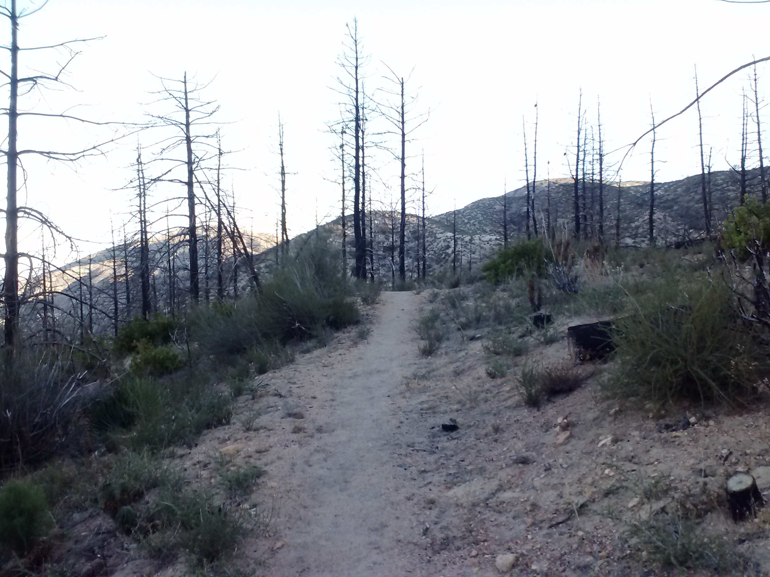
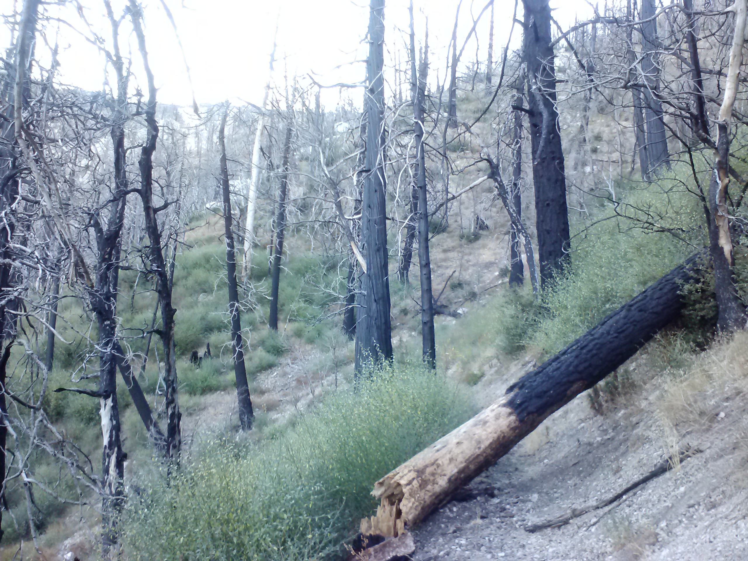
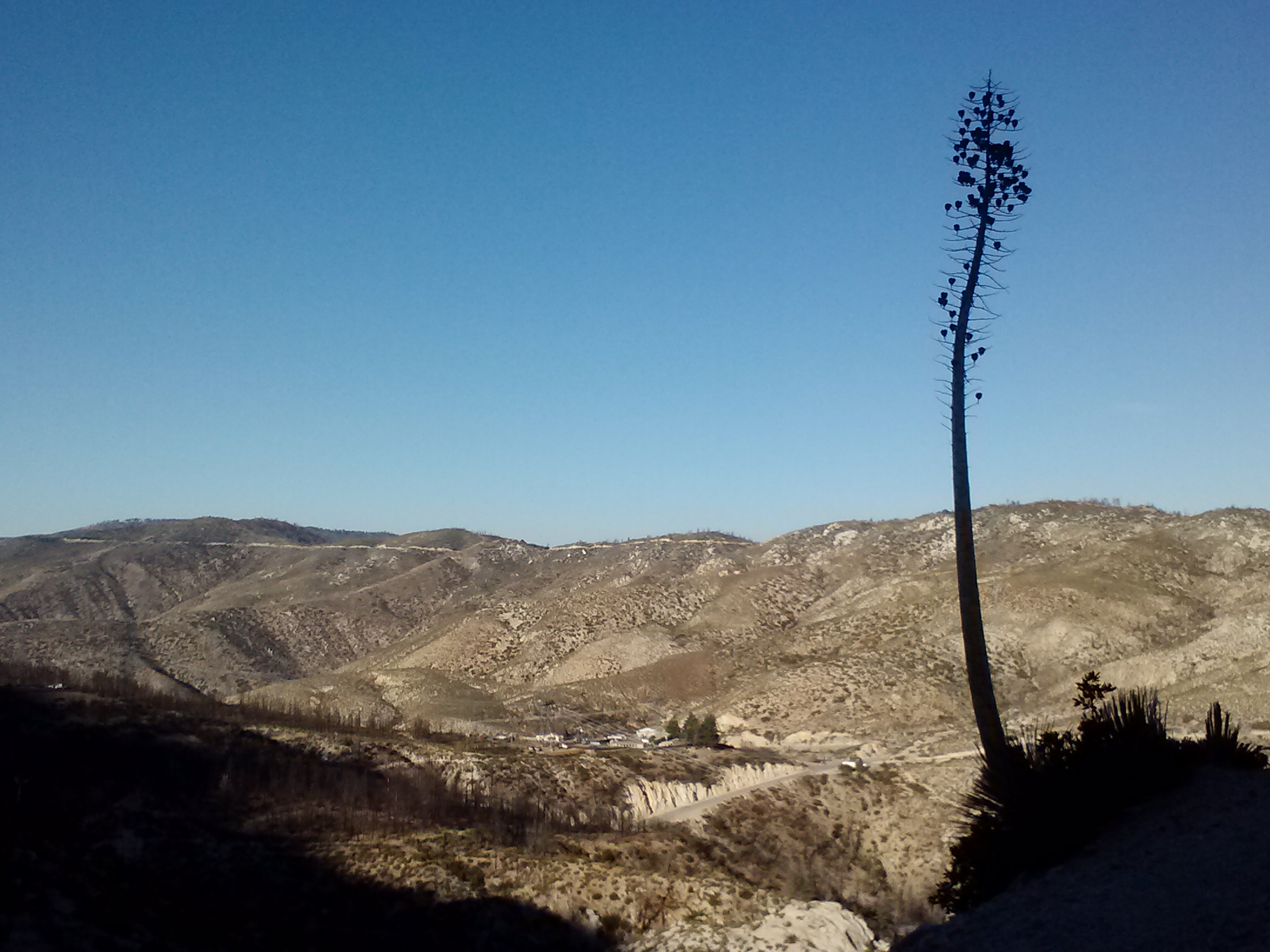
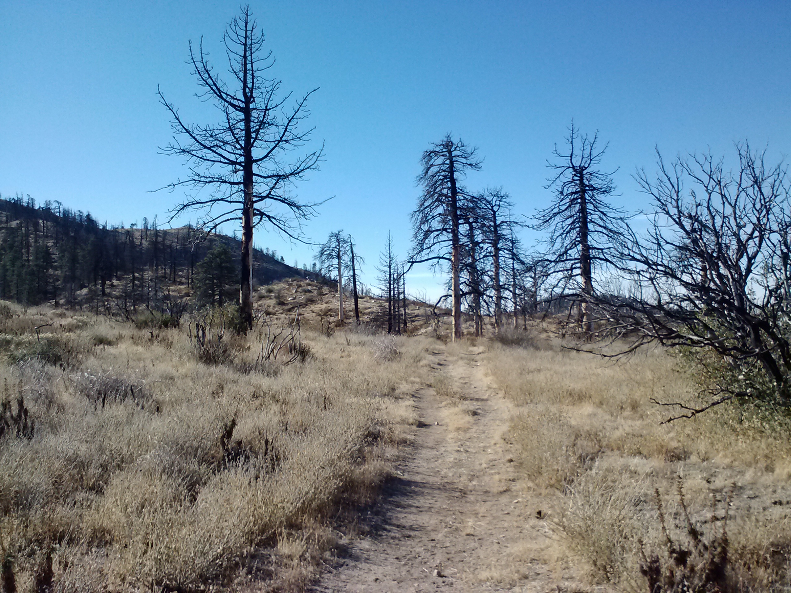
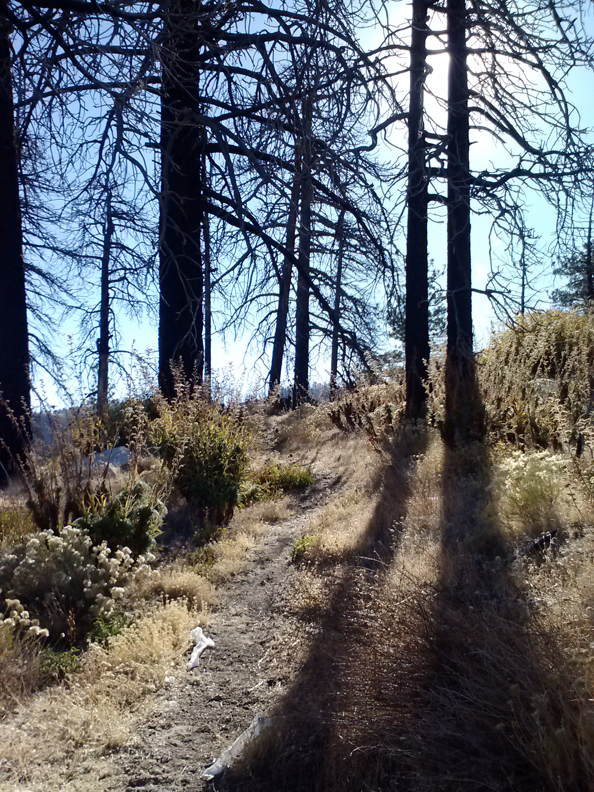
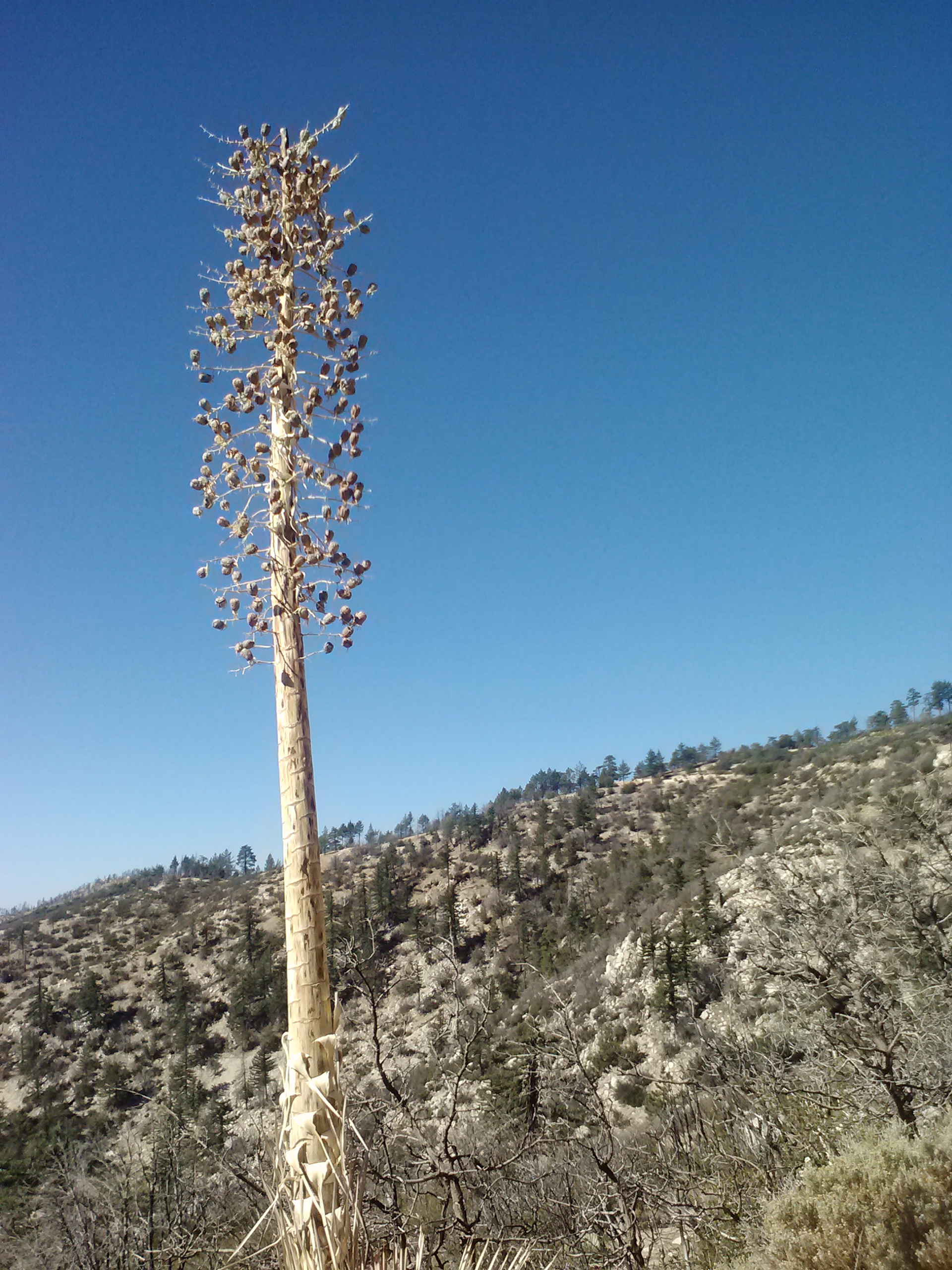
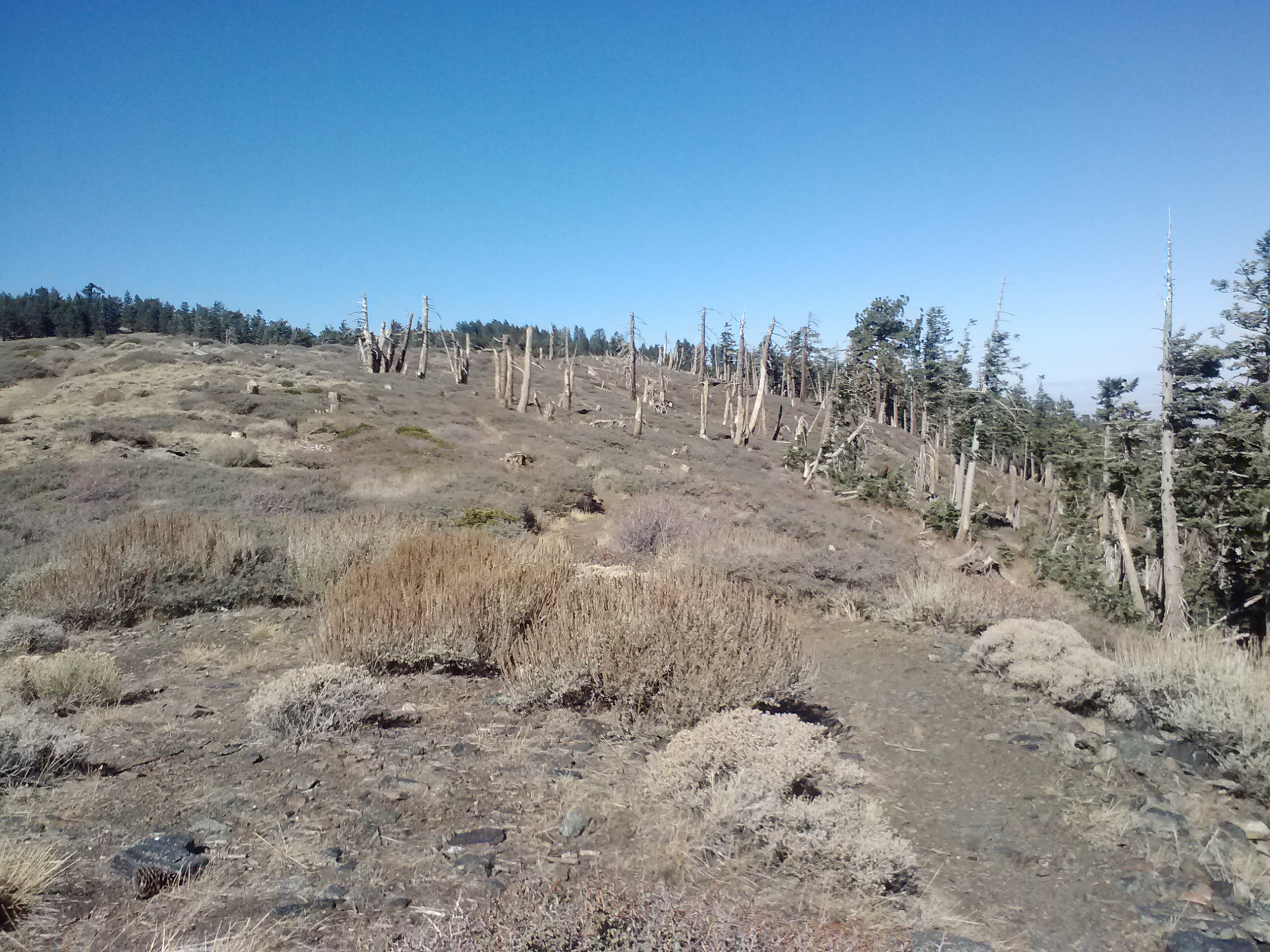
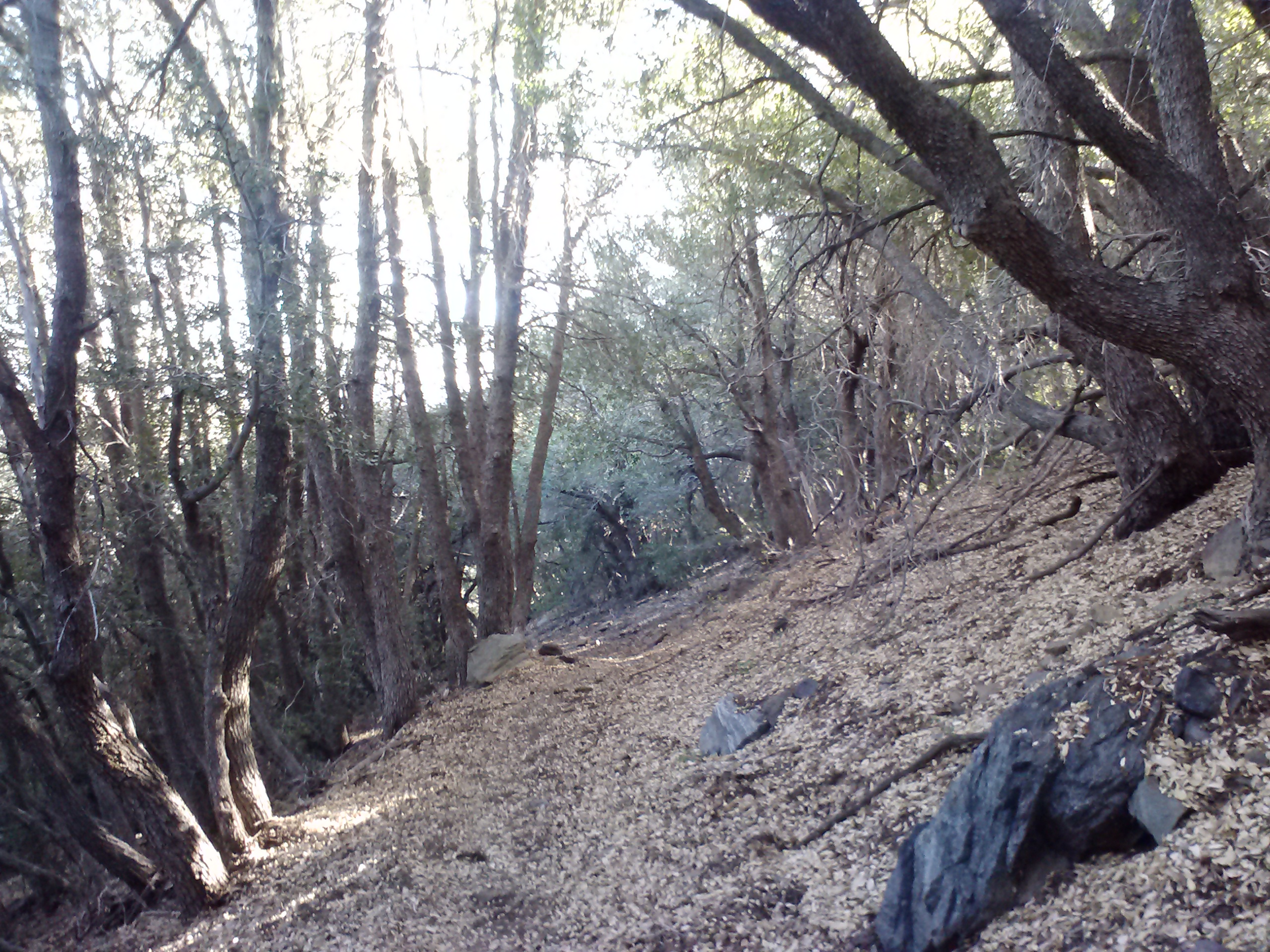
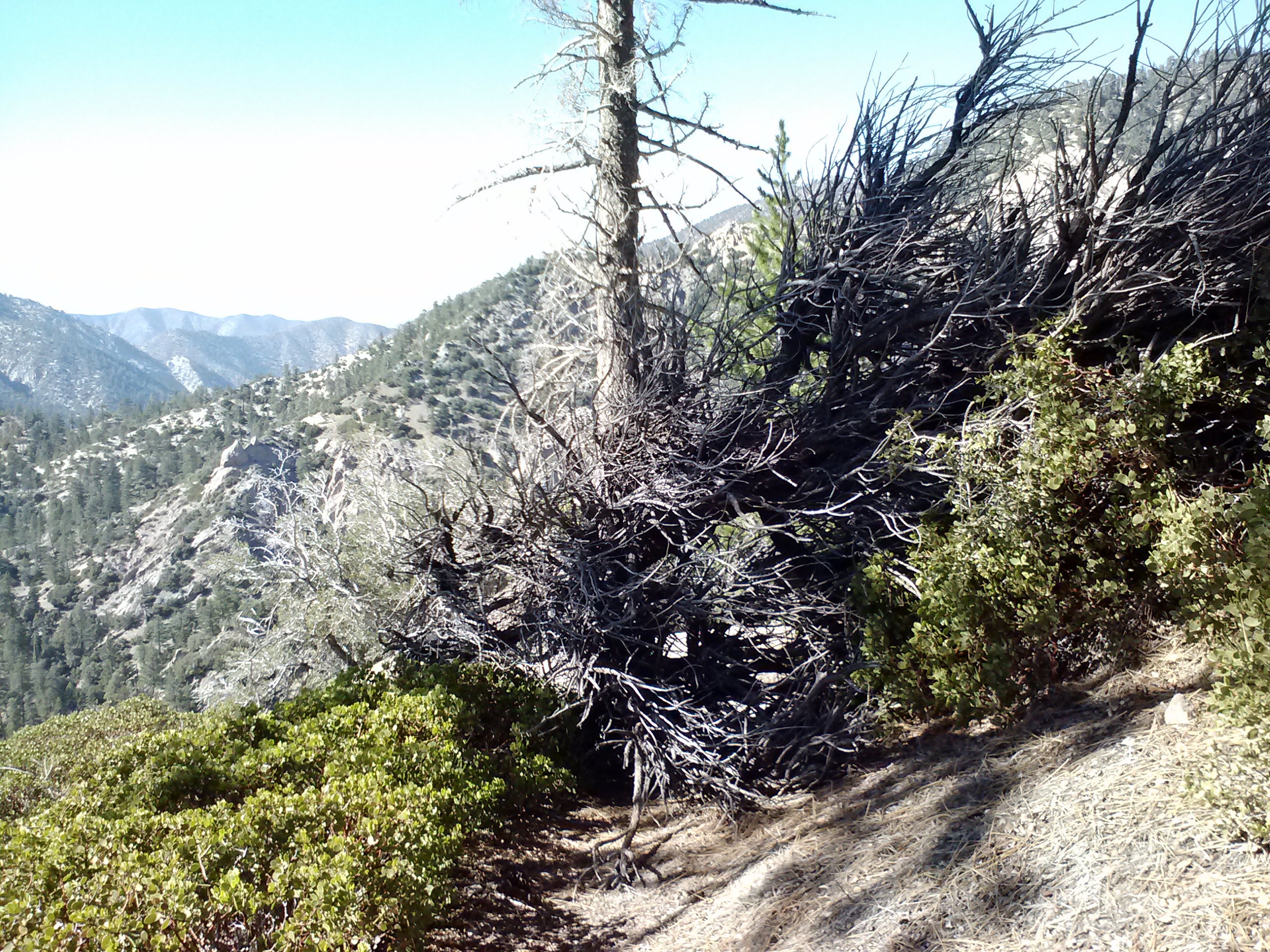
Skeleton trees
Leftover trees from the 2009 Station Fire
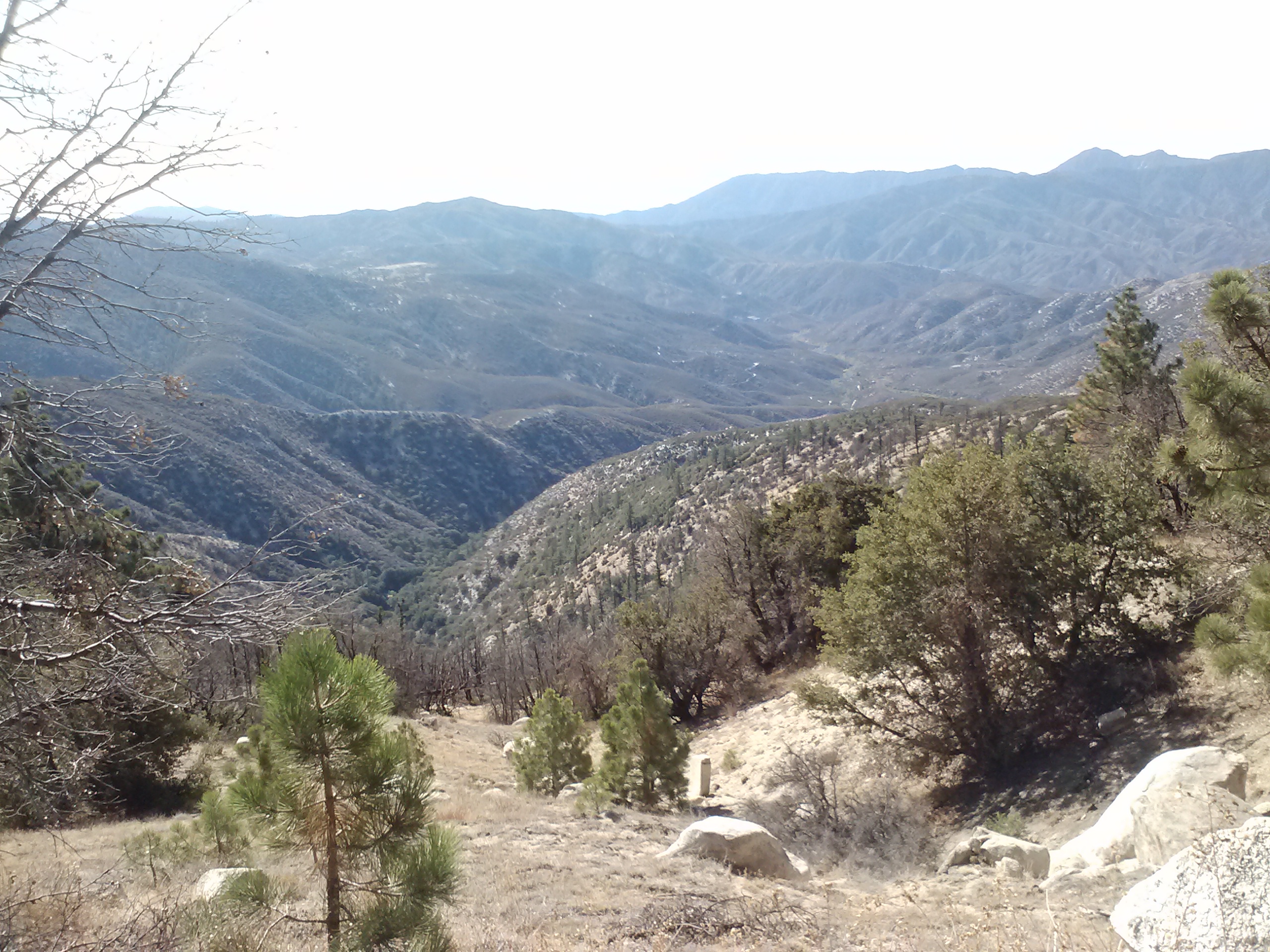
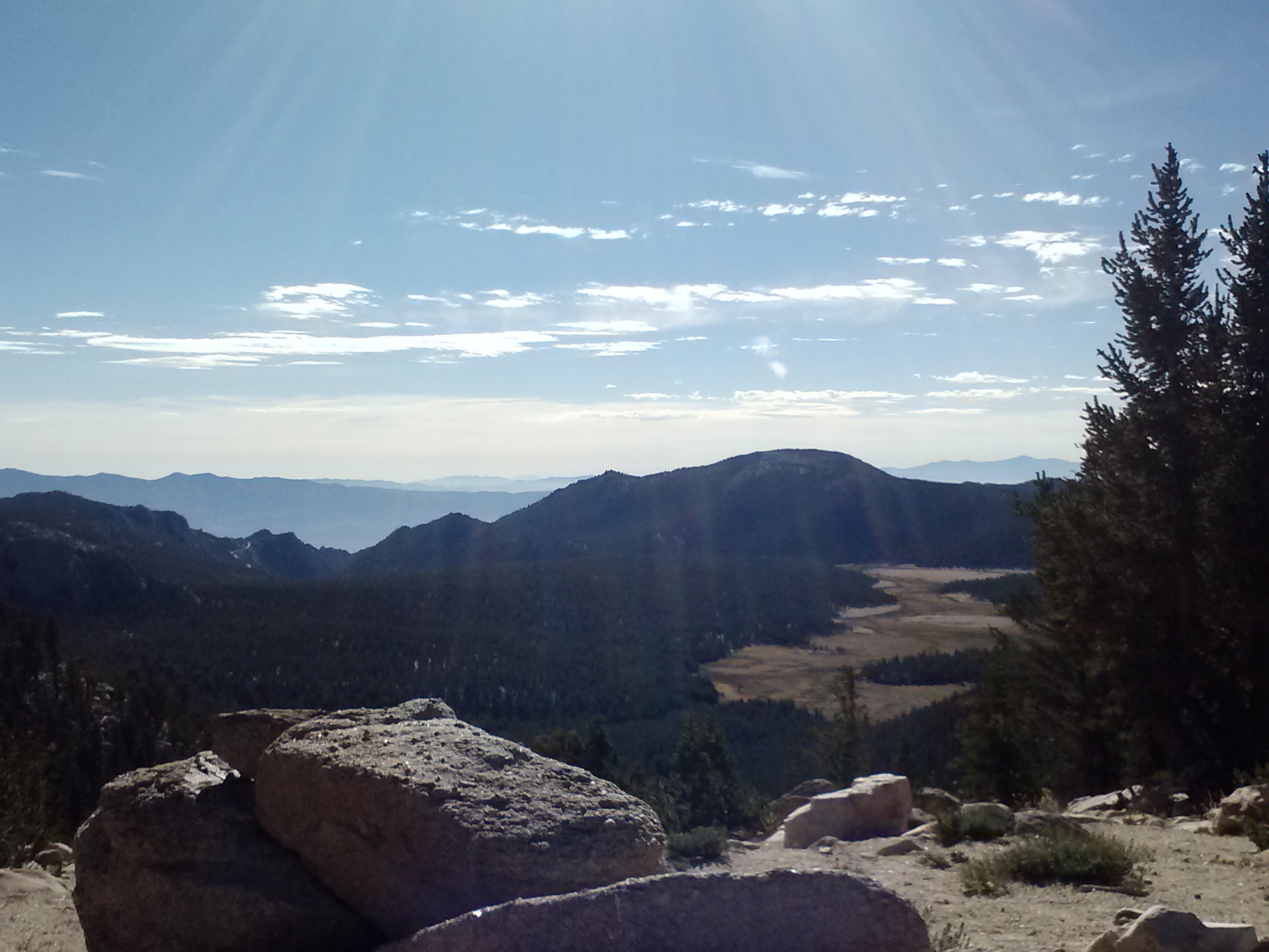
The 2009 Station Fire left this entire area toasted and barren. There were no live trees left, but mother nature moves quickly and the new growth was billowing up around the skeleton pines. The trail climbed slowly, as it would all day, and soon I was able to get views of the valleys below.
Not too far into the hike, I was startled by gun shots and wasn’t really sure if I should be concerned or not about stray bullets hitting me. Luckily, I had worn my red hiking shirt and hoped that’d be enough differeniate me from someone’s potential jerky.
Looking down on Mill Creek Summit Station
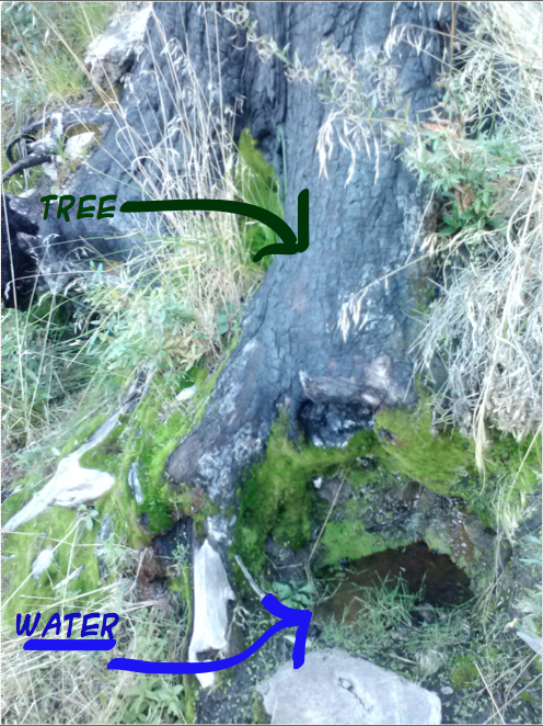
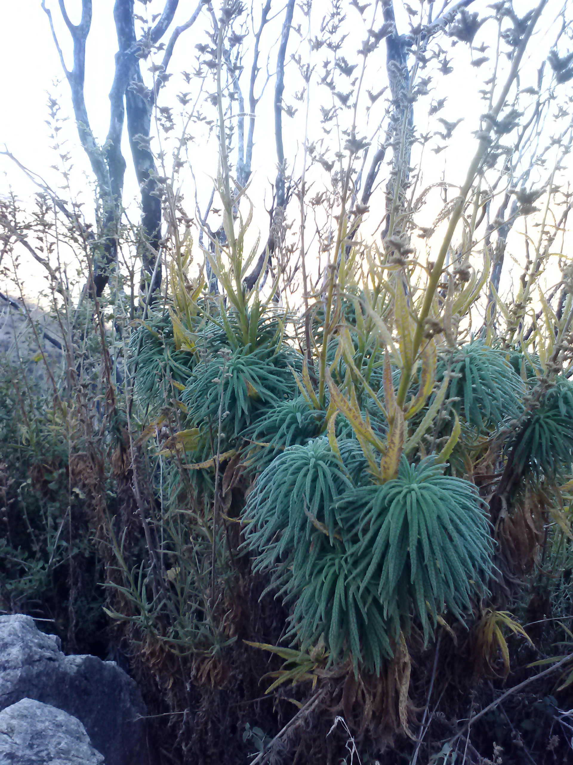
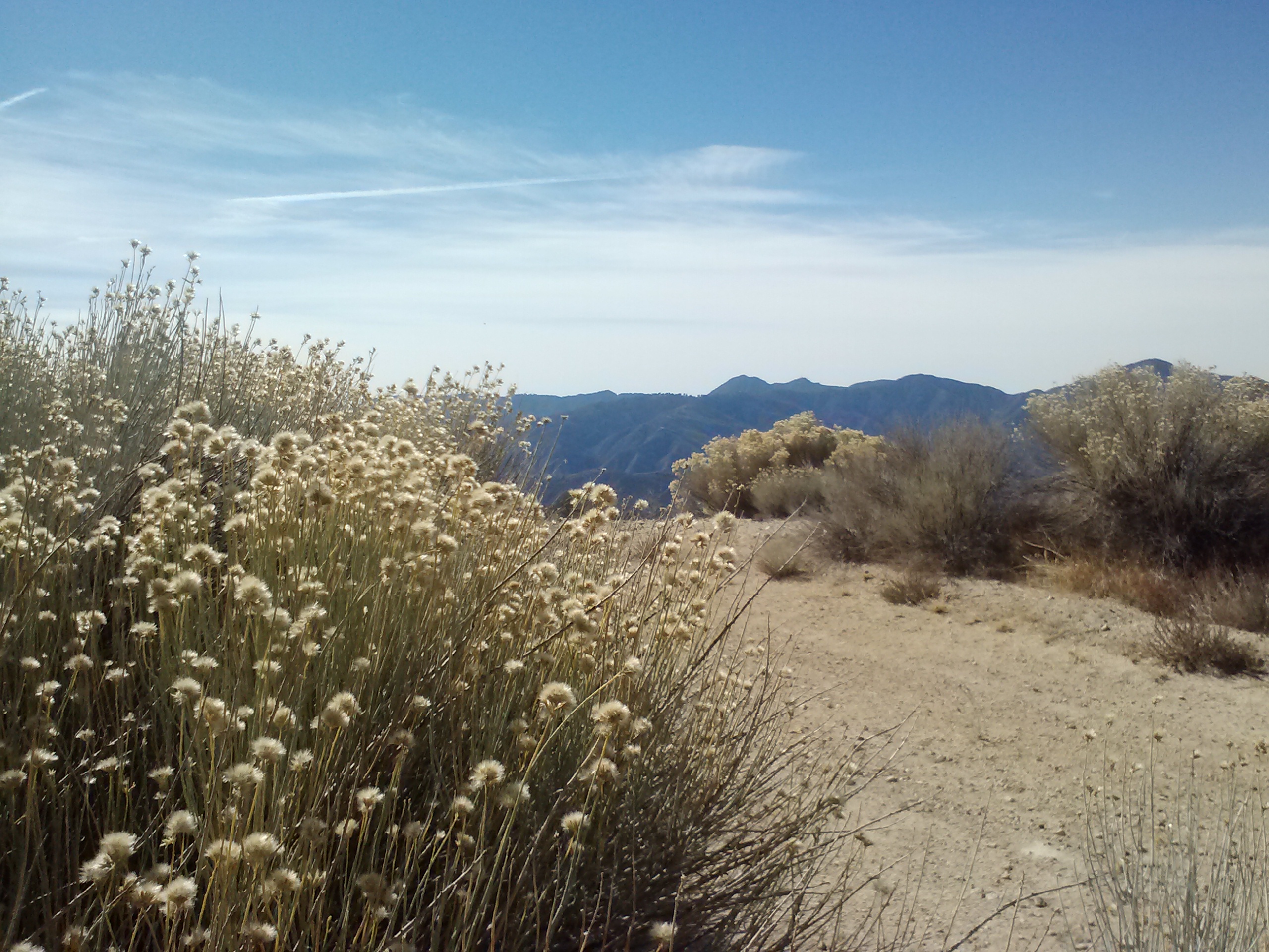
It was a dry, dry desert out there, and yet it had a stark kind of beauty. I really enjoyed the views and the little surprises of nature along the way. I came across a spring emerging directly out of the bottom of a tree and Poodle-dog bush is always entertaining because it looks like something straight out of a Dr. Seuss book. It also has an interesting odor, a bit like beer, and I could usually smell it before I saw it. When I first caught the scent, I thought for sure some hunters had dumped a bunch of beer somewhere. As funny as Poodle-dog bush looks and sounds, it can give you a horrible itchy, sore rash, so avoid it!!
Tree Spring
Poodle-dog Bush
“Not even in the Sierra have I ever made the acquaintance of mountains more rigidly inaccessible. … But in the very heart of this thorny wilderness, down in the dells, you may find gardens filled with the fairest flowers, that any child would love, and unapproachable linns lined with lilies and ferns, where the ousel builds its mossy hut and sings in chorus with the white falling water.” -John Muir (1918). Chapter 11: The San Gabriels. In Steep Trails.
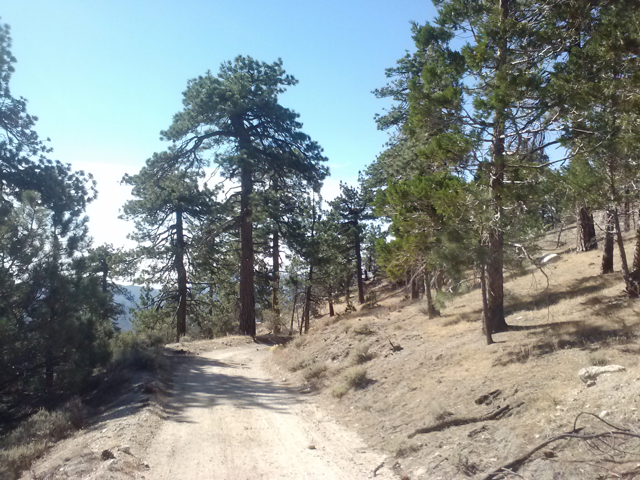
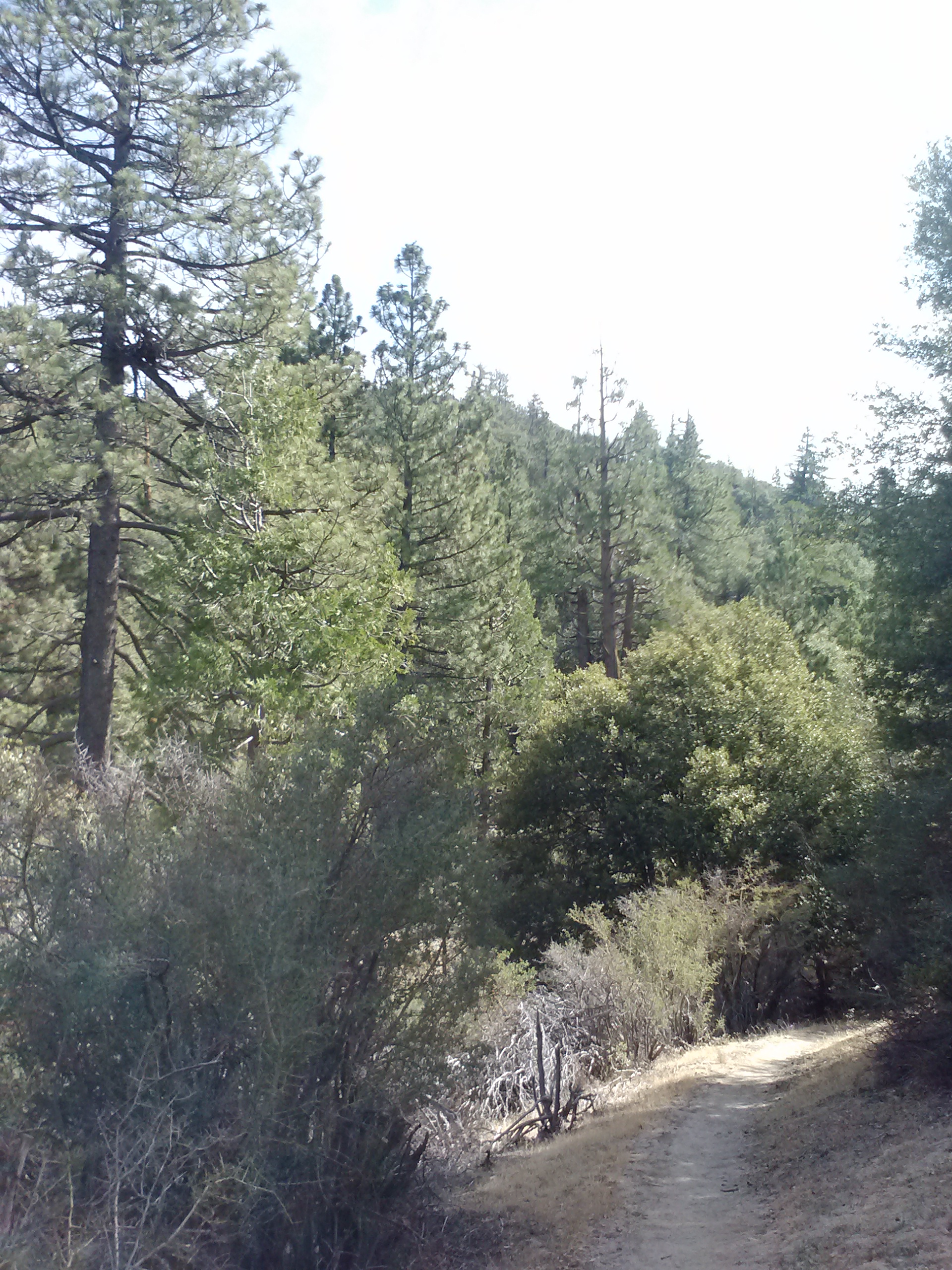
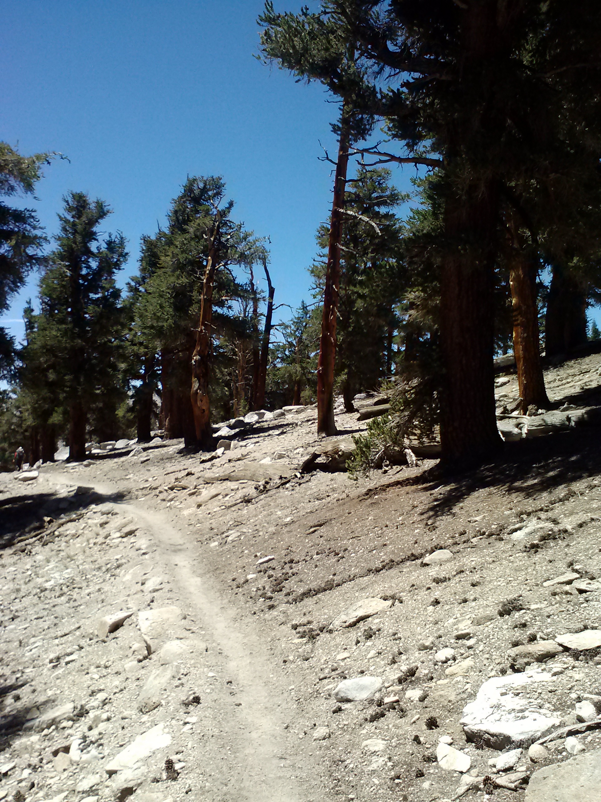
Approaching mile 415, the forest began to fill in around me. The land looked more and more like the trail I had hiked near Guffy Campground on the other side of Angeles National Forest with Penderoso and Jeffrey Pines.
Reachings the trees
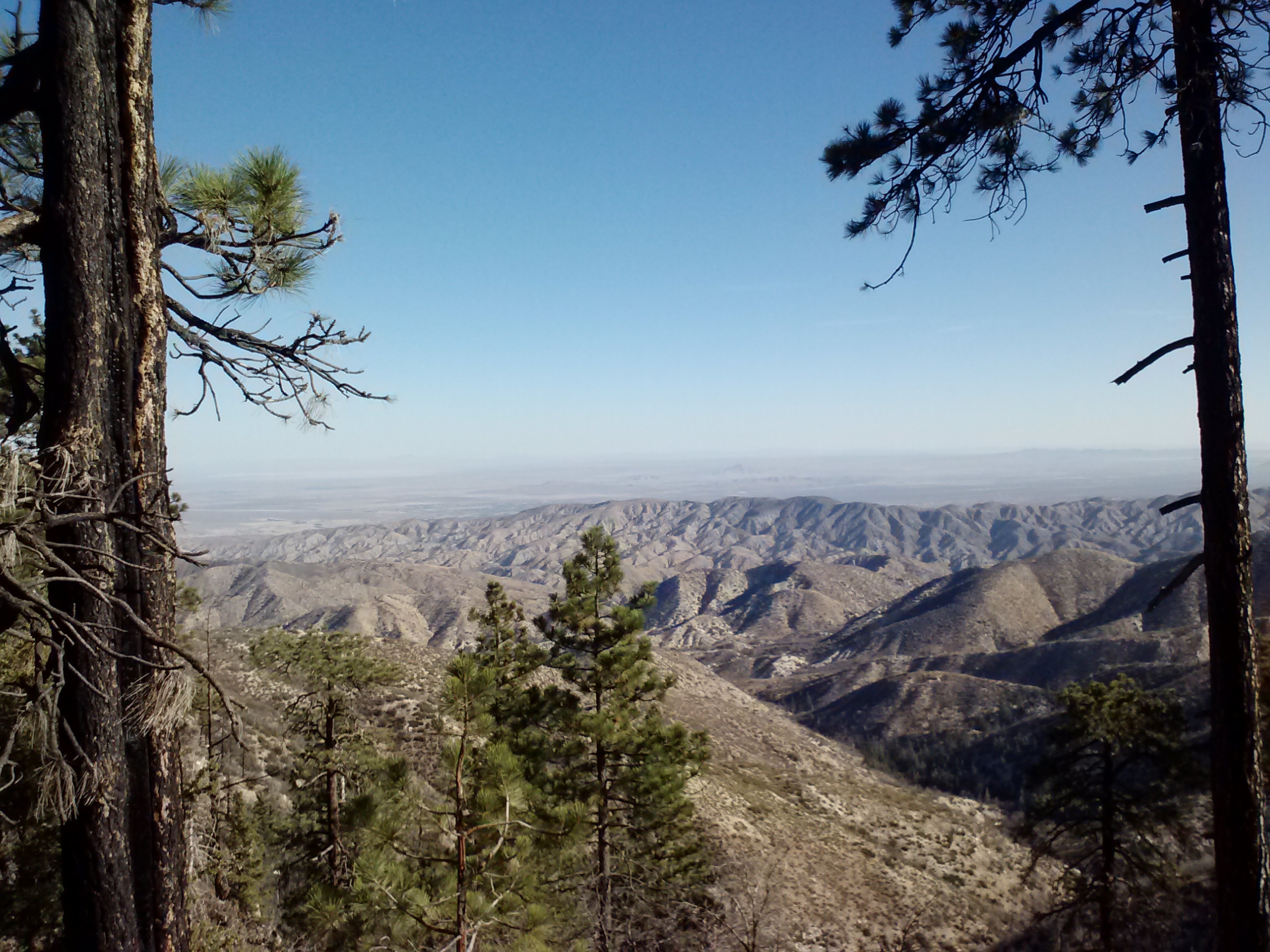
View towards Palmdale
As I approached Pacifico Mountain, I began to keep an eye out for the dirt road which I would be detouring on. The trail going around Pacifico Mtn. had recently been reported to be overgrown with unavoidable Poodledog Bush. I decided to walk along Pacifico Mountain Road leaving the PCT at mile 413.3 and rejoining it at Pinyon Flats. The detour was roughly 4.5 miles along the very rutted and dusty Pacifico road and a tiny, but paved road called Little Rock Truck Trail. The junction of Pacifico Mtn. Rd. & Little Truck Trail had a small parking area and quite a few trucks and vans were parked there, probably belonging to hunters.
Road walking on Pacifico Mountain Rd.
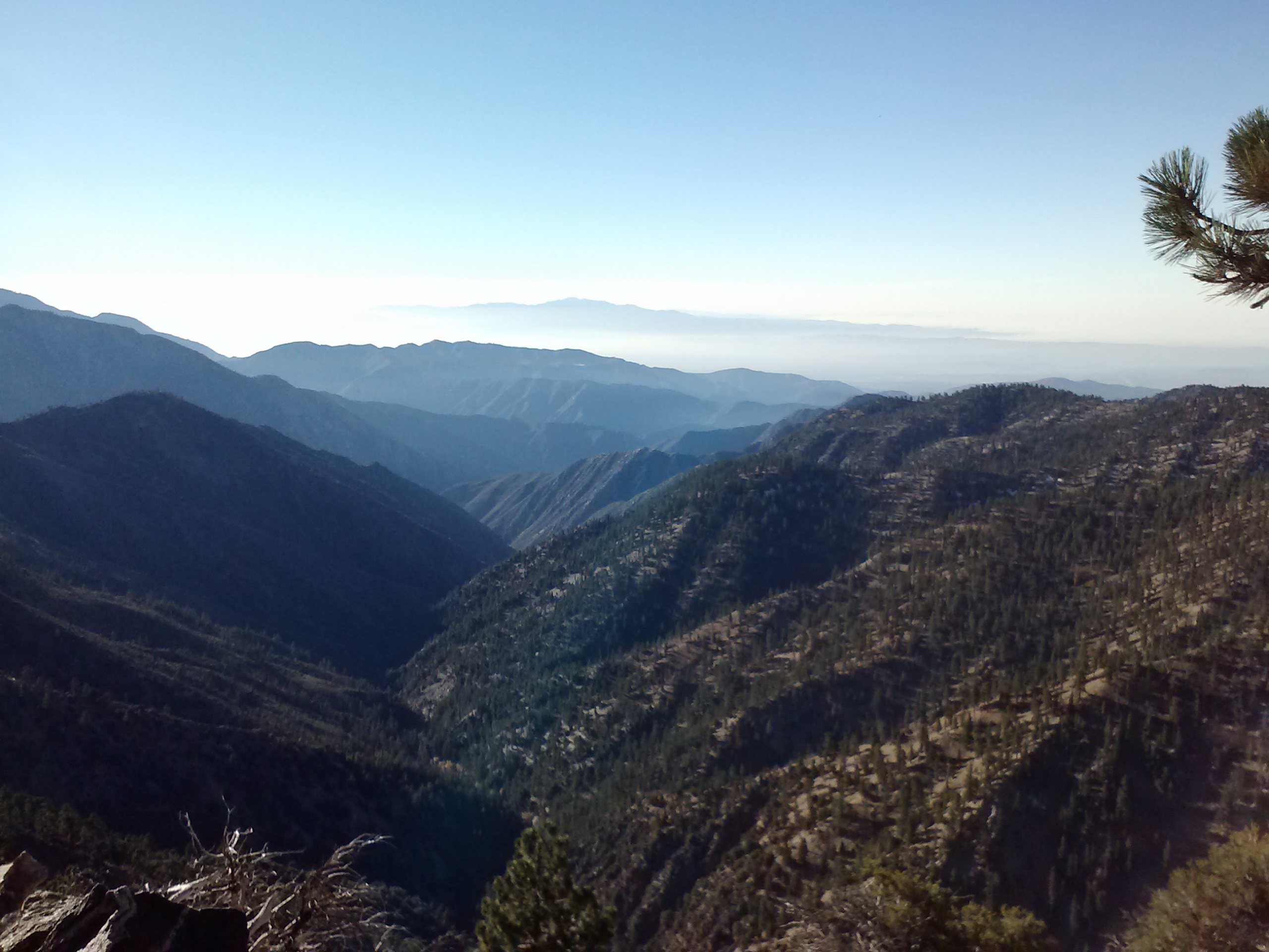
Angeles National Forest, looking south
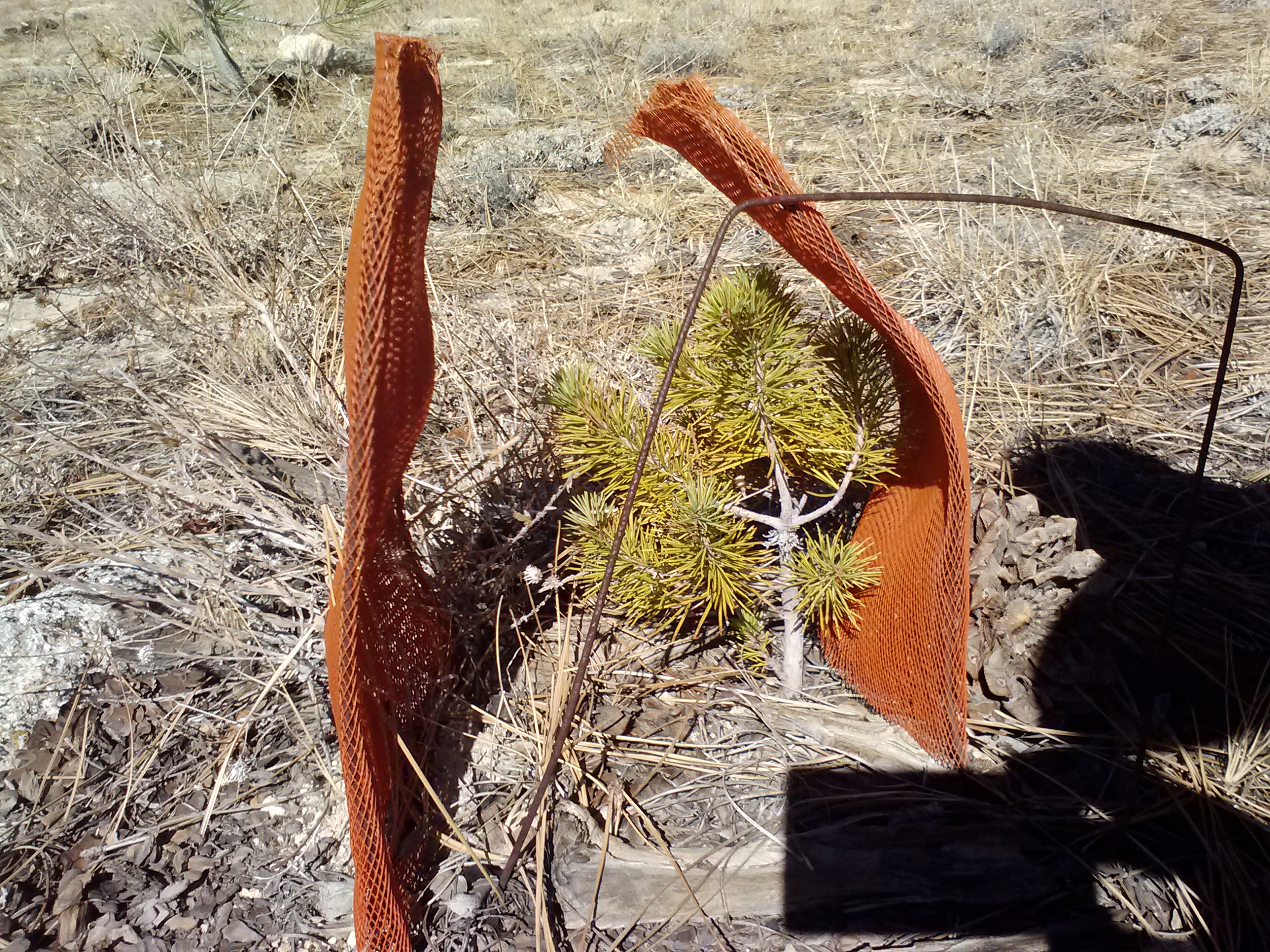
Baby tree!
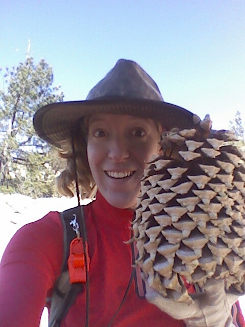
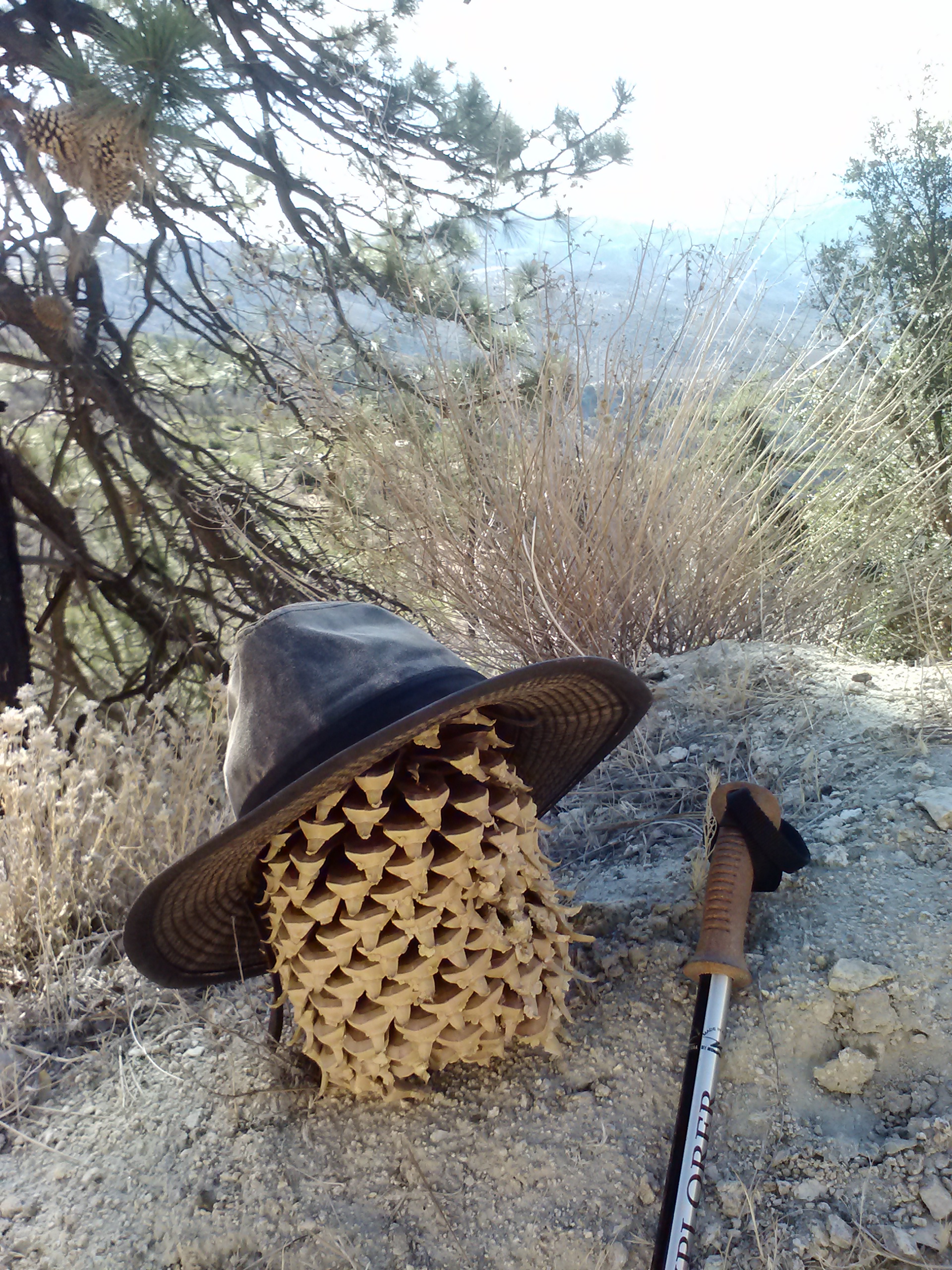
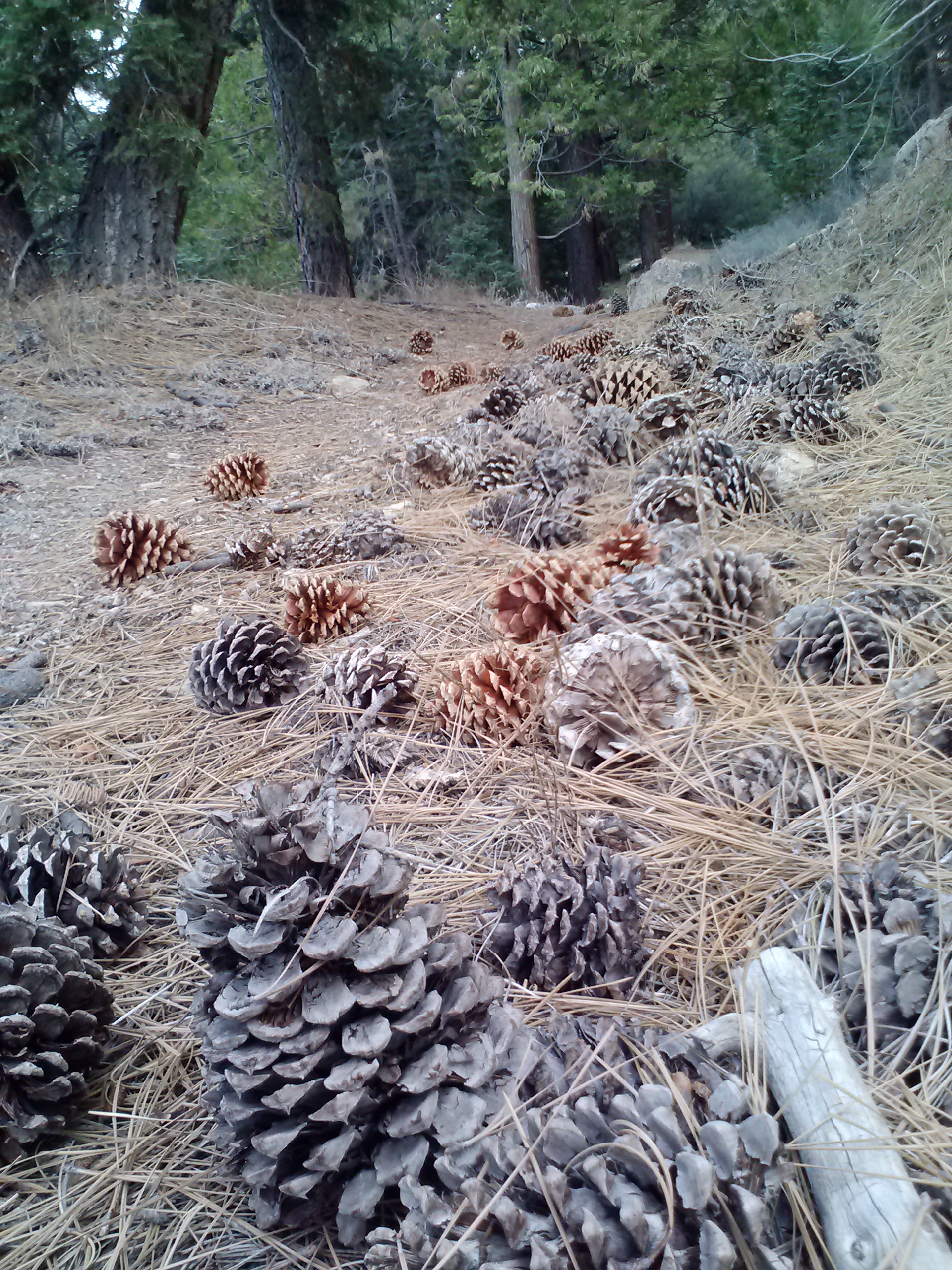
I have never seen larger pine cones in my life than I did that morning walking along Pacifico Mountain Road. They were bigger than my head! I kept looking around trying to figure out which trees they were coming from, but couldn’t spot any equally impressive trees. I’m guessing they came from the older pines, got so big in the Spring that they dropped off, and now all those pine trees have no cones whatsoever.
A Yucca plant
Much later in the day, when talking with my mom, she filled me in on a very personal family history she had with the San Gabriel Mountains. As a child, her grandfather had been taken by his father and his brothers on trips through those mountains. On one of these trips, a rockslide caught the young men by surprise and critically injured the father. They carried him back to civilization and got him to a hospital where he died within a few days. Years later, that child grew up and became a ranger for the very same mountains who took his father’s life. It was the early days of the Angeles National Forest, California’s very first National Forest, and he honored his father by naming Mendenhall Peak and Mendenhall Ridge Road after him.
Pacifico Mountain Rd.
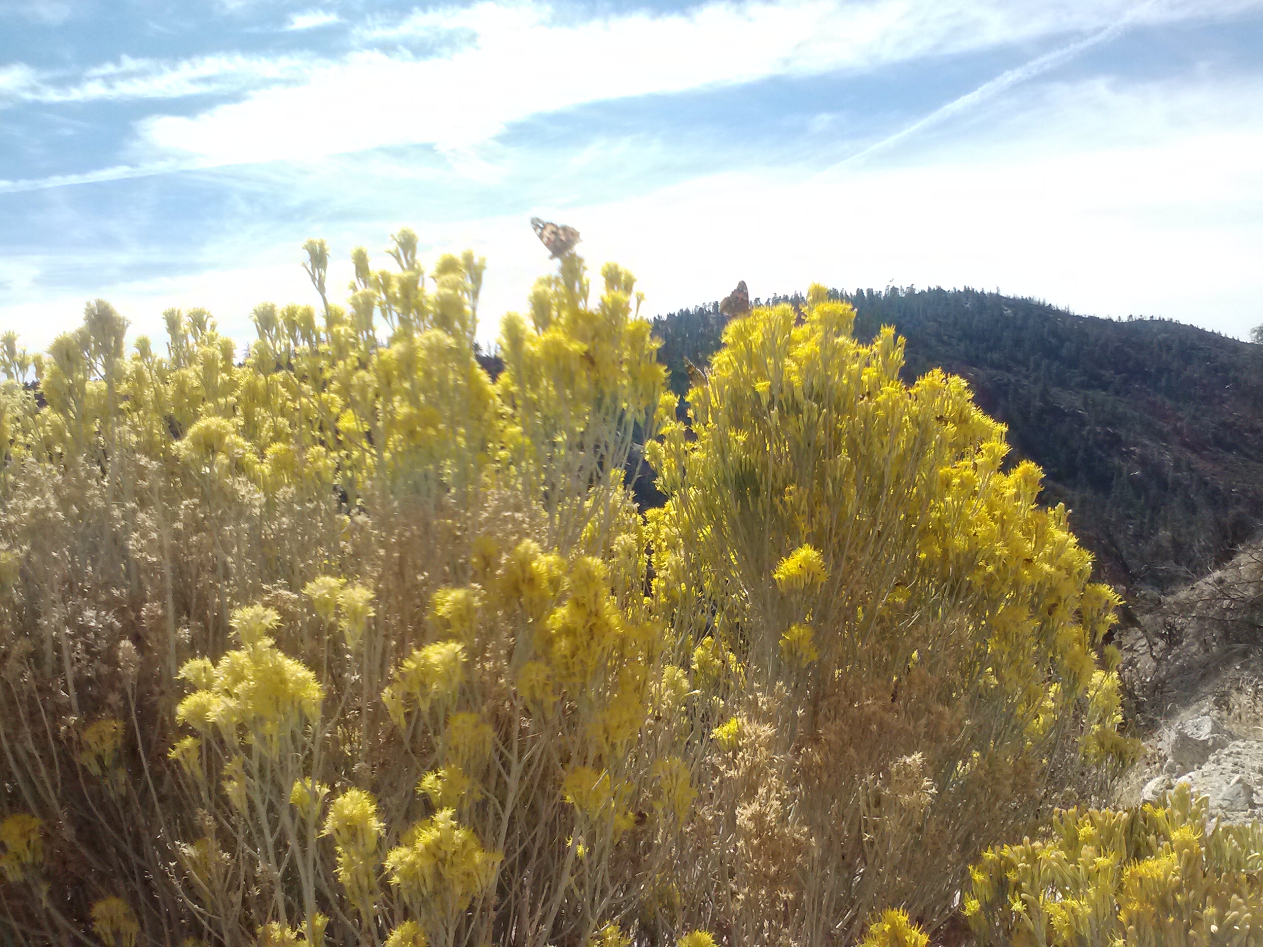
Butterflies on wildflowers
Little Rock Truck Trail
The PCT follows a small road after Pinyon Flats for a bit and then turns off as a footpath at mile 407. There’s a water resource called Sulpher Springs near this turn off, but somehow I missed it. It didn’t matter much, as I had brought all my water for the day with me. It’s just always fun to investigate things along the trail, especially water sources.
Near PCT mile 407
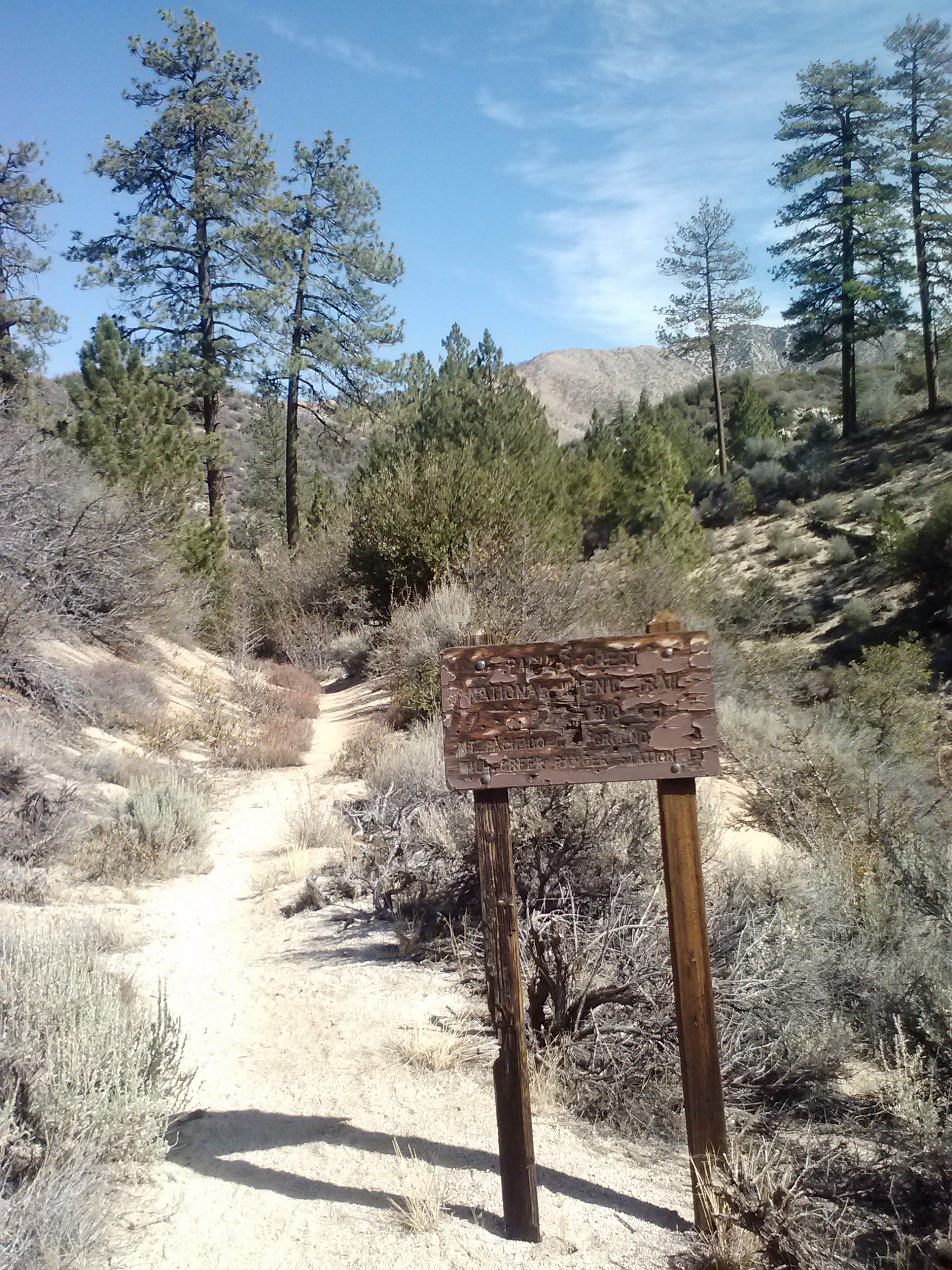
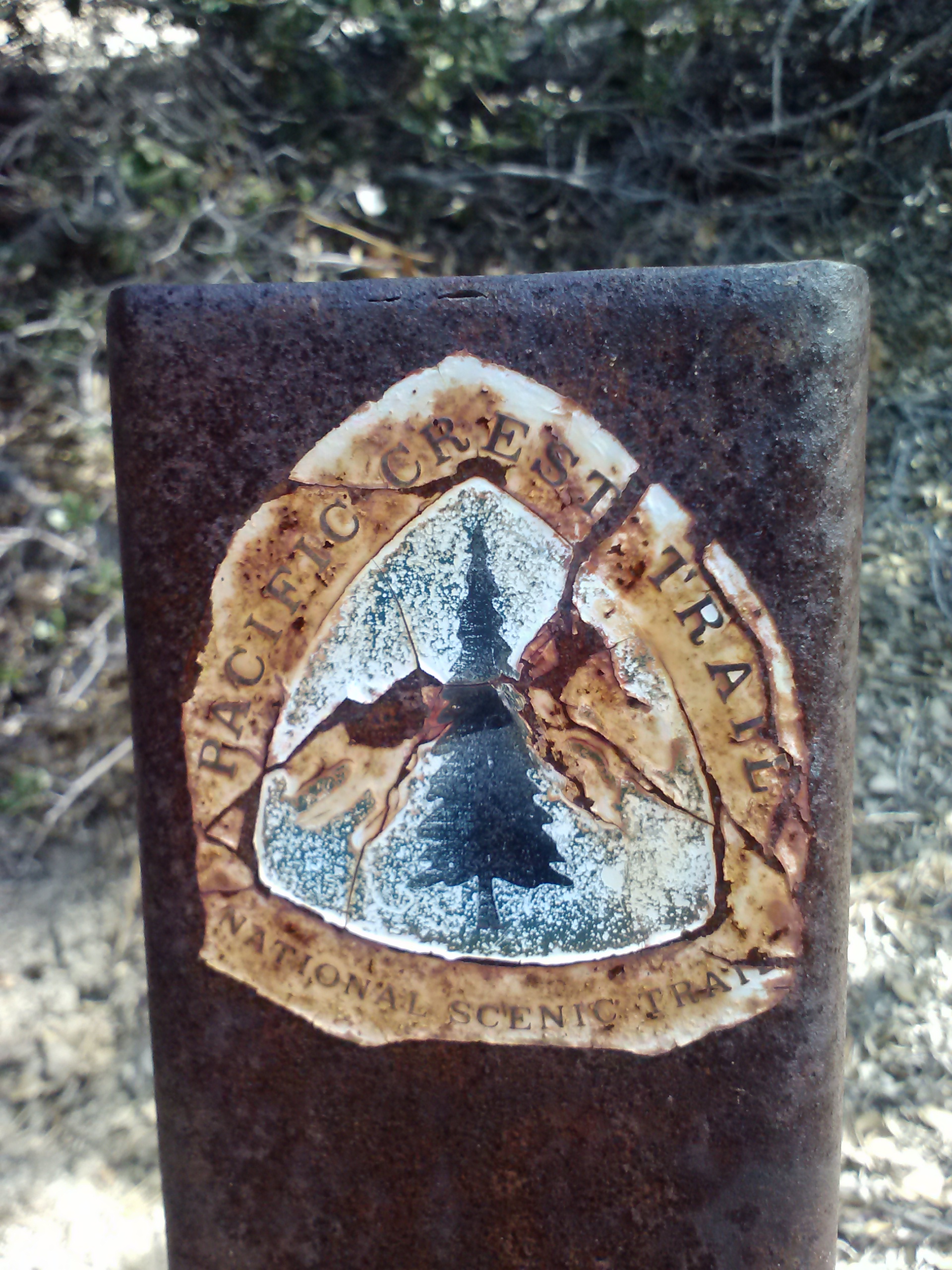
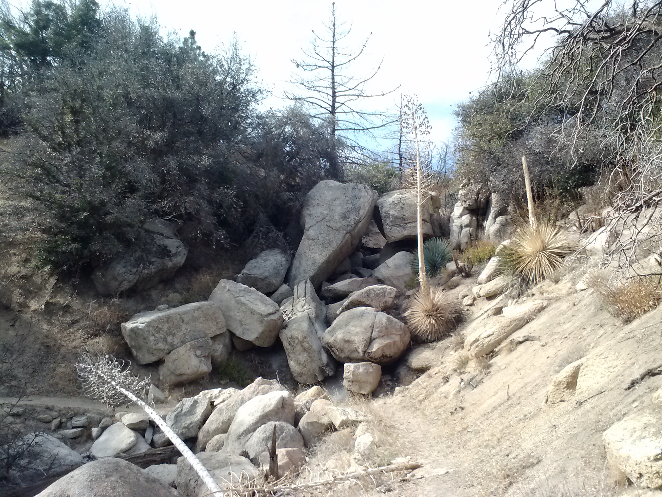
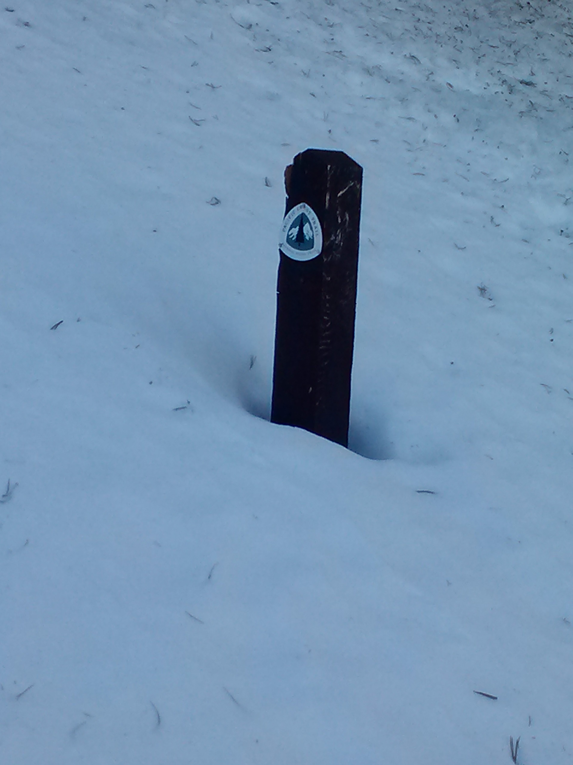
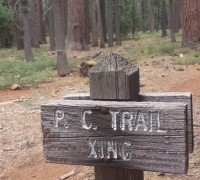
Through this next stretch, I saw several very old looking PCT signs and wondered if they might have been some of the original signs posted in the early 1970’s.
Old PCT sign
Another old trail post
I passed a large family doing a day hike, including a tiny little girl attached to her mother with a pink stretchy leash. I thought to myself, I must be getting close to the highway and picnic area if SHE’s out here. It’s great to see people hiking with their small children, it sets a precedent for that child and helps them build a relationship with the natural world that so rarely happens in modern cities these days.
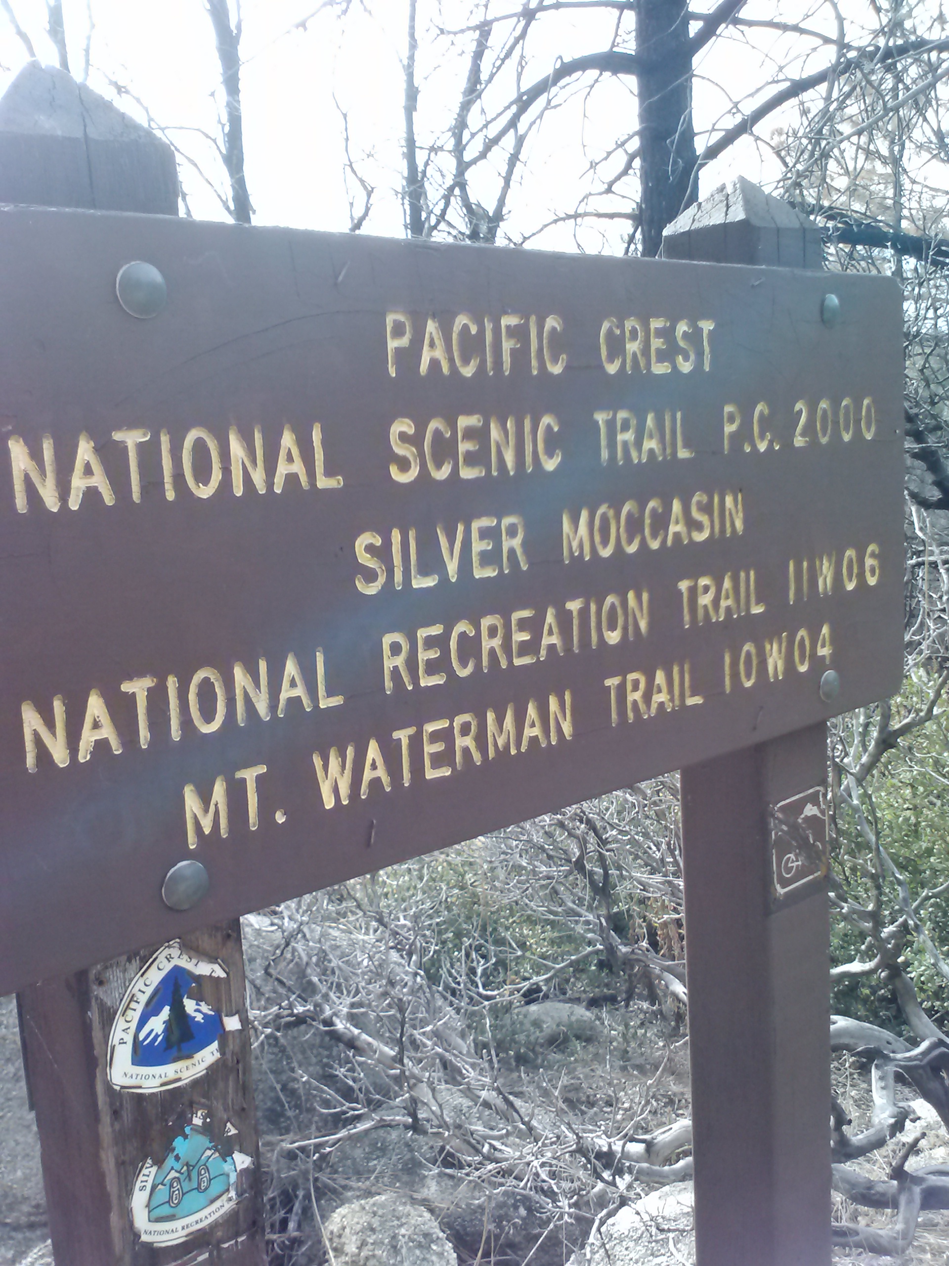
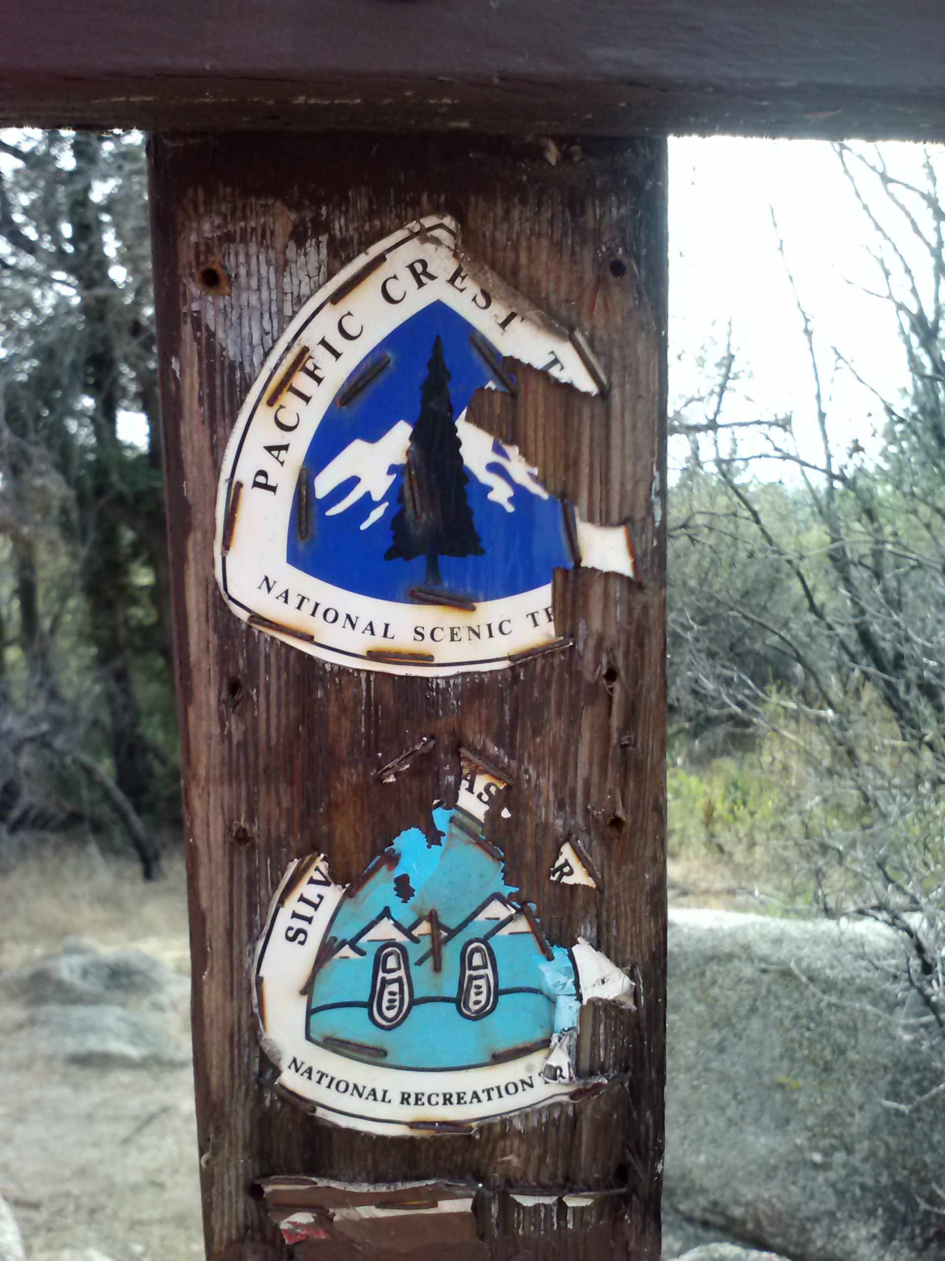
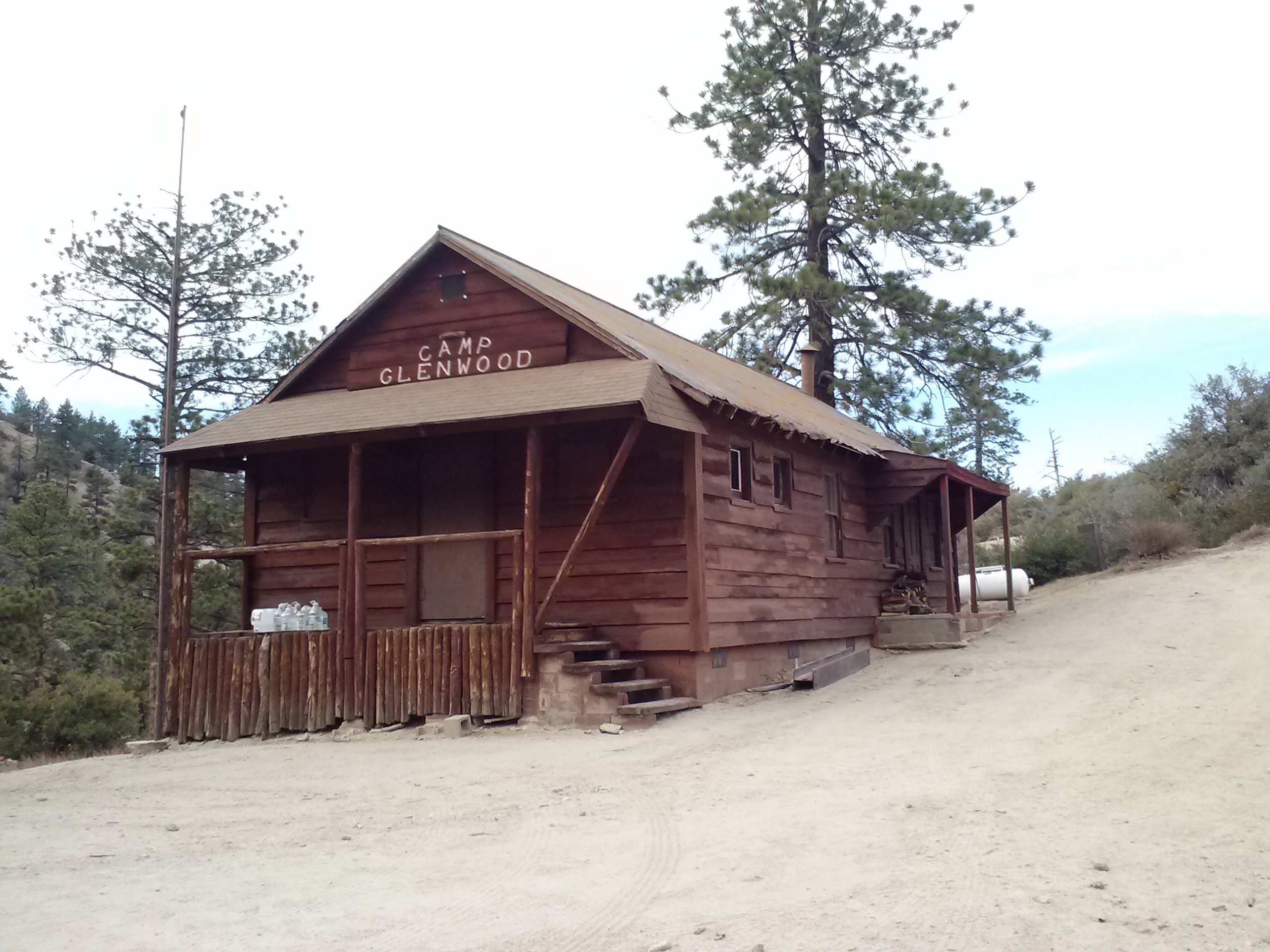
Just after Three Points Picnic Area and the Hwy 2i crossing, the PCT merges with the very old Silver Moccasin Trail (SMT). This trail originated as frequently used footpaths by the Tongva people, a Los Angeles area Native American tribe. Later, Anglo settlers used the same paths for hunting and in 1942 it was officially designated a wilderness trail by the Boy Scouts. Parts of this trail are narrow footpaths, others look like they were once dirt roads that have been washed out season after season.
Three Points Picnic Area
Stepping onto the Silver Moccasin Trail
Camp Glenwood
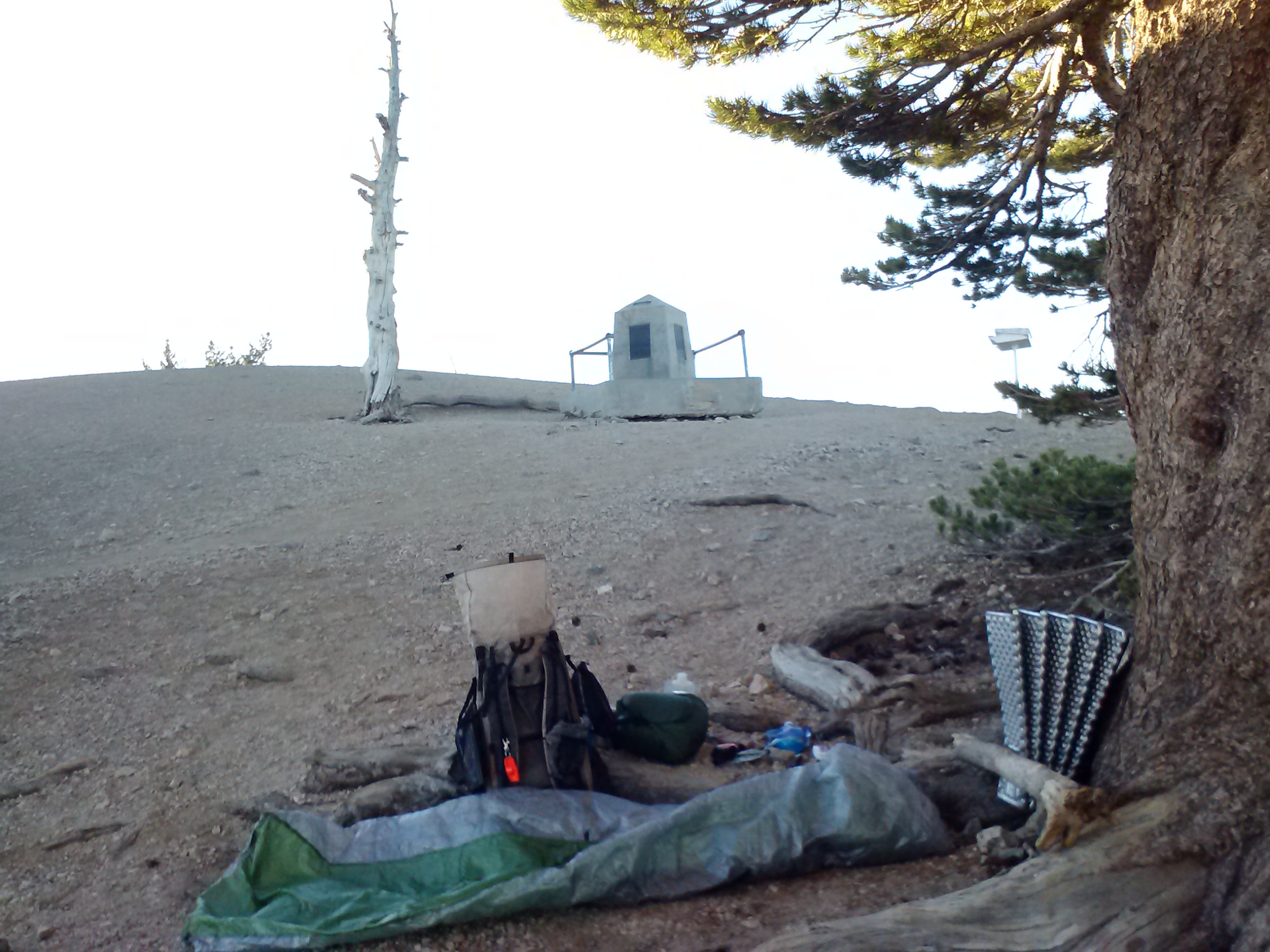
PCT 400 mile marker
As I was pushing up toward the Hwy 2g crossing, I almost trotted right past the 400 mile marker. Even though I’m section hiking Southern California and the mile markers don’t indicate how far I’ve come or how far I have to go, I’m always still excited to see them. In a way, they are still milestones for me. As I hike through the various sections, I’m slowly filing in the gaps on my map and each mile marker is symbolic of that section being completed, no matter the order or date of when I hiked it.
It wasn’t long after that I finally came out to Hwy 2f and Cloudburst Summit. It felt good to put in my second ever 20-miler day and I looked back along the mountains I had just climbed up with great satisfaction. As I was planning on a much earned dinner in a diner, I changed into some clean clothes before driving out of Angeles National Forest. My diner of choice that evening was Hill Street Cafe in La Canada Flintridge. I treated myself to a Tequila Lime Linguine with Blackened Chicken and Bell Peppers, a chocolate shake and a salad. It was absolutely excellent and I highly recommend it to everyone, coming off a mountain or not!
With the beginning of the school year in late August, I wasn’t able to jump back on the trail until October. My success in August with Mt. Whitney trip left me feeling strong and grateful. I spent September looking carefully over Halfmile’s maps and weather reports, and decided that Mt. Baden-Powell in Angeles National Forest and PCT Section D would be my next victim.
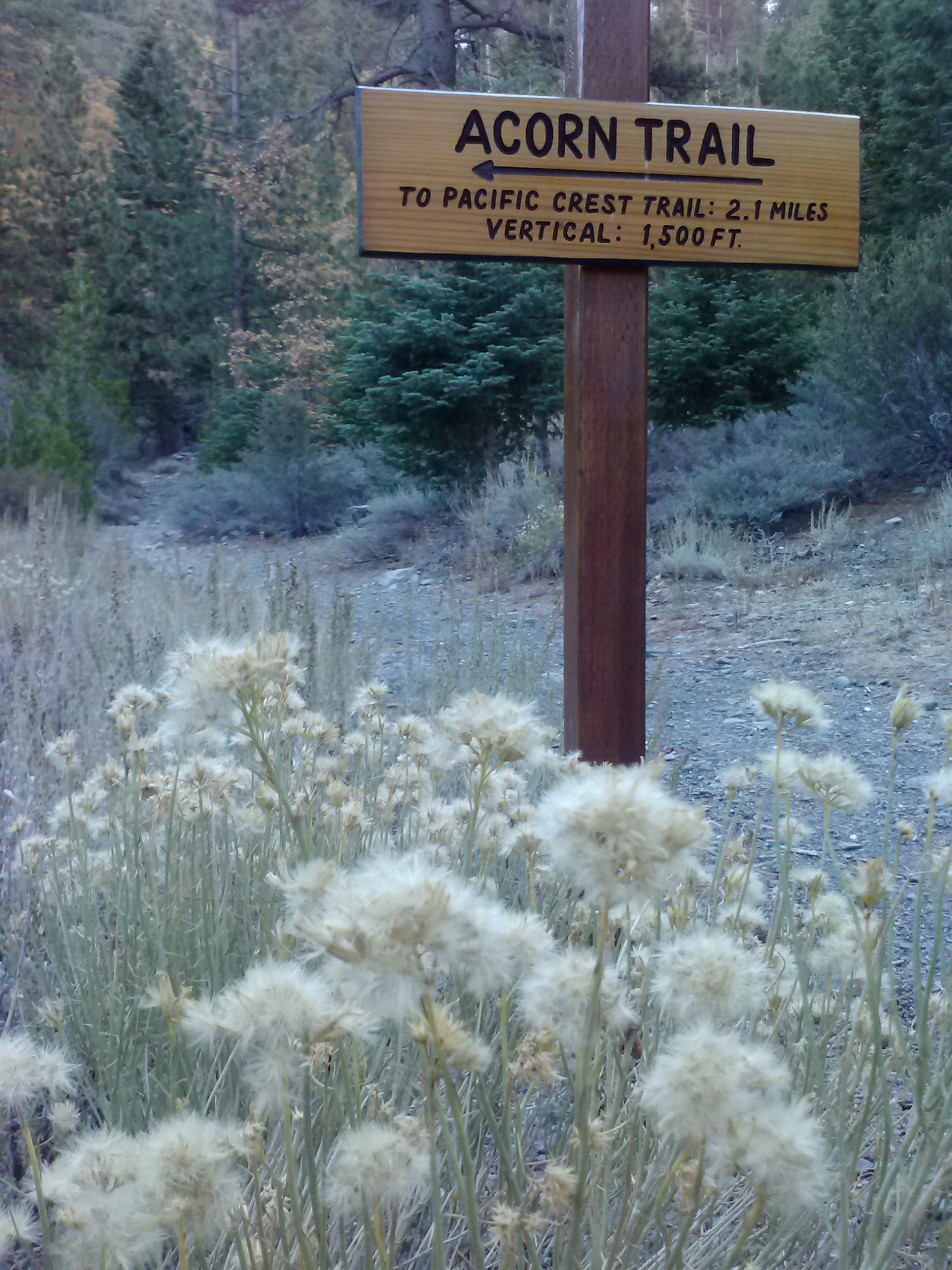
This hike started with a car shuttle with a little help from my friend and personal Trail Angel, Sabrina. We left my car at Eagles Roost Picnic Area on Highway 2 and then she dropped me off in Wrightwood at the Acorn Trailhead. This was a lovely trail, but it was a steep climb with 1,500 feet gained over just 2 miles.
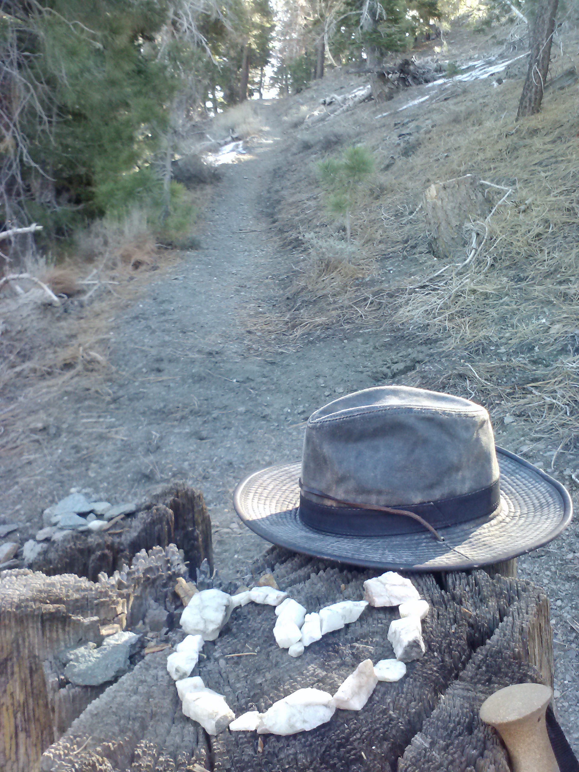
Acorn Trail, Wrightwood, Ca
Trailhead for Acorn Trail
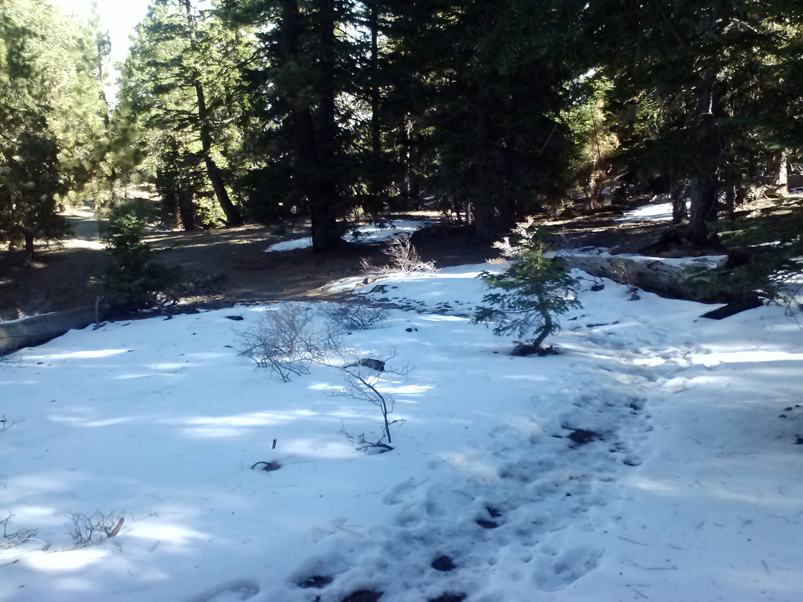
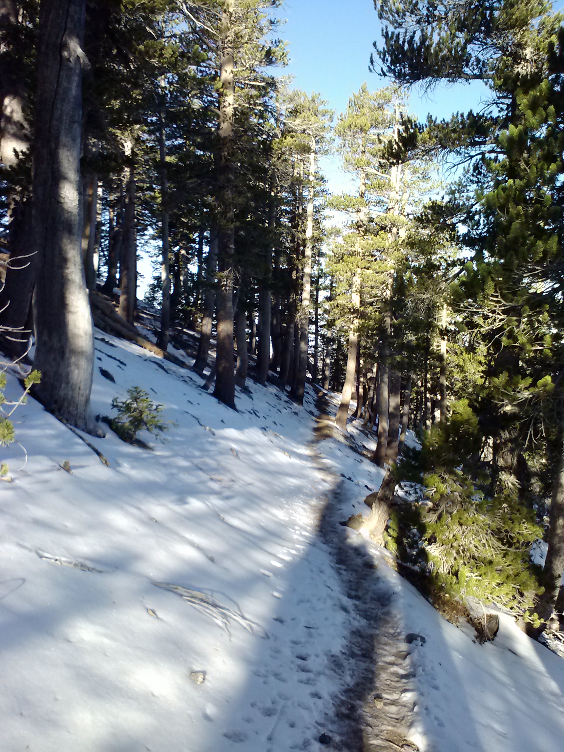
True to my forgetful nature, I was 30 feet up the trail when I realized I’d left my trekking pole in Sabrina’s car. Luckily, she was still at the trailhead, texting on her phone. It was a delightful suprise to see snow along the trail that morning. One of the reasons I had picked this section of the PCT to hike next is because I wanted to hike it before it became too snowy for comfortable walking. The snow I got to walk through, however, was perfect and put me in the mood for Fall!
Found art
Snow along Acorn Trail
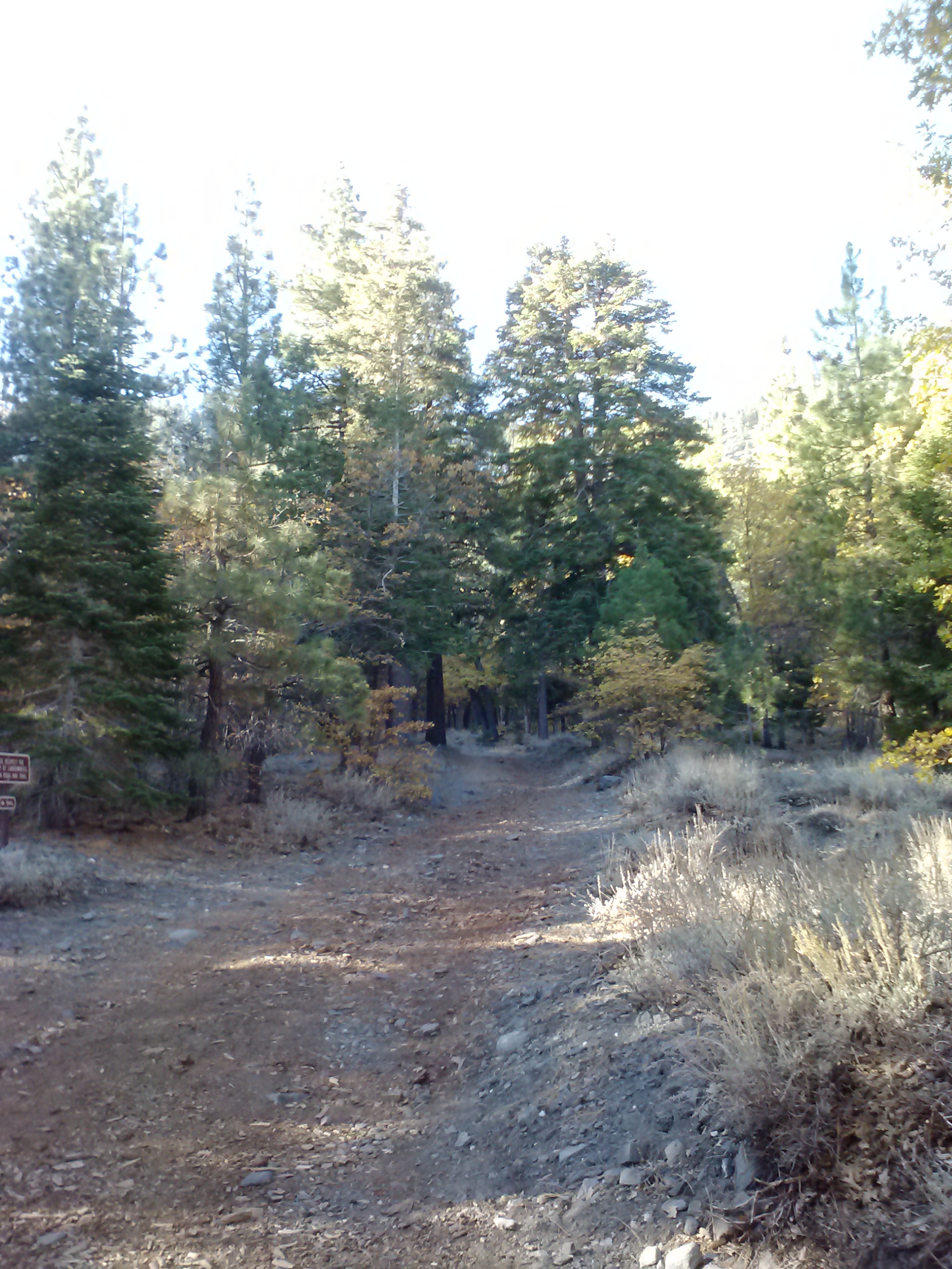
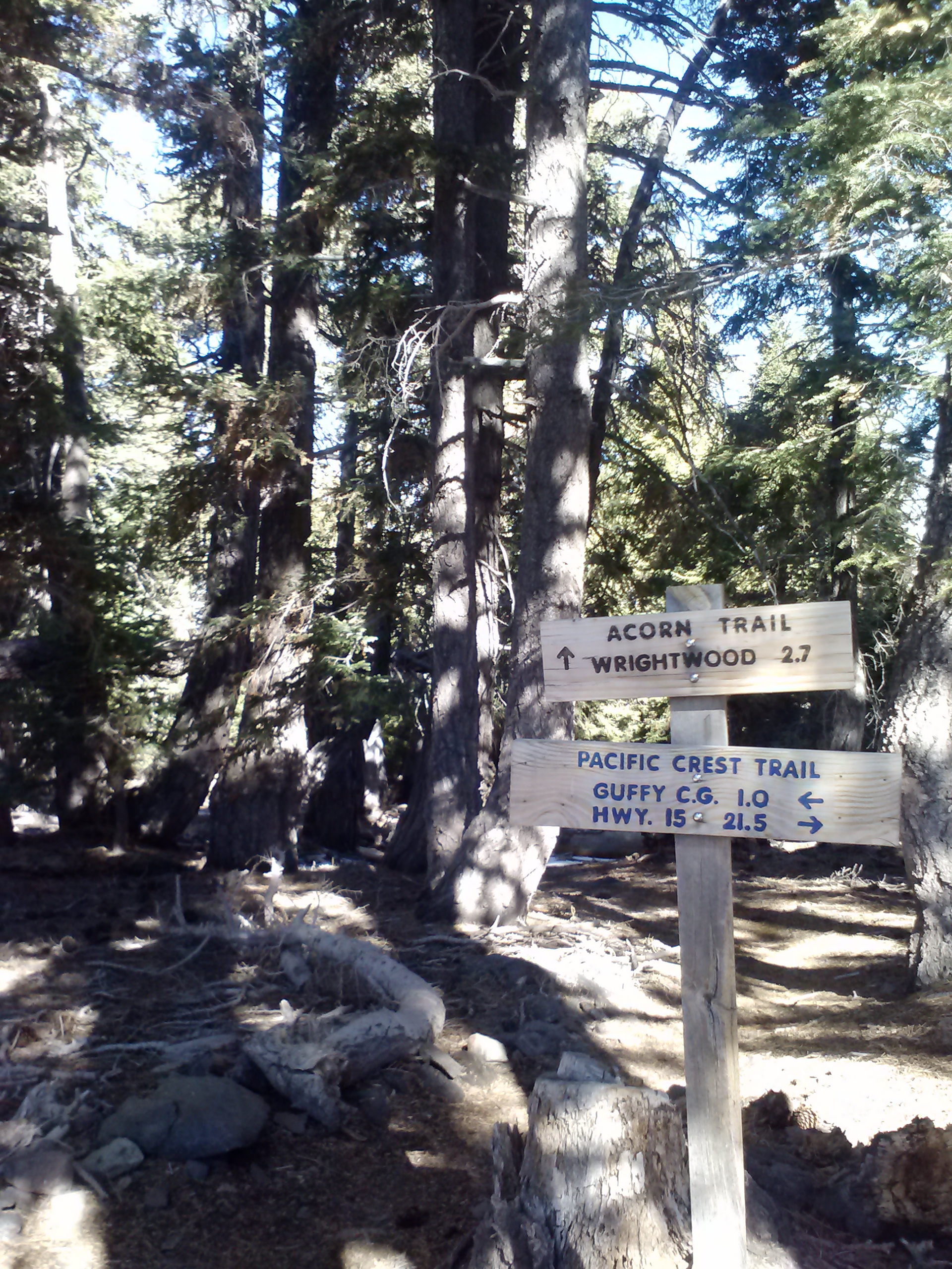
Junction of the PCT and Acorn Trail
Acorn Trail
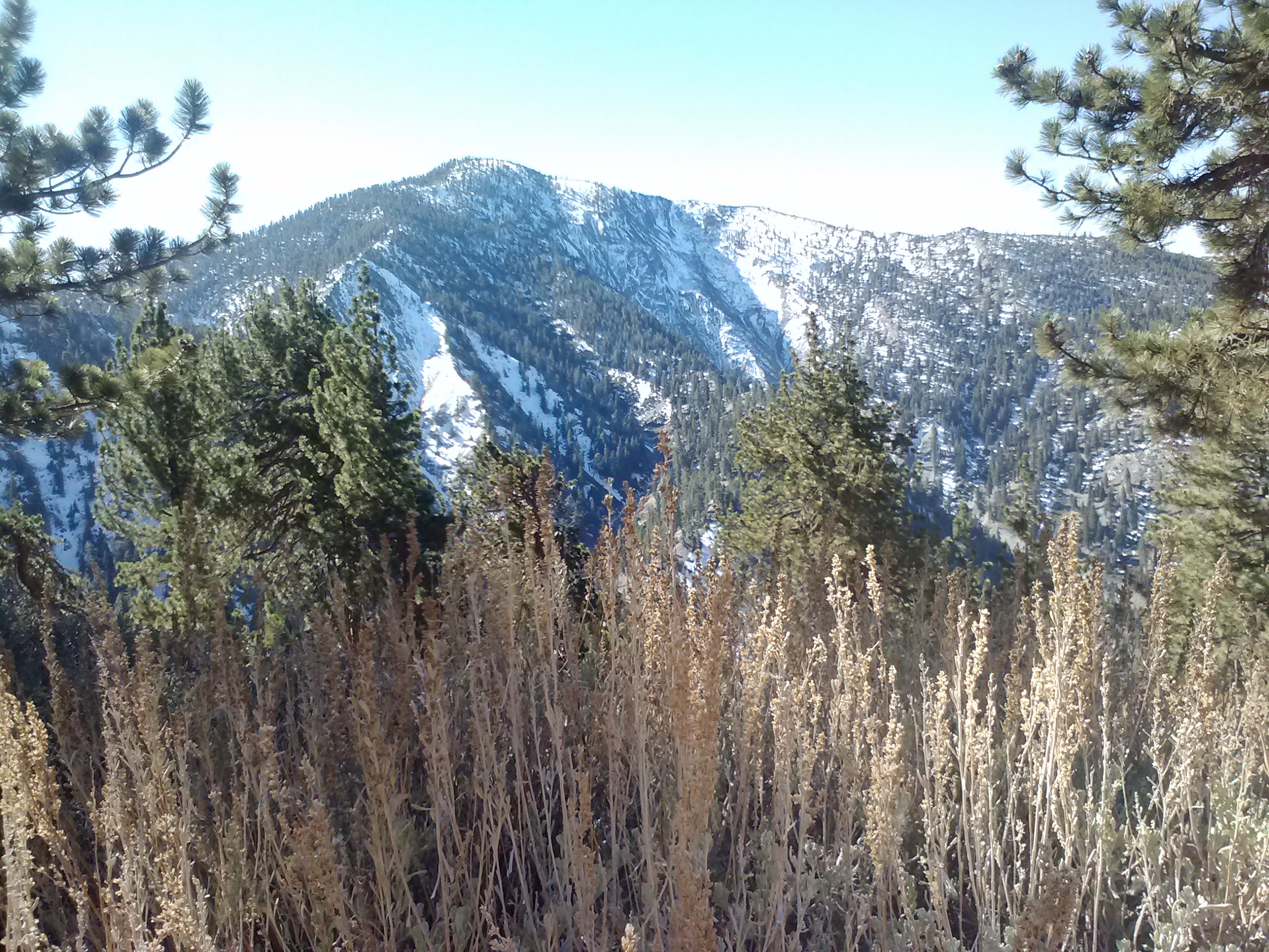
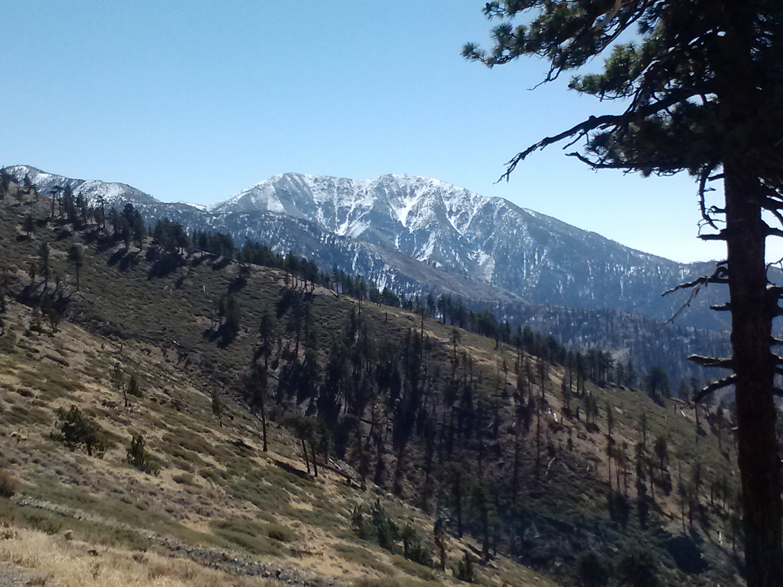
Reaching the junction at the top of Acorn Trail was a joy, not only because I loved the idea of being back on the PCT again, but also not having to climb UP anymore! I was immediately greeted with spectacular views of Mt. San Antonio, also called Mt. Baldy. At a height of 10,068 ft, it’s the tallest peak of the San Gabriel Mountains.
Mt. San Antonio, Angeles NF
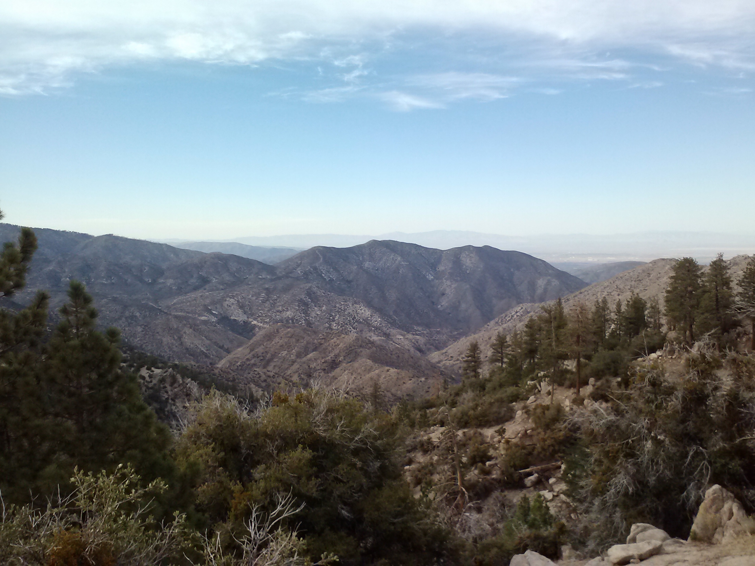
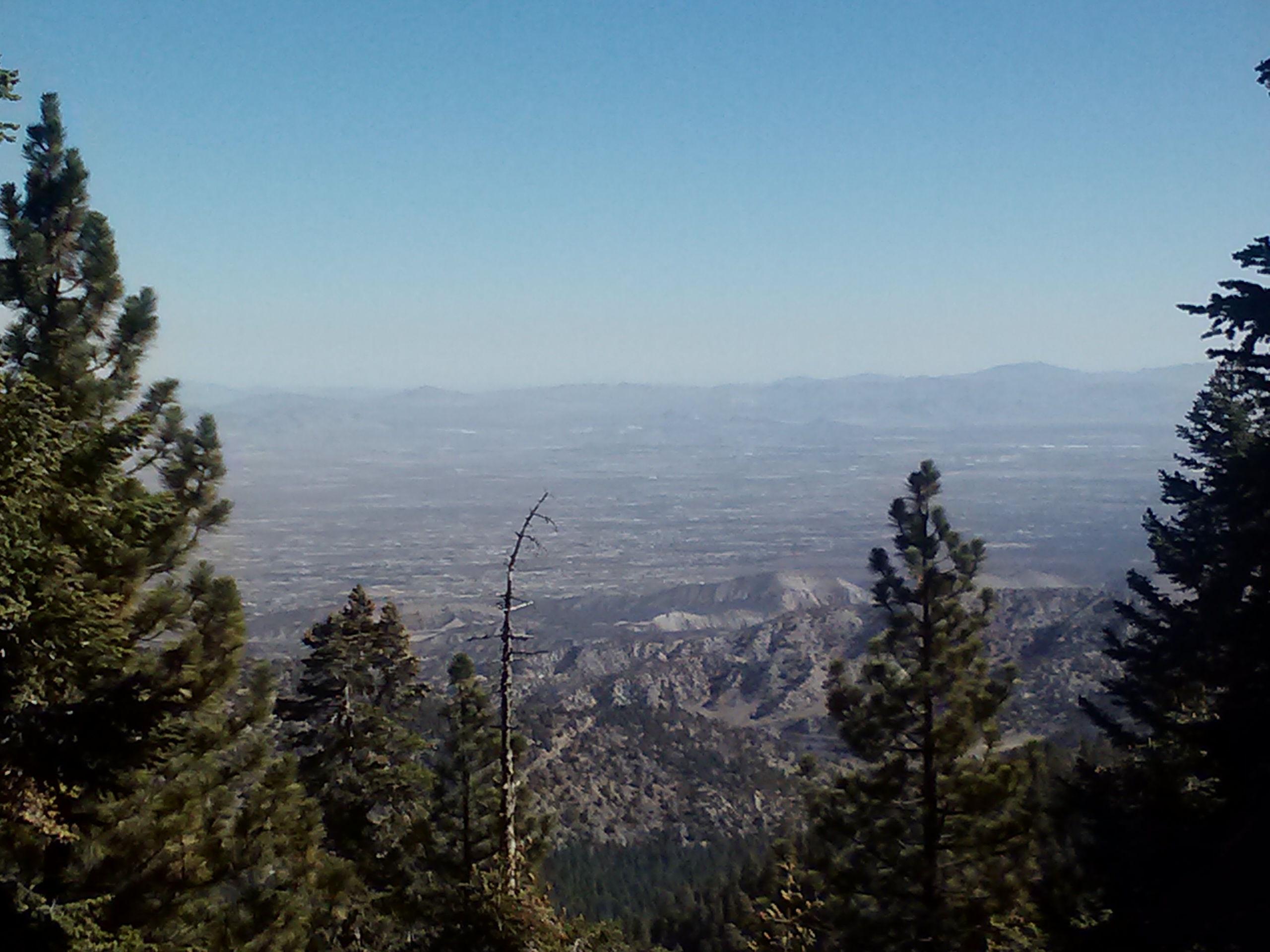
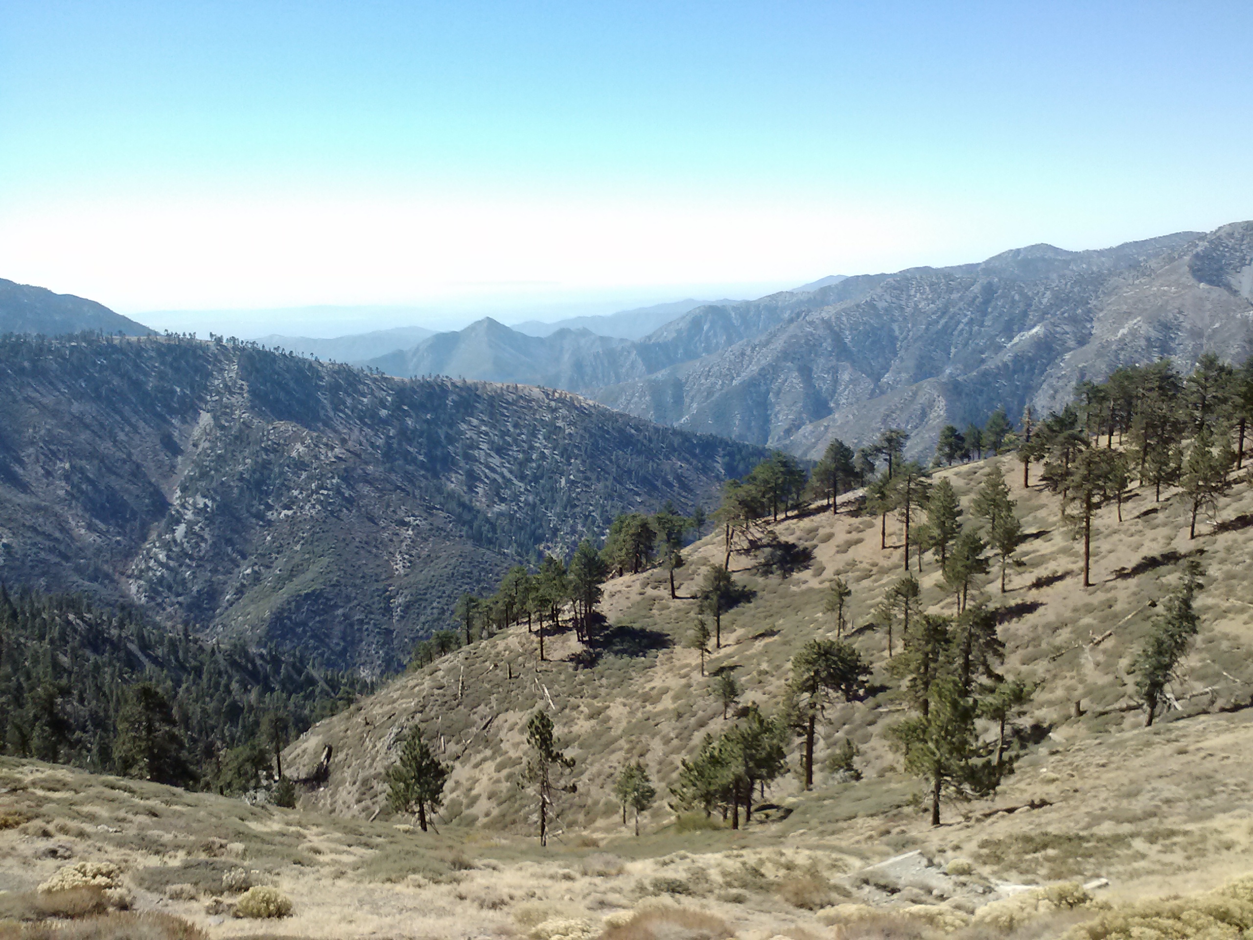
This hike was my second time visiting Angeles National Forest, the first visit being only a quick drive along Hwy 2 earlier that year. To be honest, I unfairly presupposed that it wasn’t much of a forest, that the mountains were crummy and the views urban and smoggy. Turns out I was quite wrong. Yes, there was quite a bit of smog hanging in the valleys, but the drama of the San Gabriel Mountains rivaled that of the Sierras. There were plenty of trees to constitute a forest, and, to my surprise, I was particularly entranced with the views of Antelope Valley and the Mojave desert floor. Topping it off was a sweet, pine smell permeating the air which I didn’t recall smelling in the Sierras.
Mountain and valley views near Guffy Campground
View toward Antelope Valley
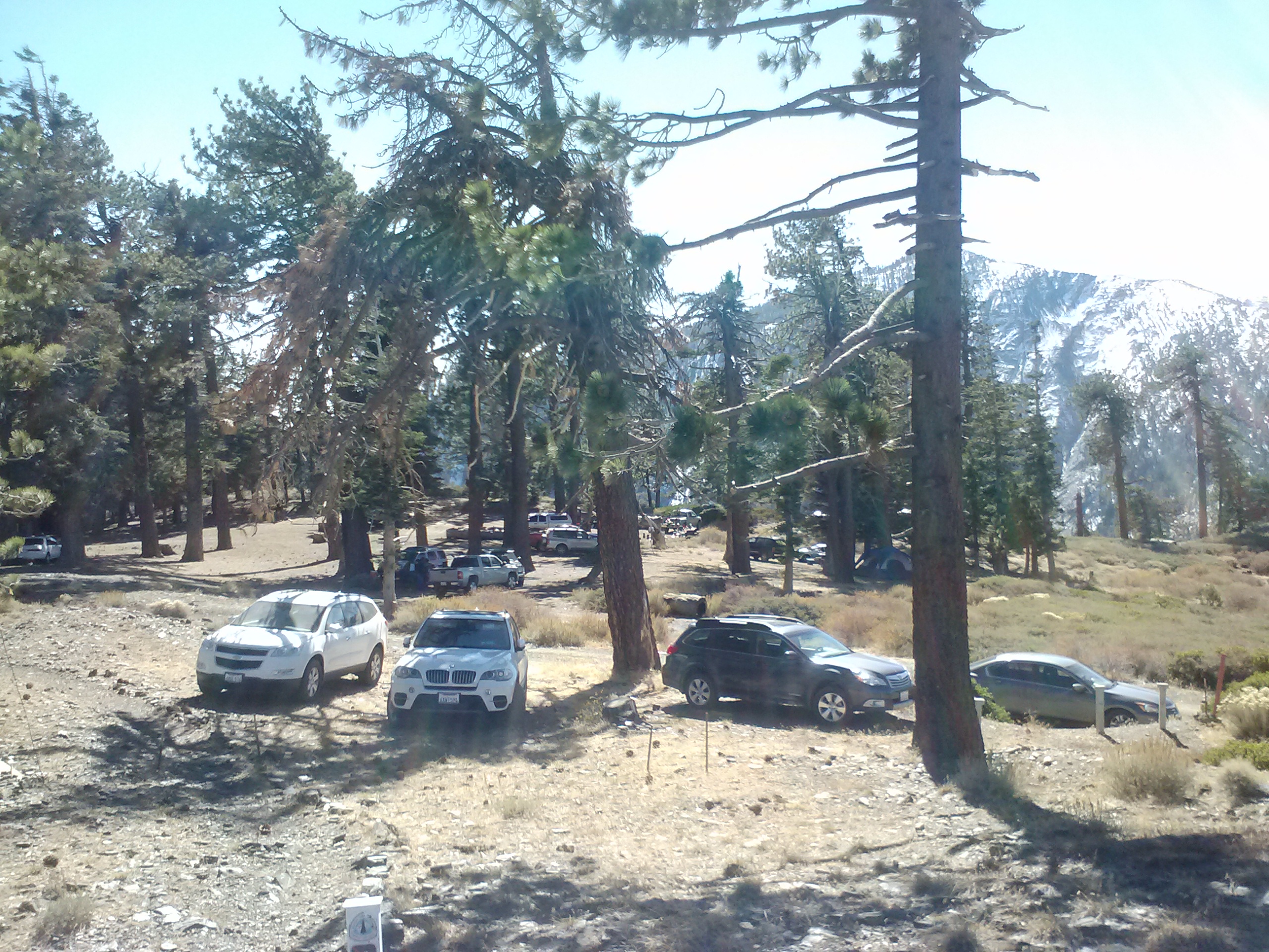
It didn’t take long to run into a few hunters, and it seemed they were all camped out at Guffy Campground. Guffy was car camping city! There were SUVs and sedans, blow up mattresses, grills cooking up hamburger patties, giant coolers full of beer and soda, and boom boxes blasting. I was pleased that there didn’t seem to be any hunters up past the campground and that I had the trail to myself again.
Guffy Campground
The PCT just above Guffy Campground
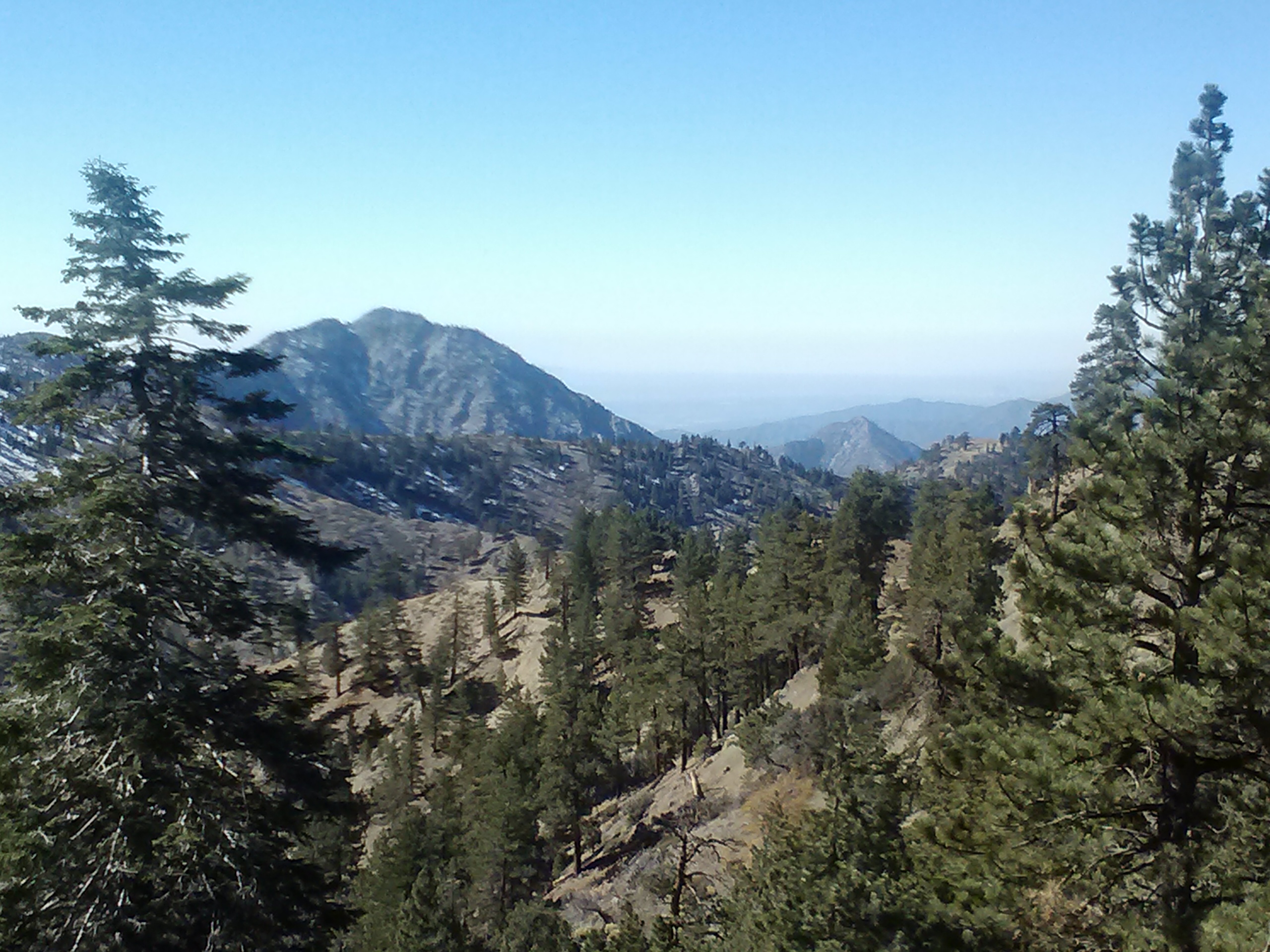
The section of PCT betwen Guffy and Hwy 2 at mile 369.5 gave me that sense of childhood adventure. The one where you feel safe because you’re just exploring your own backyard, but exciting because you don’t really know what you’re going to see around the bend. This was such a new forest to me and it was actually kinda fun to have views of cities and other areas that you could point to and identify. (“Over in that direction is Mojave; that must be Claremont, and that mountain way in the distance could be Santiago Peak in Orange County’s Saddleback formation,” etc.)
View towards Claremont
Mt. San Antonio, aka Mt. Baldy
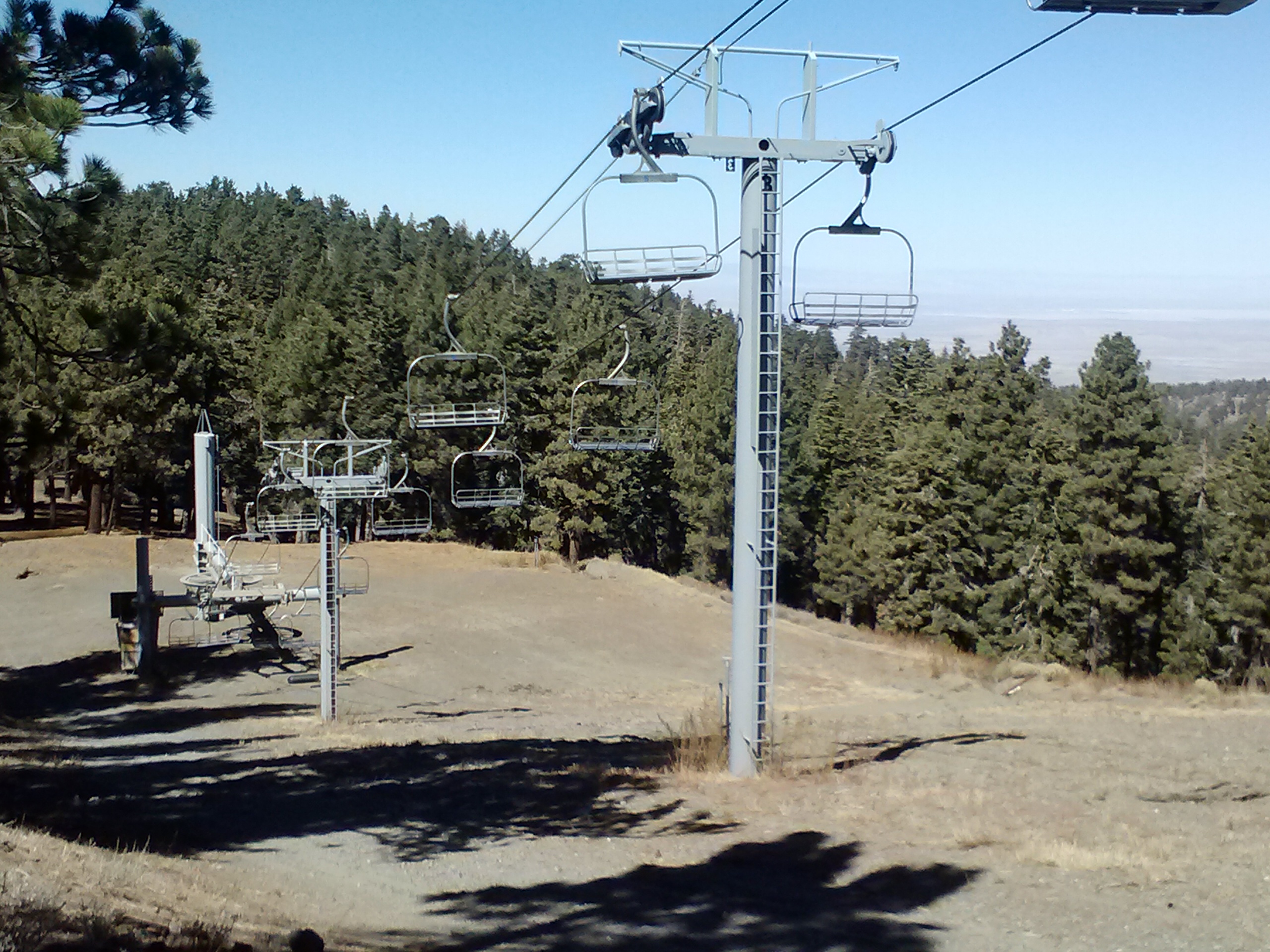
It’s funny how a little bench, a reservoir, or other man-made structures are so much more exciting on the trail than off. Halfmile’s PCT maps have the ski resorts and reservoirs marked on his map, and it gave me something to look forward to as I marched along the moutain sides. It reminded me of when I was a child (I see a theme here! :-D) on road trips and my mother would tell me to keep an eye out for funny things like Santa Claus statues, roller coaster towers, or special mountains. Any kind of landmark on the trail is always something to look forward to.
Ski lifts
Ski resort reservoir
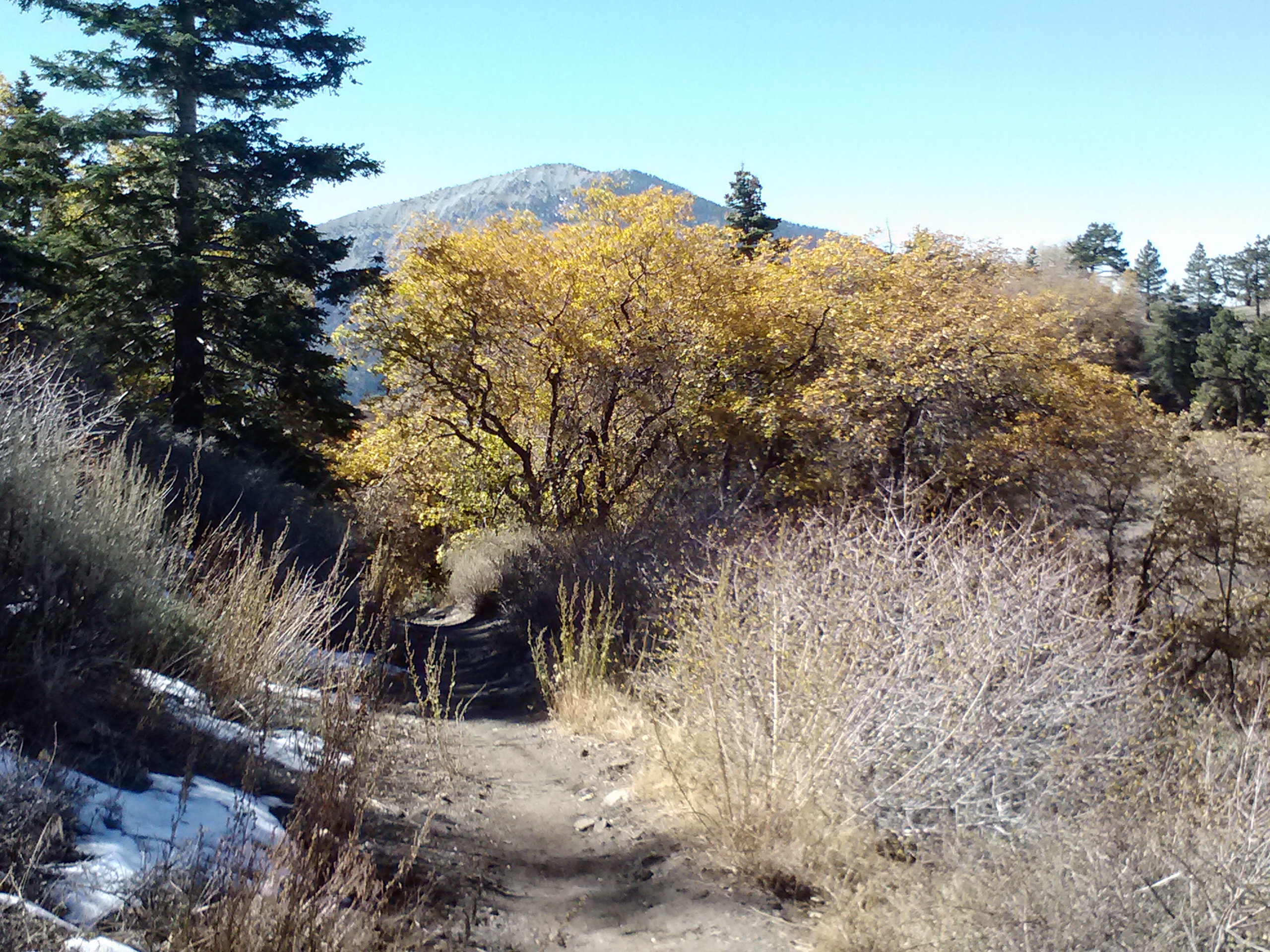
Passing Blue Ridge Campground, also a popular car camping spot, all sorts of deciduous trees lined the trail. Since we don’t see too much seasonal change in Southern California, small things like leaves changing color and bits of snow on the ground are very exciting. (In fact, shortly after this trip, I was in such a Fall mood that I bought THREE new very Fall-ish looking sweaters.) I’ve always found the natural world so fascinating. Bits of information from middle school science class trickled into my mind about chlorophyll & leaf pigment. Thinking about all the chemical reactions going on inside each plant, geological histories of each mountain, and the daily lives of the local animals entertains me to no end.
Fall colors
373 miles to Mexico, 2,277 to Canada
Soon I was crossing Hwy. 2 and anticipating my arrival at Grassy Hollow Visitor Centor, where I planned to refill water bottles, eat lunch, and roll out my legs on a little foam roller. I’ve been going to physical therapy since I had knee surgery in June, and my new favorite therapy toy was a 6-inch long foam roller. I decided to bring it along for this trip and see how well it worked for me out on the trail. Would it be a nuisance to pack? Would it be worth it’s 11 ounces of weight? Turns out, it is a bit of a nuisance, as I had packed it into my bear canister and then had to stash my food every where else in my pack. However, it was pretty awesome to roll out my legs right there on the trail. Afterwards, I felt like I’d had a quickie deep tissue massage and could easily carry the next batch of water up and over Mt. Baden-Powell.
The visitor center had nice bathrooms, a deck and benches, which I took full advantage of for my lunch break. I stuck my head inside the visitor center to ask where the camp water spigot was, but the ranger and volunteers were nice enough to just let me fill up my bottles in their kitchen sink. Whoohoo! Apparently, the water from the spigot, despite being good enough for drinking, comes out slightly orange.
The center was a charming little museum about the natural history of the forest, complete with maps, old photos, exhibits of pine cones and grasses, and an extremely large looking stuffed mountain lion. Looking into the dead cougar’s glass eyes sent shivers down my spine. No longer did I have that childhood sense of exploring my own backyard.
Grassy Hollow Visitor Center
Lunch
Next, I hiked around Jackson Flat Campground and on towards Mt. Baden-Powell. The 2 miles between Jackson Flat and Hwy 2b seemed to take forever. I was starting to get tired and, trying to determine how fast I needed to hike to summit Mt. B-P before dark, was getting a bit concerned about daylight.
Descending to Hwy 2 and the Mt. Baden-Powell Trailhead
42 switchbacks to reach the top
I saw only hikers coming down the mountain as I headed up toward the summit. It was already 4:00 in the afternoon when I started up and the sun would be setting in about two hours. I could feel the altitude changing as I became more and more out of breath, but I was determined to reach the top before dark. I hustled up the trail, slowly making my way into deeper snow, and counting every switchback along the way.
More snow meant more opportunities for spotting animal tracks, including any surviving relative of the stuffed cougar at the visitor center. There were clearly large cat tracks in the snow that evening, but I couldn’t tell how recent they were. They didn’t look old, but it seemed unlikely a mountain lion would’ve been recently hanging around with so many hikers going up and down during the day. Either way, there was a lion living in the area, and, with the sun sinking quickly in the west, my eyes darted over the terrain and I turned to look up and behind me every few feet.
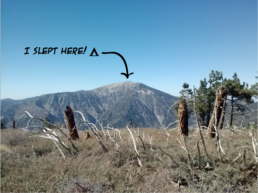
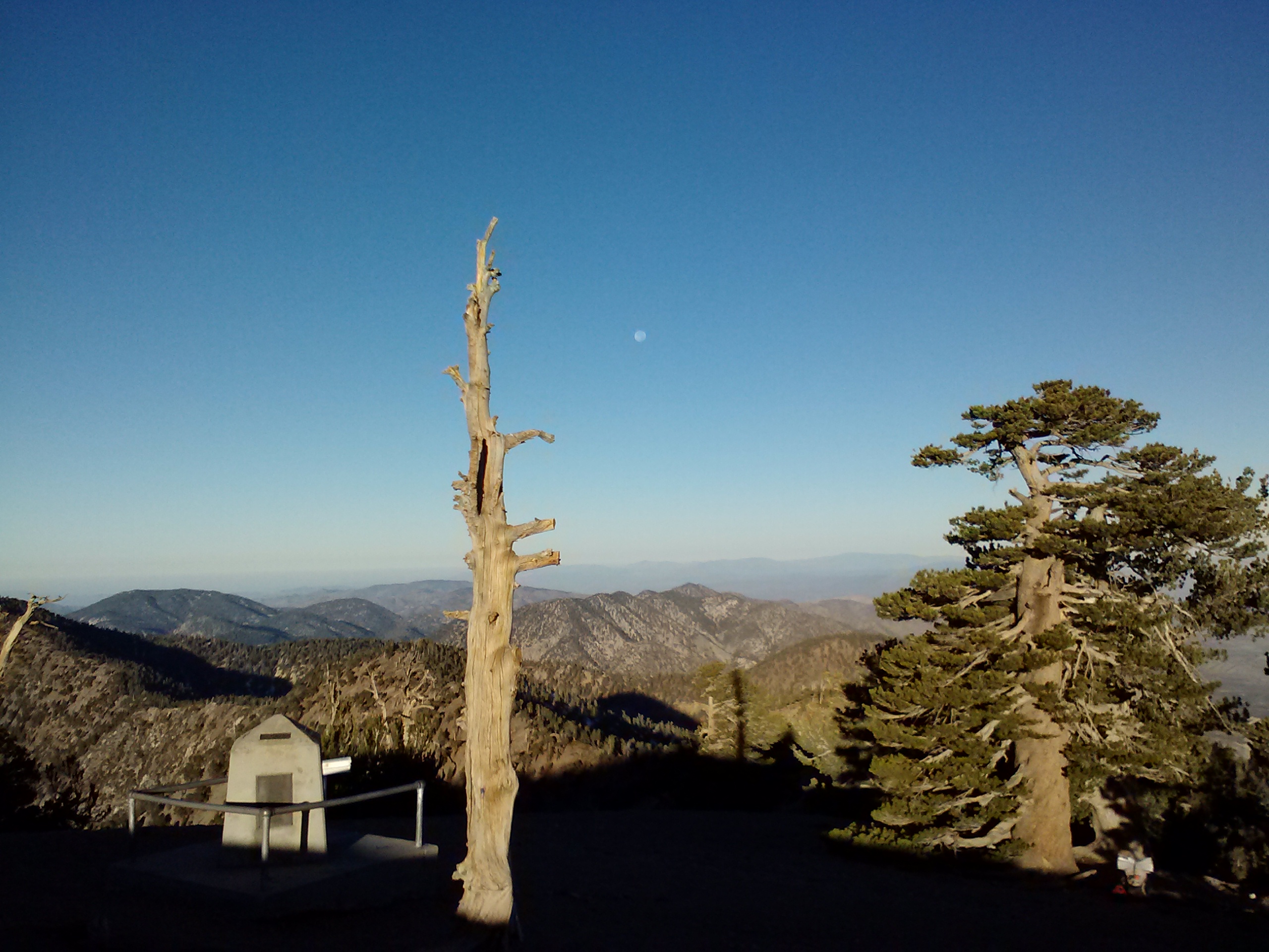
An hour up the mountain maybe around switchback number 25, I began to feel really exhausted and sore. I was sure some meat eating monster would sense I was an easy target, like I was some wounded, sick animal, and make a meal out of me. To boost my moral and, hopefully, convince carnivores I wouldn’t go down easily, I began shouting out the switch back numbers in the loudest, strongest voice I could muster. I did this all the way to number 39, when I was startled suddenly by two hikers coming down the mountainside. They must’ve thought I was either pretty weird or pretty funny. They promised me I had only a few more switchbacks to go. That was good news because the sun was just about down as I reached the summit of 9,406 ft.
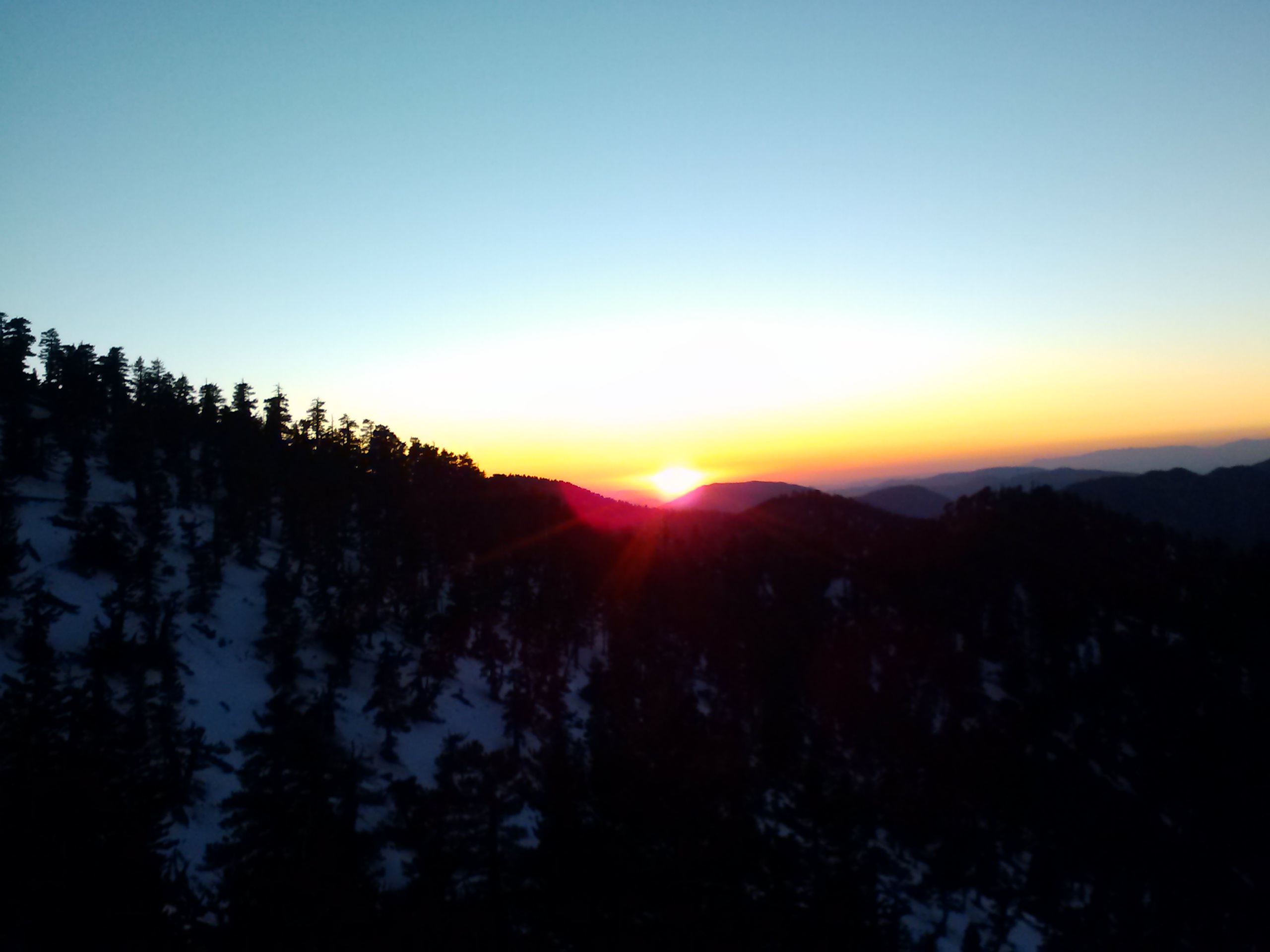
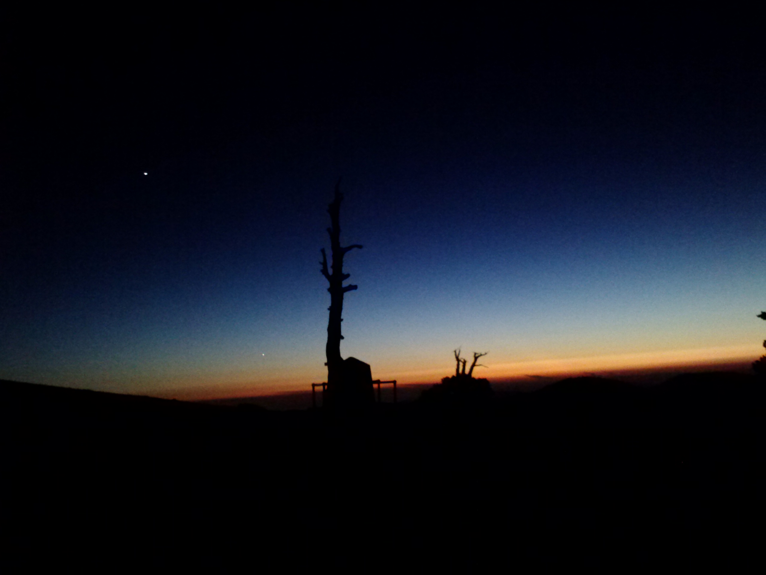
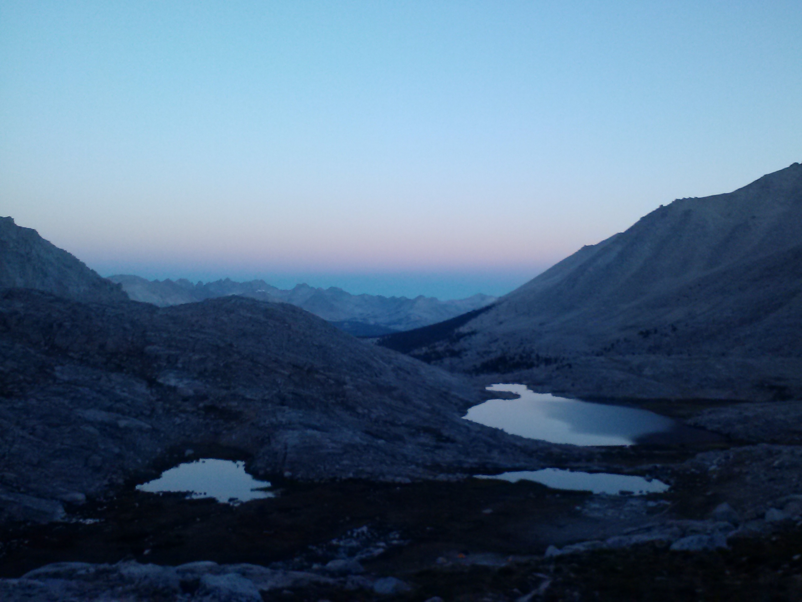
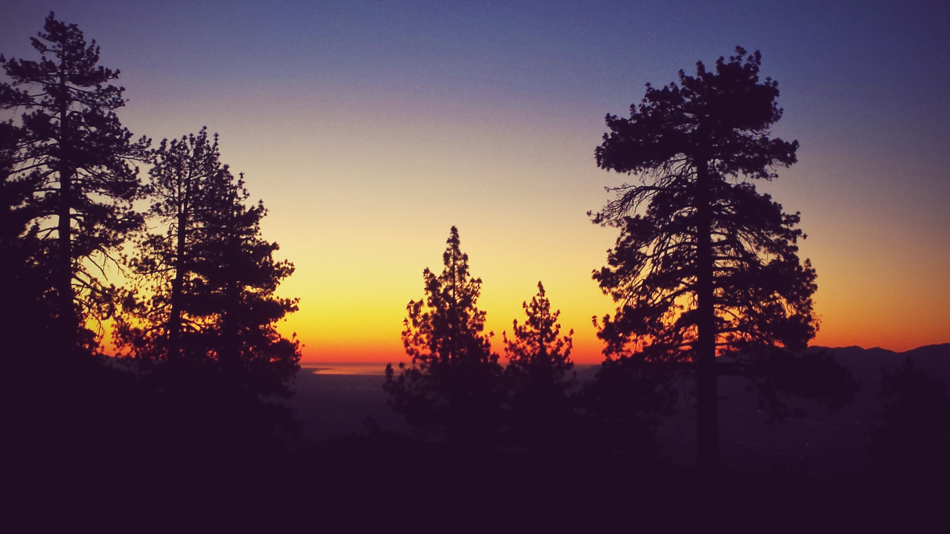
Sunset near Mt. Baden-Powell
Sunset on Mt. Baden-Powell summit
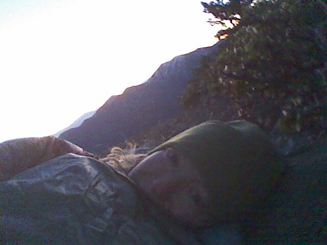
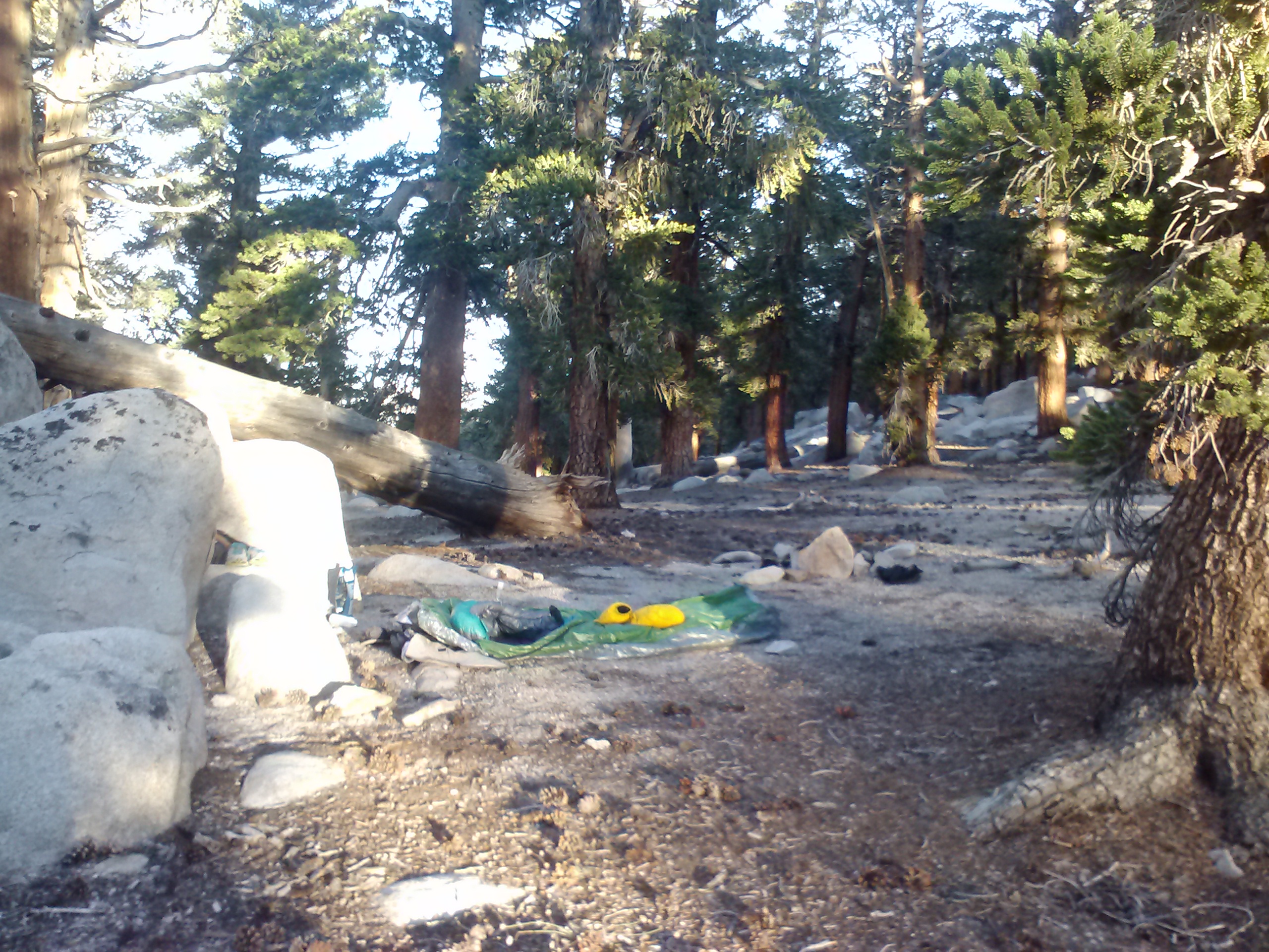
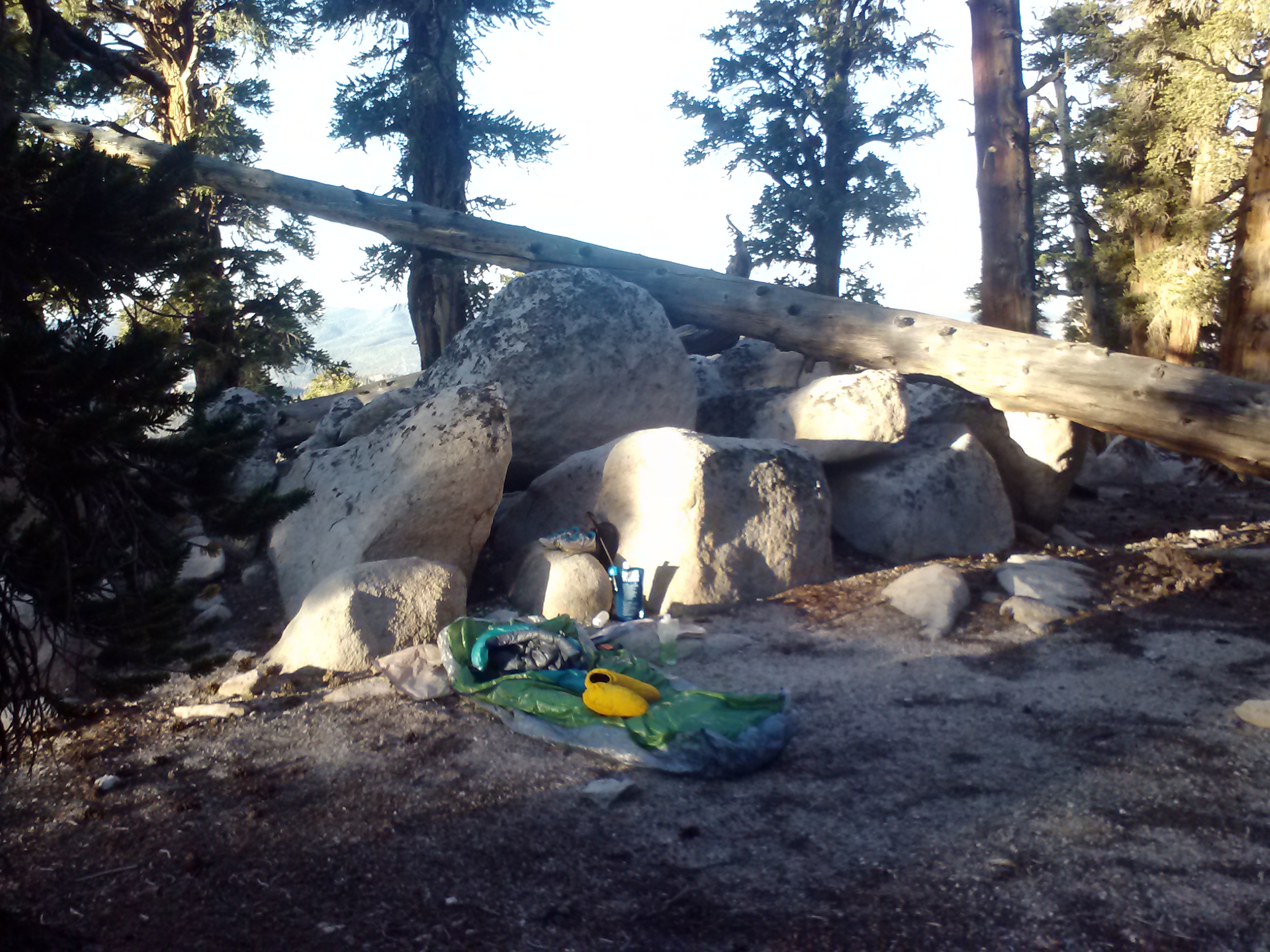
I quickly unrolled my sleeping pad, bivy sack, and sleeping bag on what looked to be the only flat spot, just under an old tree. I cooked up a black bean soup with chicken using my headlamp, and then packed all my smell-ables into my bear canister. I placed the canister up the hill just a bit, but as I started back towards my bivy, I heard a loud and very distinct CRACK. [Heart attack time!] I had done a bit of mental rehearsal on lion encountars, and immediately jumped to my defensive mode. Defensive mode for me consists of the most offensive words and threats that happen to fall out of my mouth in the moment at the top of my lungs: threats of body mutilation, permanent emotional damage that will make a lion second guess ever approaching a human again, and maybe even certain death. So, all these obscenities fly out of my mouth into the stillness of the night on top of Mt. Baden-Powell, and my little Ace Hardware headlamp isn’t strong enough to illuminate my bivy site. I carefully approach my gear, listening for sounds and looking for reflective eyes or dark cat silhouettes. Turns out I’d been screaming threats at my fallen trekking pole. I climbed into my bag before anything else caught my eye, and pulled out a book. Even with a good book and a huge beautiful moon rising in the east, my imagination still got the better of me. For the rest of the evening, a dark animal-like silhouette, which I was sure I could see moving, creeped me out; and, upon morning sunlight, it turned out to only be a dead tree trunk.
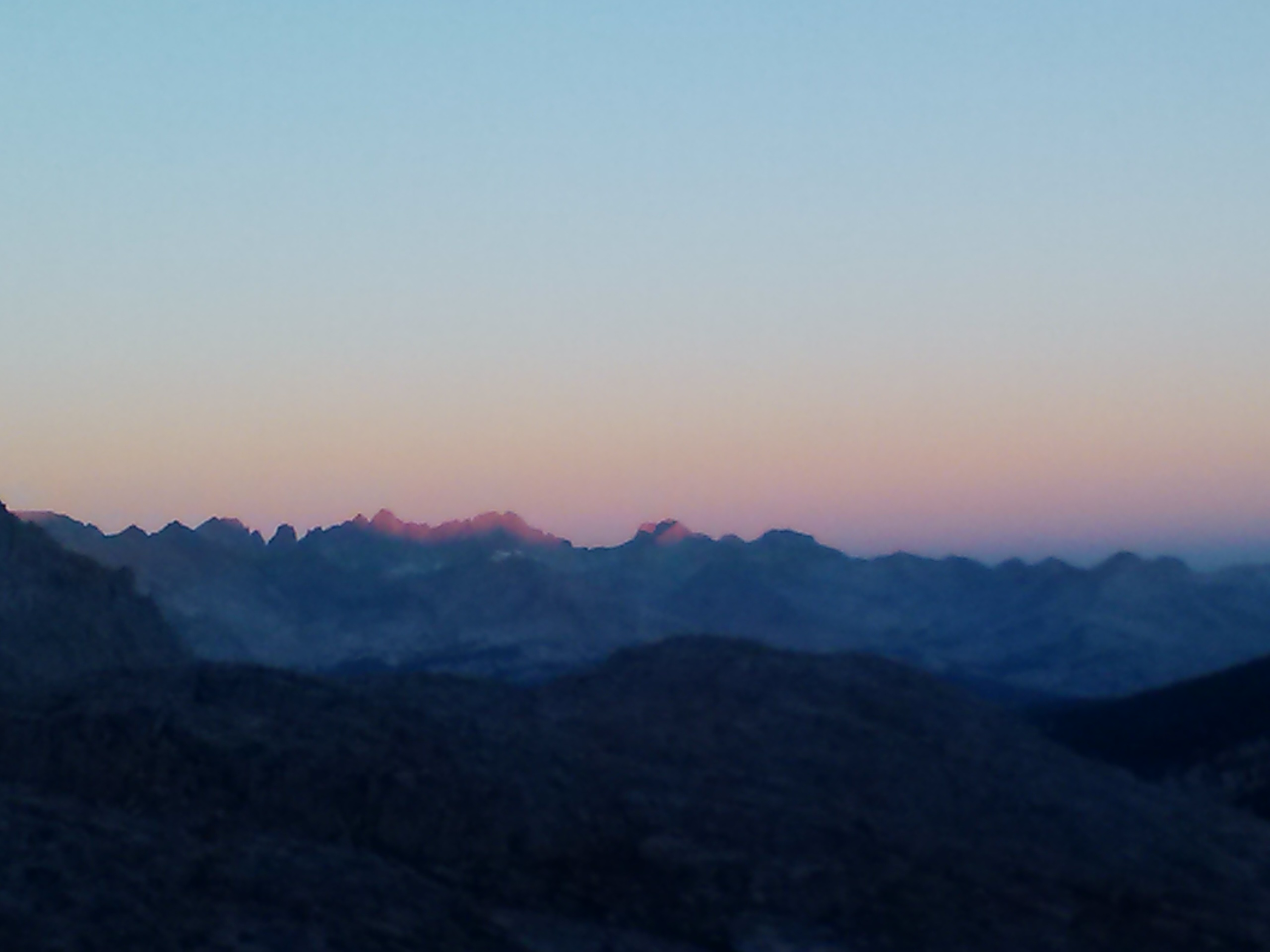
Waiting for sunbeams, summit of Mt. Baden-Powell
Moon setting
Day 2
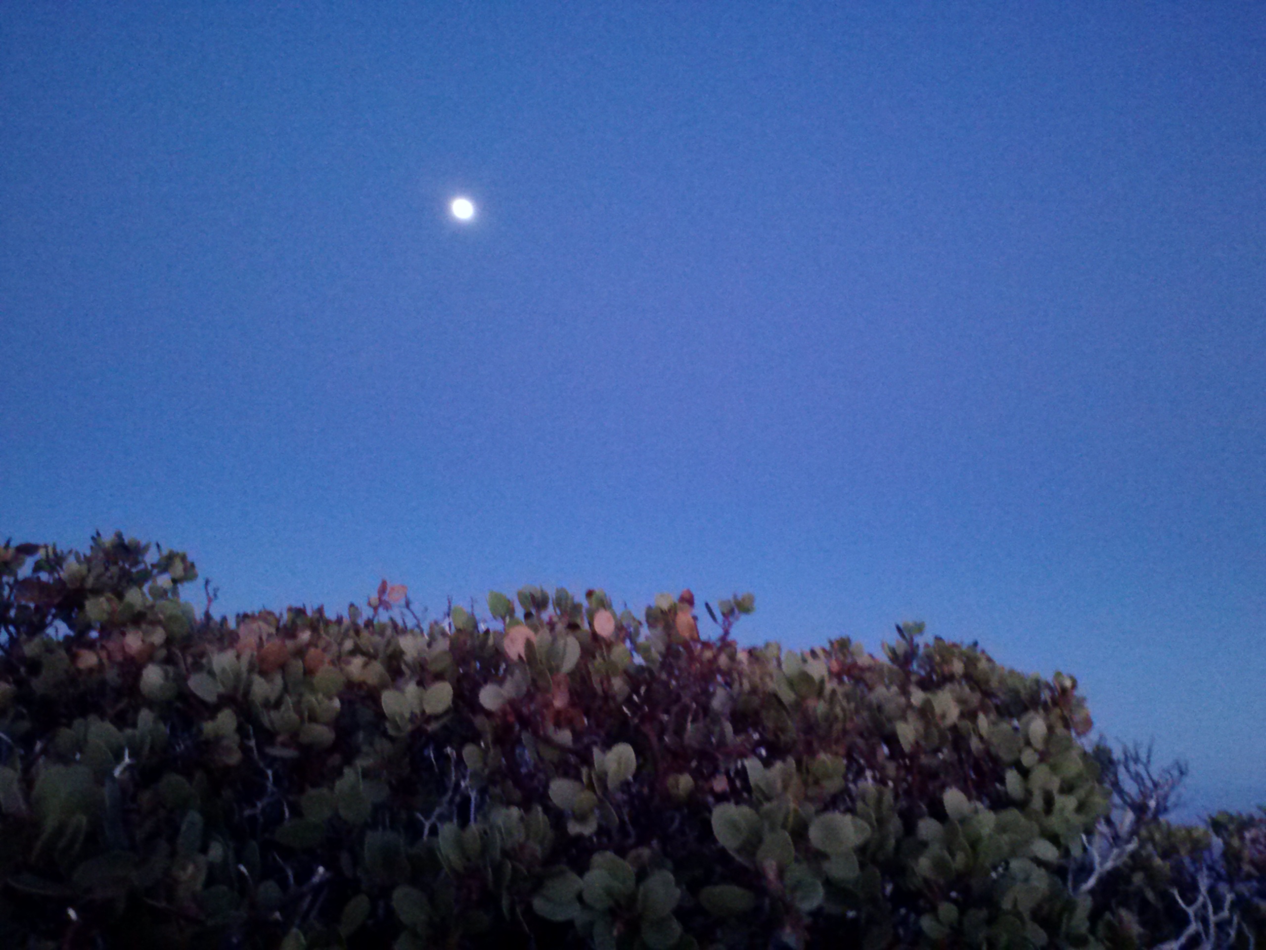
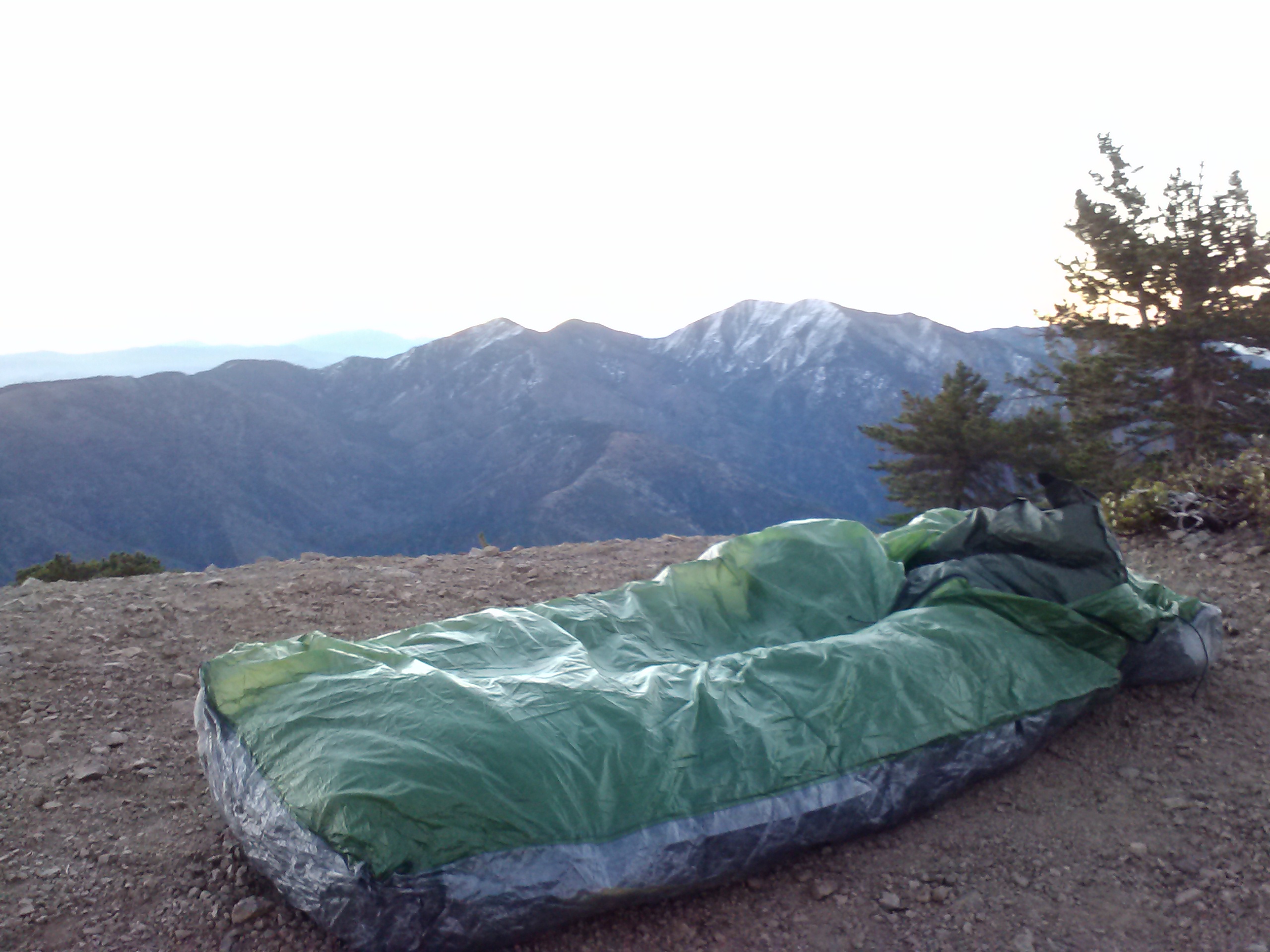
I woke before the first rays of sun and watched the soft colors of dawn feather out on the eastern horizon. Scooping up my entire sleep set-up in my arms, I shuffled to the summit and popped myself back in bed to watch the sunrise. To the west, the sky was still a dark blue and the moon was still making its way west. It made for an enchanting morning.
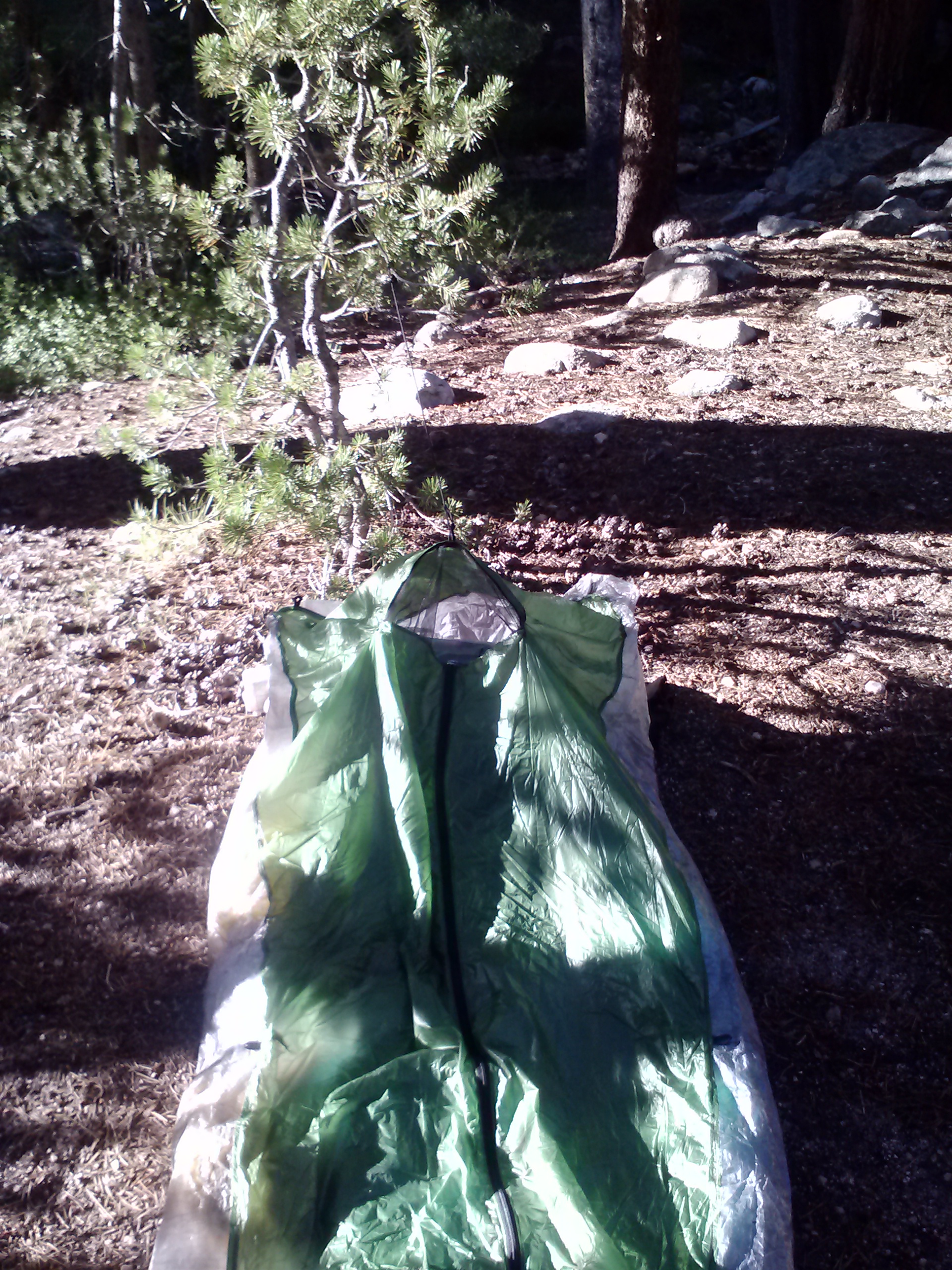
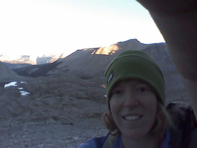
Watching the sunrise over Mt. Baldy with my very portable Zpacks bivy.
Mt. Baden-Powell campsite
Moon setting in the morning, Mt. Baden-Powell
Since it was chilly, I didn’t bother to change out of my pj’s or eat breakfast until further down the trail. As I tend not to like cooking in the morning, breakfast consisted of jerky and fig bars, with some True Lemon in my water. I must’ve been a bit dehydrated because I just couldn’t seem to satiate my thirst that morning. Less than 30 minutes down the trail I passed a couple who’d also hiked up the afternoon before, passing Mt. B-P and camping along the ridge, in a fairly exposed, but really beautiful spot.
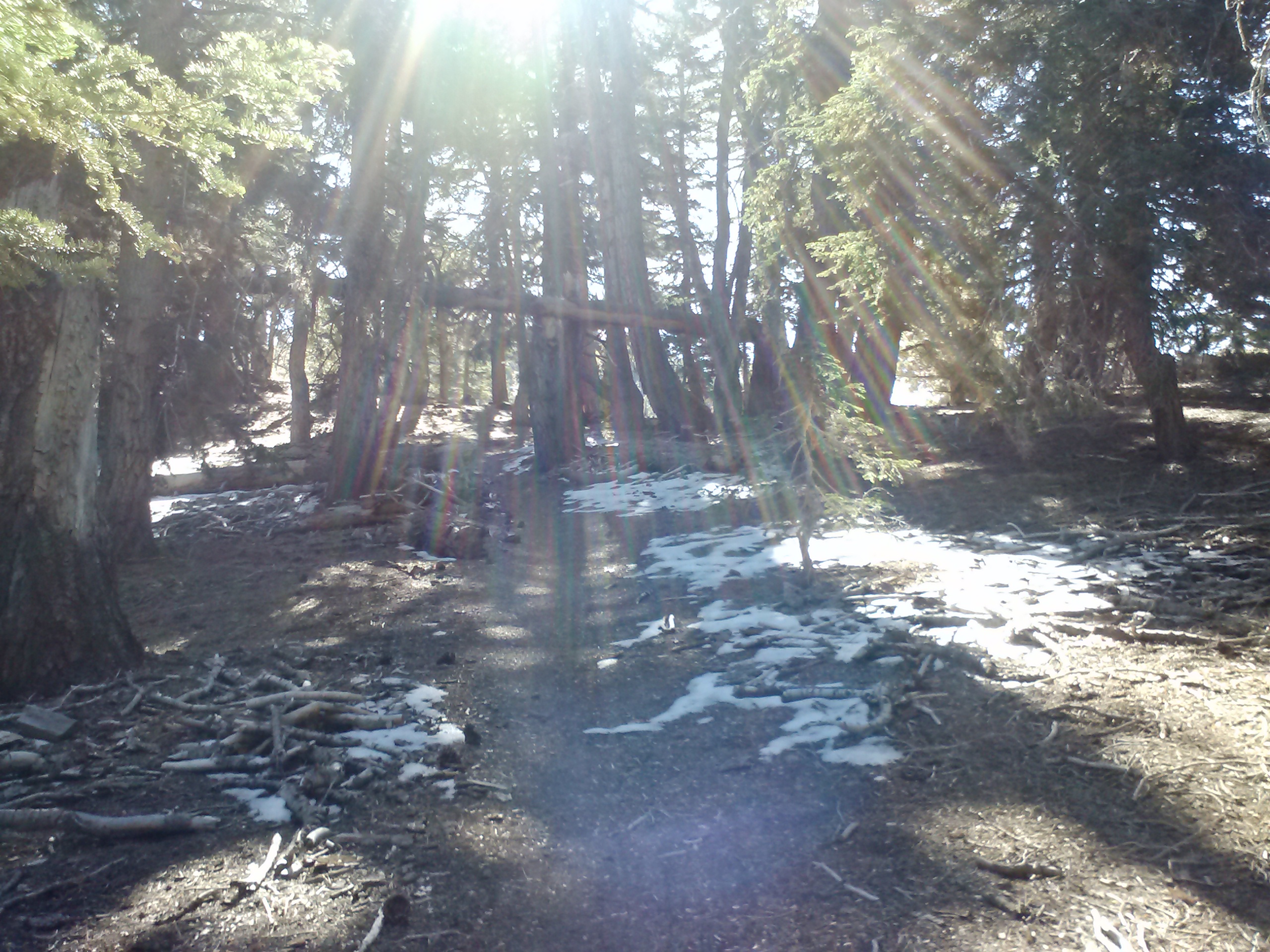
Snow on the PCT
Just past Mt. Baden-Powell
View towards Claremont, between Mt. Baden-Powell and Mt. Throop
I passed numerous day hikers that morning and was still lucky enough to see a couple of deer. It always amazes me how agile they are; they practically glide up and down clifs, over rocks, and through thick bushes as though they were simply skating at the roller rink. They often make me imagine that’s how so many dinosaurs must’ve moved millions of years ago. Bambi: a gentle, little creature of Angeles N.F. or a window to the ferocious and primal Jurassic world!
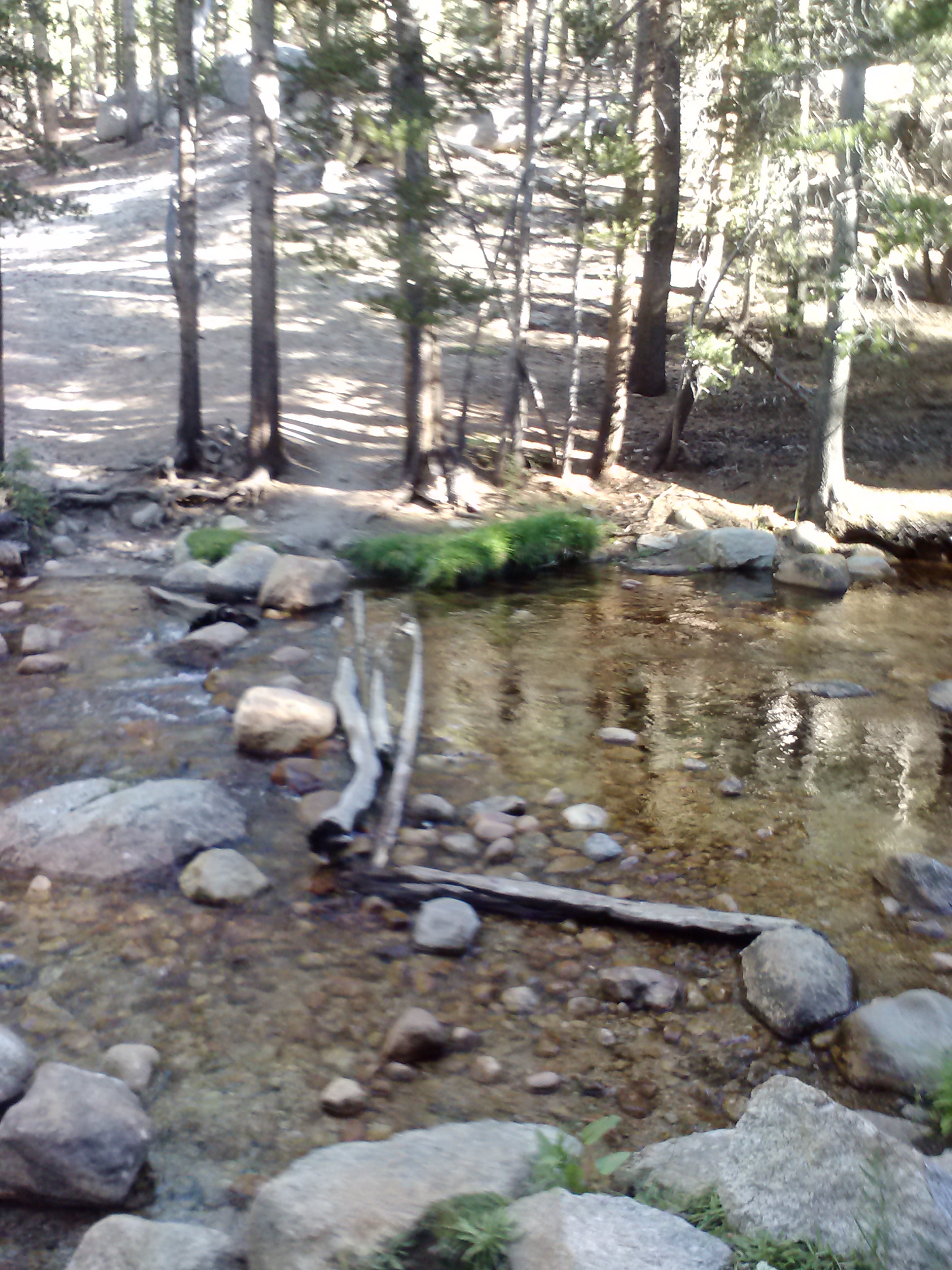
Little Jimmy Spring
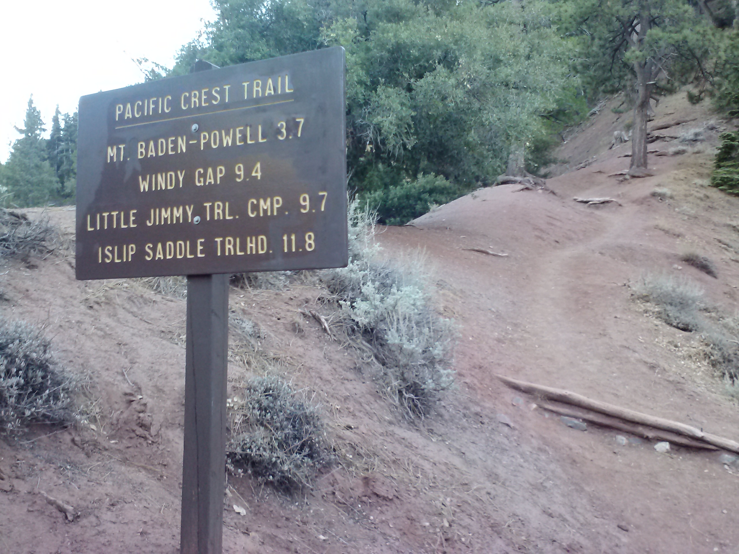
The next goal on the trail was Little Jimmy Spring near PCT mile 384. It was a 5.75 mile hike almost entirely on a gentle downhill. The spring was just past Windy Gap, a trail junction to Crystal Lake with a nice little bench. I met several campers coming and going from the Spring all doing quick overnights at Little Jimmy Campground. This well-flowing spring is built up with a stone wall and deck, and a simple bench.
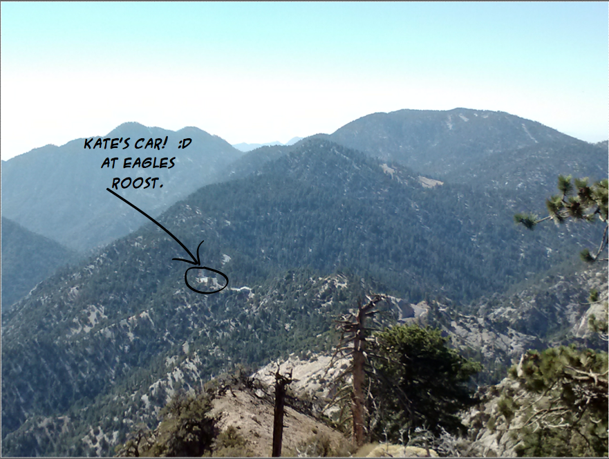
Another 2.25 miles later, I again found myself crossing Hwy 2 at Islip Saddle. I was feeling tired and, eyeballing the height of Mt. Williamson, was extremely tempted to just road walk to Eagles Roost instead of hiking up and over the mountain.
Just a third of the way up Mt. Williamson, I panicked and thought I might be on the wrong trail. Since there’s a trail closure between Eagles Roost and mile 394 due to an endangered species of frog, many hikers take a detour called South Fork Trail. This detour trail begins at Islip Saddle along with the PCT and branches off toward South Fork Campground and Punchbowl Creek. I didn’t remember seeing the trail junction at all, and I was in no mood to backtrack down the mountain and then up again on the correct trail. It must’ve been my anxiousness to reach Eagles Roost, but I really felt like I couldn’t think straight. I stared and stared at the map and couldn’t quite determine which trail I was on. Looking at the map now and remembering the terrain, it really shouldn’t have been that hard to figure out.
At the time, I resorted to pulling out my smartphone and using, for the first time ever, Halfmile’s app to locate myself on the PCT. Once a mileage position popped up, I still struggled because I didn’t know if Halfmile called official detours the “PCT,” which would mean I was on the South Fork Trail. If I had only tested out the Halfmile app other places on the trail, none of that confusion would’ve happened. The app is actually VERY clear about whether you’re on the PCT, a detour trail, or a road-walk. It even tells you how far off trail you might been and in what direction! I decided to trust I was on the PCT and not the detour, and hiked upward hoping to come upon a very distinct switchback to confirm my location. Indeed, Halfmile had me covered and I was exactly where I should be on the PCT. [How could I have ever doubted you, Halfmile? <3]. It still bugs me, however, that I never even saw the junction for the South Fork Trail.
View from Mt. Williamson, Angeles NF
A desert forest
Downed tree
I was overjoyed to reach the top, round the bend and look down toward Eagles Roost at my little car. The day was hot and I was ready for a big lunch in town. I practically ran down Mt. Williamson to the Hwy 2d crossing and raced myself across the last little section between Hwy 2d & Hwy 2e. I was making spectacular time and not even a big, bushy downed tree on the trail could slow me down. With branches cracking & limbs scraping, I charged over the tree and down to towards the highway and picnic area. Lunch followed shortly at Newcombs Ranch Bar and Restaurant down Hwy 2, which was not as awesome as I was hoping.
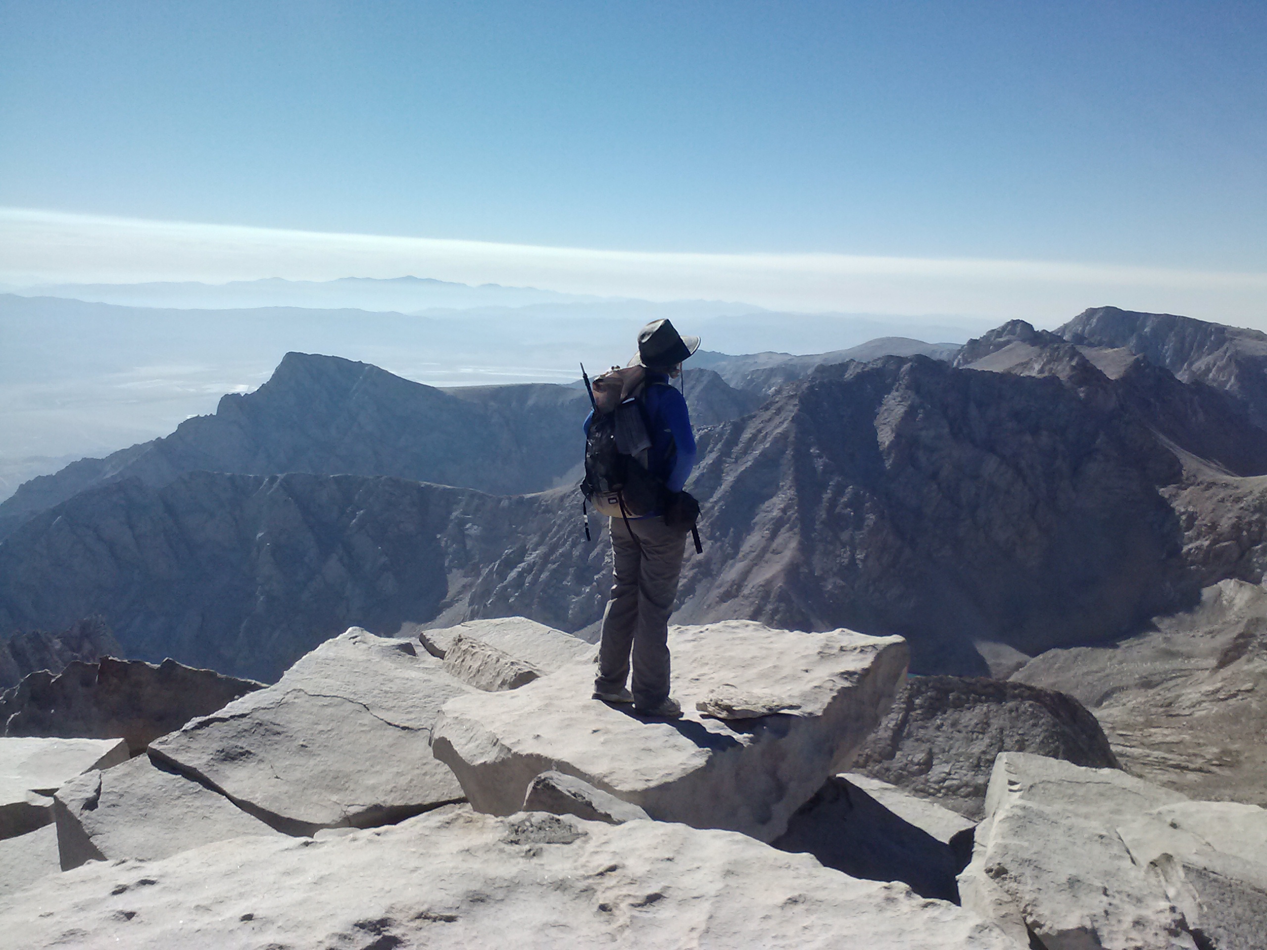
On August 5th, seven weeks after knee surgery, I found myself at the summit of Mt. Whitney. [applause, applause!]
I found myself on that summit for several reasons: the love of hiking, excellent medical care, determination and hard work. I was absolutely determined not to allow an injury to hinder my love of hiking. When I first injured my knees, I was heartbroken at the prospect of never hiking a long trail, or even day hiking, again in my life. Luckily, I had an excellent surgeon and physical therapist, who put me in right order in no time. Two years prior, I had to exit the John Muir Trail (JMT) after 90 miles because torn cartilage in both knees left me scooting down Selden Pass on my backside. In the year leading up to the JMT, I had fallen in love with the idea of long distance hiking, but hadn’t yet done a backpacking trip longer than 3 days. Every minute of planning for that trip and every day on the trail had been a joy, and leaving the trail early was crushing. I cried like a baby at Muir Trail Ranch as I faced the decision to leave early. It seems like a small thing, but it was one of the most disappointing moments of my life.
Post surgery dance!
Fast-forward to June, 2013. As I sat in the surgeon’s office, discussing the operation and recovery, I made the decision, then and there, I would hike the entire Pacific Crest Trail over the next year. In my mind at the time, the PCT was the ultimate long distance trail; and, if I strove for it, maybe even succeeded, I felt I would have truly healed: body and heart.
It makes sense that my journey should start with the tallest peak in the contiguous United States, right? I chose to start with this particular section of the PCT and Mt. Whintey because I missed out on it when I didn’t finish the JMT. Plus, it’s one of the best places to do an August hike!
I’ve decided to section hike Southern California until the end of the school year, and then begin my thru-hike next Spring. If I go northbound, I’ll begin the thru-hike at Onion Valley and finally complete the remaining miles of the JMT; if southbound, I’ll end at Onion Valley. Either way, it kinda feels like coming full circle.
No. 1- Horseshoe Meadows to Onion Valley, 2013
loading map - please wait...
Onion Valley Trailhead: 36.771323, -118.340097
Horseshoe Meadows: 36.447730, -118.169289
Toilet: 36.567288, -118.335929
Day 1
The first trail steps of my PCT Journey began after a car shuttle. I left my car at Onion Valley Campground below Kearsarge Pass and was driven by my good friends, Jonathan and Brendan, to Horseshoe Meadow. We stopped in between for lunch at Lone Pine’s Mt. Whitney Restaurant. I think our server was having a bad day, but the Pasta Primavera was DELICIOUS!
Jonathan & Eve
Brendan
As I disembarked from Horseshoe Meadow and the boys (it was adorable how much they fussed over me— thanks, guys!), my stomach was all a flutter with excitement and apprehension. What if my knees didn’t work? What if I was lonely and scared? What if I was cold, PMSy, or my homemade food sucked? OH, WELL! I was out the gate and there was no point in worrying any more. I was going to take one step at a time and one night at a time, and each of my fears would just have to wait in line like everything else!
My plan took me up Trail Pass Trail a couple miles to join the PCT near mile 745.5. If arriving at Horseshoe Meadow made me feel like a 6 year-old at Disneyland’s gates, then stepping onto the PCT felt like climbing into a car on Space Mountain!
I intended to only hike about 3 miles and find a campspot near Poison Meadow Spring. Despite really taking my time climbing up Trail Pass Trail, I still felt like I was making excellent time, especially after I had reached the PCT and the trail had leveled off. I had found my stride and it felt great! I took time to look around at the views, trees, rocks, & vegetation. I’ve always loved the drama of the rocks and trees in the Sierras. As the sun became low in the sky, I reached for my super cute, super cheap pink sunglasses only to find them missing already. I dropped my pack and scurried back along the trail at least 2/3 of a mile looking for the glasses, to no avail! Shuffling back to my dropped pack, I saw that the sun was ready to set and I still hadn’t found a place to camp. Bivy camping means pretty much anywhere could potentially be a camping spot— I could sleep directly on the trail if I had to, but it’s not the best. Nonetheless, a beautiful campsite appeared not too far up the trail.
Horseshoe Meadow looking towards Trail Peak
I tossed out my sleeping pad, unrolled my Zpacks bivy sack, and changed into my pj’s. After getting every thing set-up for cooking dinner, I noticed, for the first time, how very quiet it was around me. As I had seen only a few hikers that afternoon, and they were all exiting the trail as I entered, I felt quite alone. I boiled some water and poured it into a freezer bag with dry quinoa and chicken soup. Dropping my water balloon of a dinner bag into a cozy, I crawled over the rocks to watch the sunset across the valley below.
First night’s camp, near mile 748
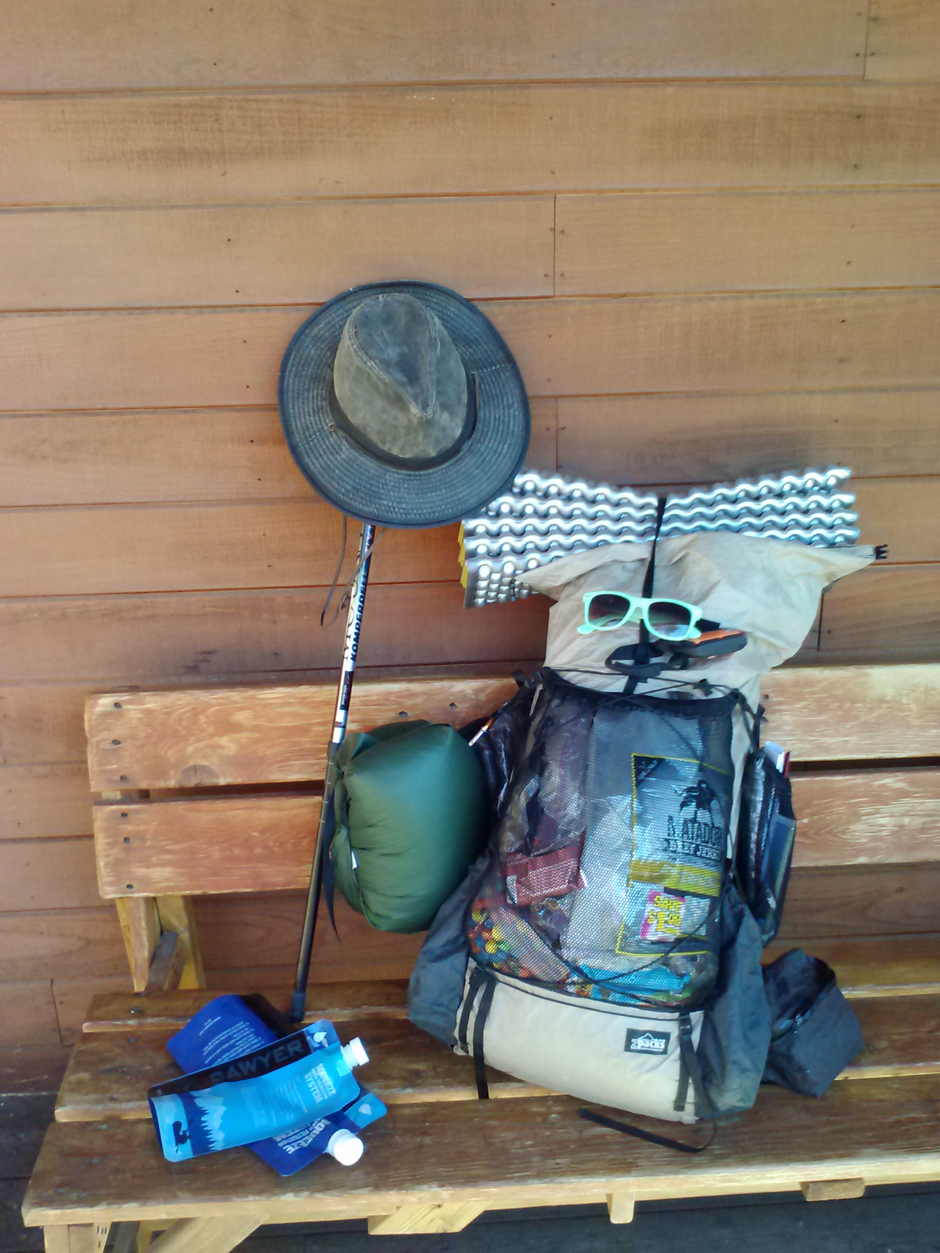
Lots of my gear was new for this trip, and I was still getting used to it. In an attempt to lighten my base weight, I treated myself to a Zpack’s Arcblast backpack, a Zpack’s bivy sack, a Therm-a-Rest Z-lite sleeping pad, and a little Trangia alcohol stove. I was also trying out a new FlexAir Ultralight Pillow, which I had read about on Lady on a Rock’s blog. (It’s a great blog, so check it out!)
Please note the tree & rock drama.
Comfort being a top priority for me in the backcountry, I was excited to find a comfortable pillow that weighs less than an ounce. The pillow gets inflated with a plastic straw, and then some ingenious folds in the material trap the air inside once the straw is removed. After having tested the pillow at home with great success, I was frustrated to no end as my head kept slowing sinking to the cold ground throughout the night. I couldn’t figure out if I had screwed up the fabric folds in the pillow or if maybe it had something to do with the elevation, but there were no pillow parties to be had that night.
View from first night’s campsite
The first night out in the wilderness is always the toughest, particularly when you’re alone. It had been over a year since I’d slept in the woods, and almost two years since I’d done my one and only other solo trip. The silence presses in on you, the unfamiliar feel of your sleep set-up and the climate against your face, and the inevitable boredom which your mind, just for entertainment’s sake, spins toward dark, scary thoughts. I found myself straining for the sound of cracking branches, indicating an approaching bear, lion, demented hiker, or aliens… I fancied I’d distract myself with star gazing, but my face was so cold I couldn’t be bothered to stick it out of my bag. I was beginning to feel like a failure. “How can I handle a week out here, if I can’t get past one night?!” As I couldn’t shut down my new super power of extra-dimensional senstive hearing, I dug out my Kindle and listened to Little Bee by Chris Cleave until I fell asleep.
Day 2
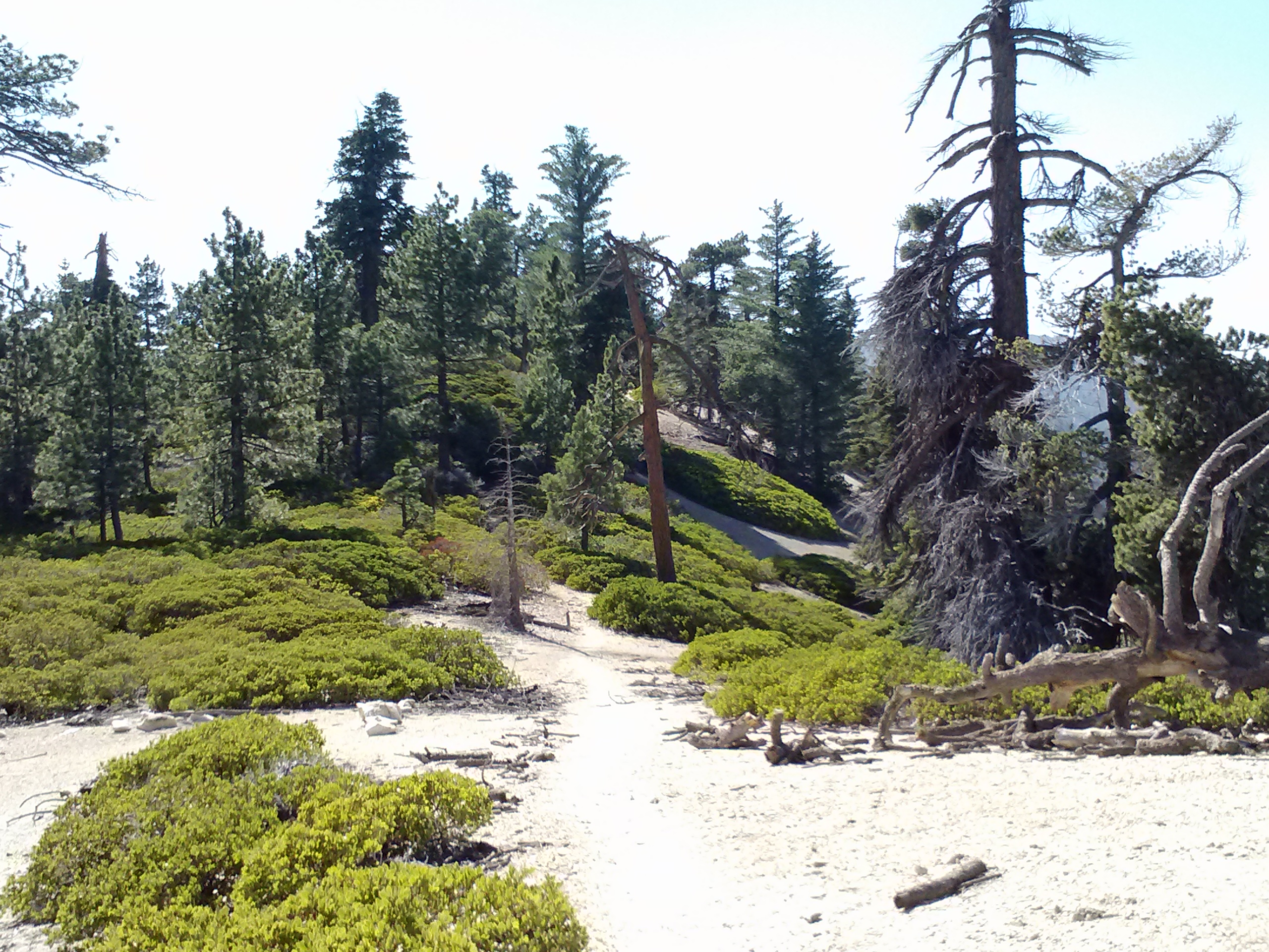
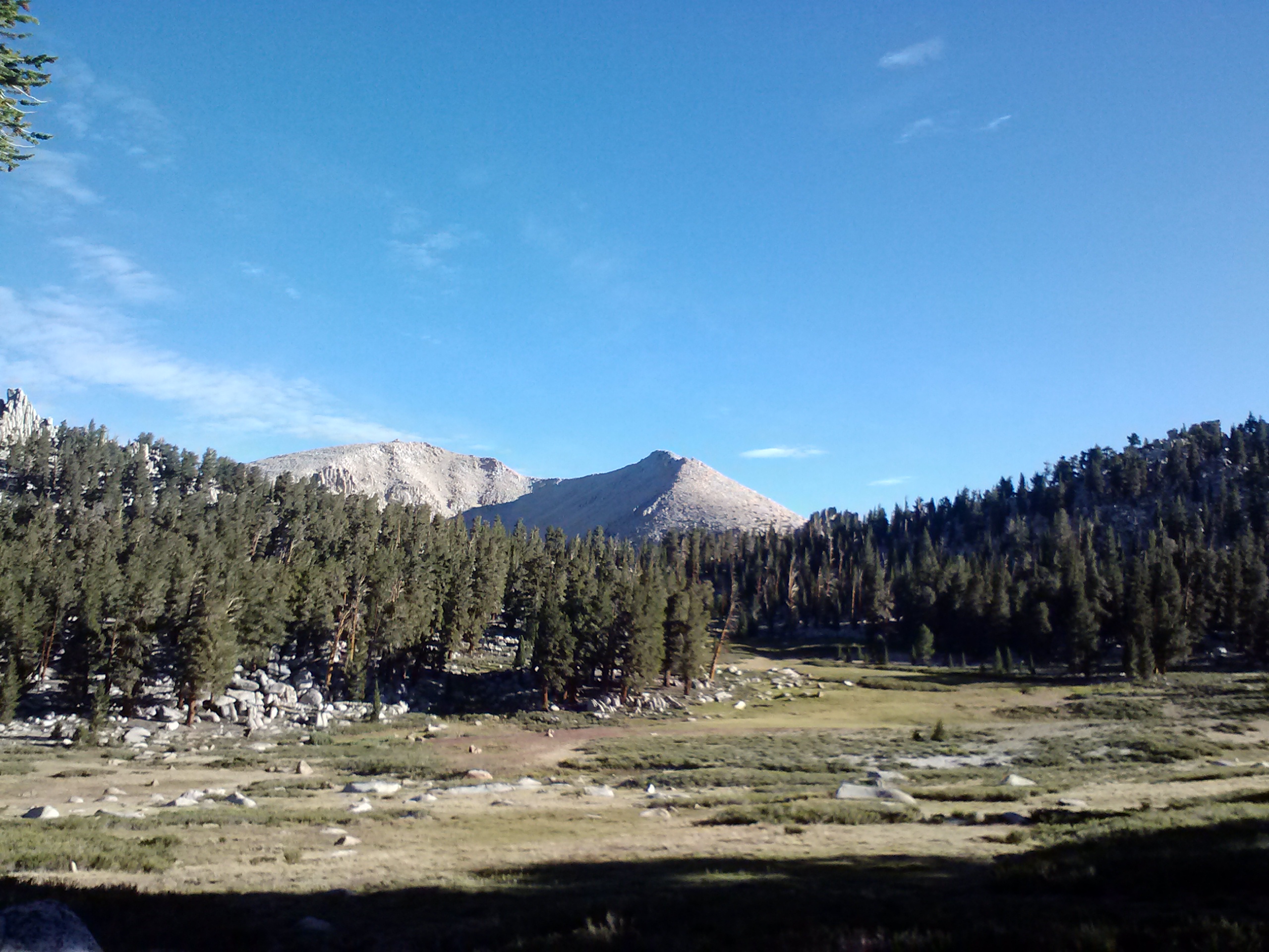
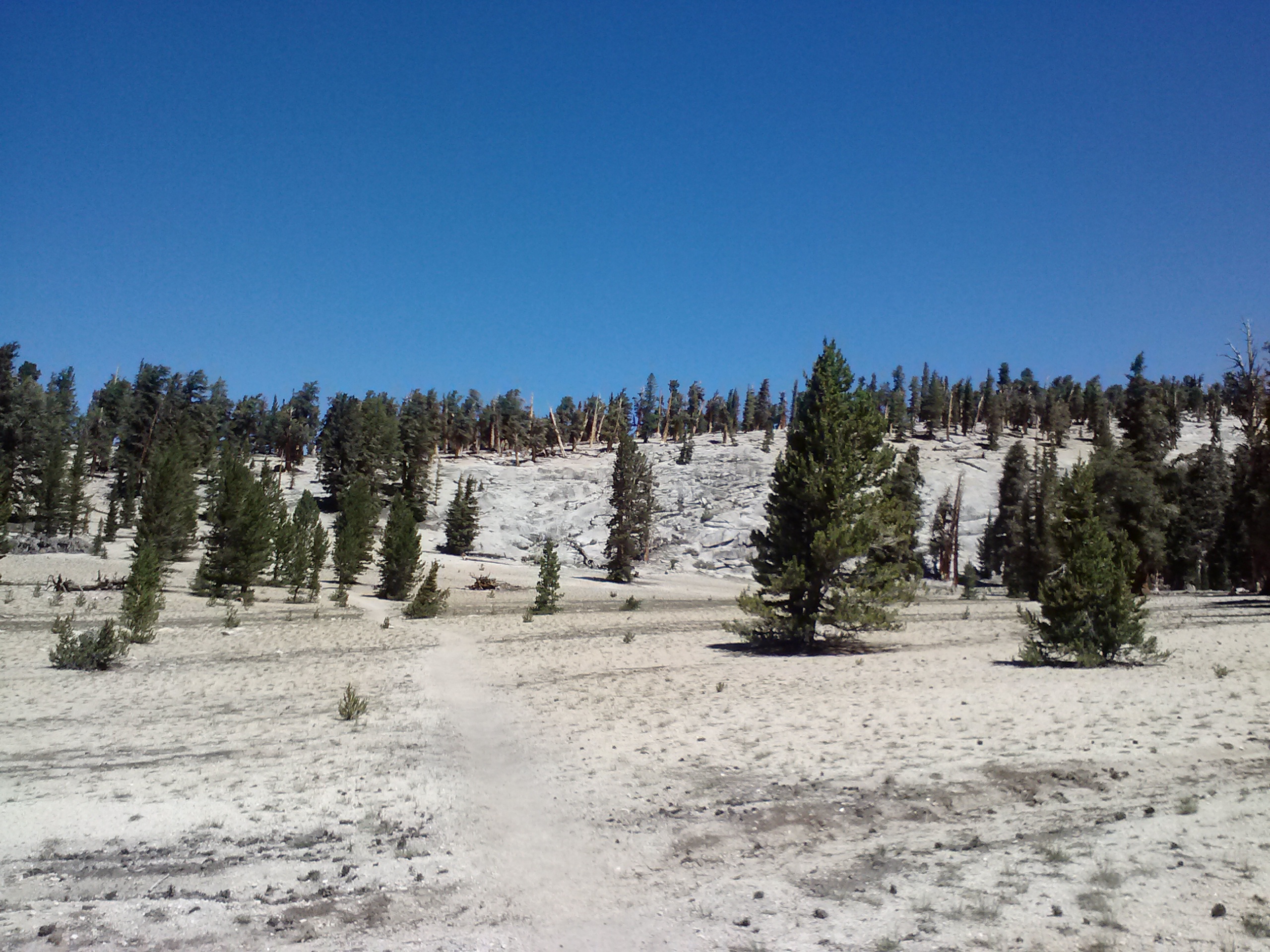
Waking up the next morning, I felt like a new person… a new person with a dead Kindle battery. Looking around my comfortable, now very safe-looking campsite, I felt silly for being so wound-up the night before. If every night was going to be like the first, I’d have a lot of Kindle charging to do during the day! Tossing that thought aside, I packed myself up and powered through the morning toward Cottonwood Pass and Chicken Spring Lake. As charming as the softly rolling and pine tree-carpeted mountains of the southern Sierras were, I was anxious to move into higher elevations, the more dramatic mountains, and the otherworldly scencery that comes with them.
Meadow near Cottonwood Pass
View of Horseshoe Meadow from Cottonwood Pass
While surveying the view of Horseshoe Meadow from the top of Cottoonwood Pass, I met at least 10 hikers and a dog. Seeing so many people, I again felt silly about the previous night’s mental drama. One of the hikers I met was fun lady named Suma Fong training for a hike in Peru, and it turns out she lives not far from my neighborhood in Southern California. We exchanged info and I hope to hike with her soon!
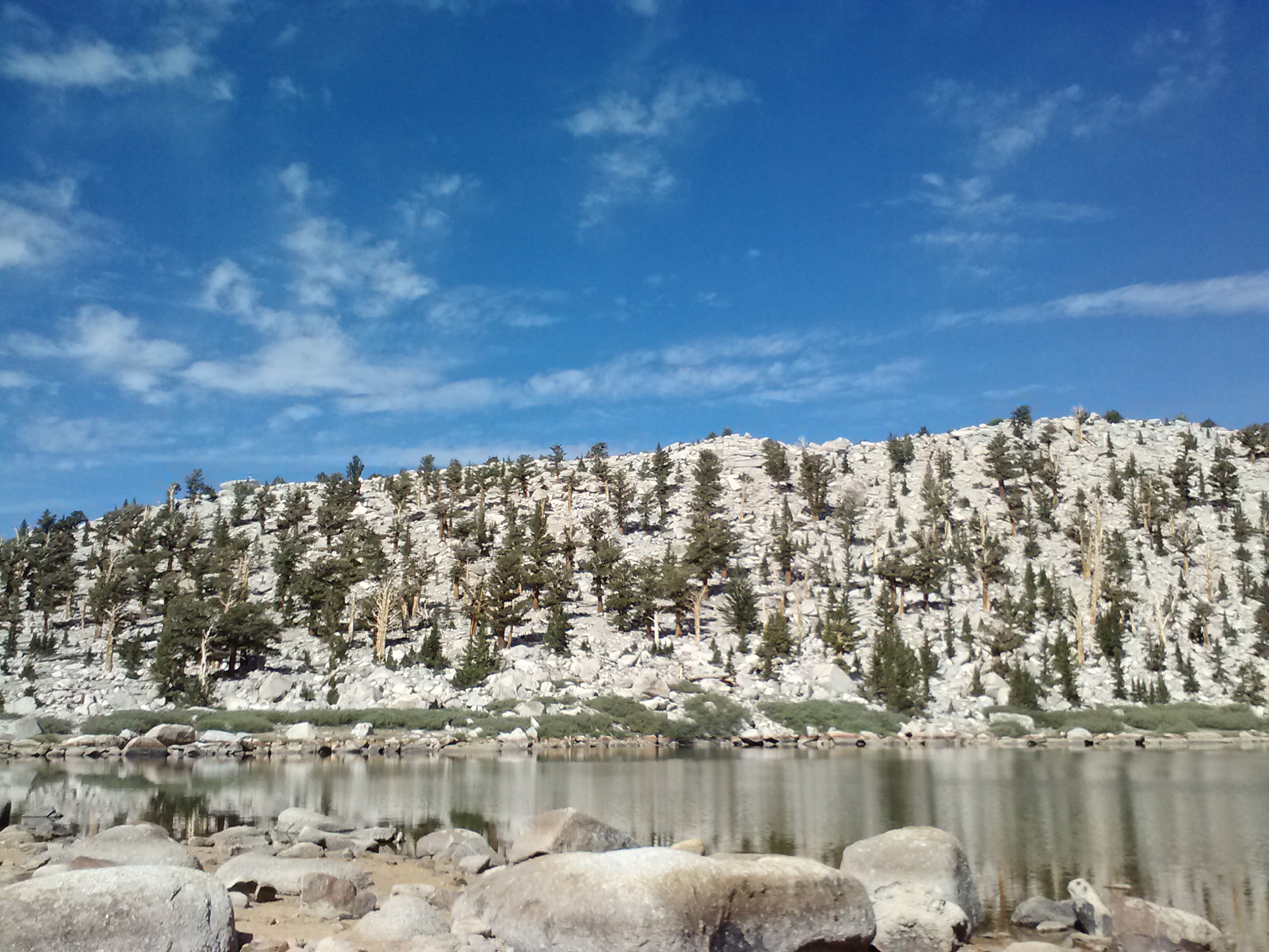
Chicken Spring Lake
Fantastic views from above Chicken Spring Lake
My goal for Day 2 was to hike 12.5 miles to Rock Creek and camp there for the night. Along my way I continually leapfrogged with a family of 6 also aiming for Mt. Whitney. After passing Chicken Spring Lake, the next water source would be Rock Creek, so I carried several quarts of water for the day. For most of the day, the trail was quite warm, dry and dusty.
Dusty trail
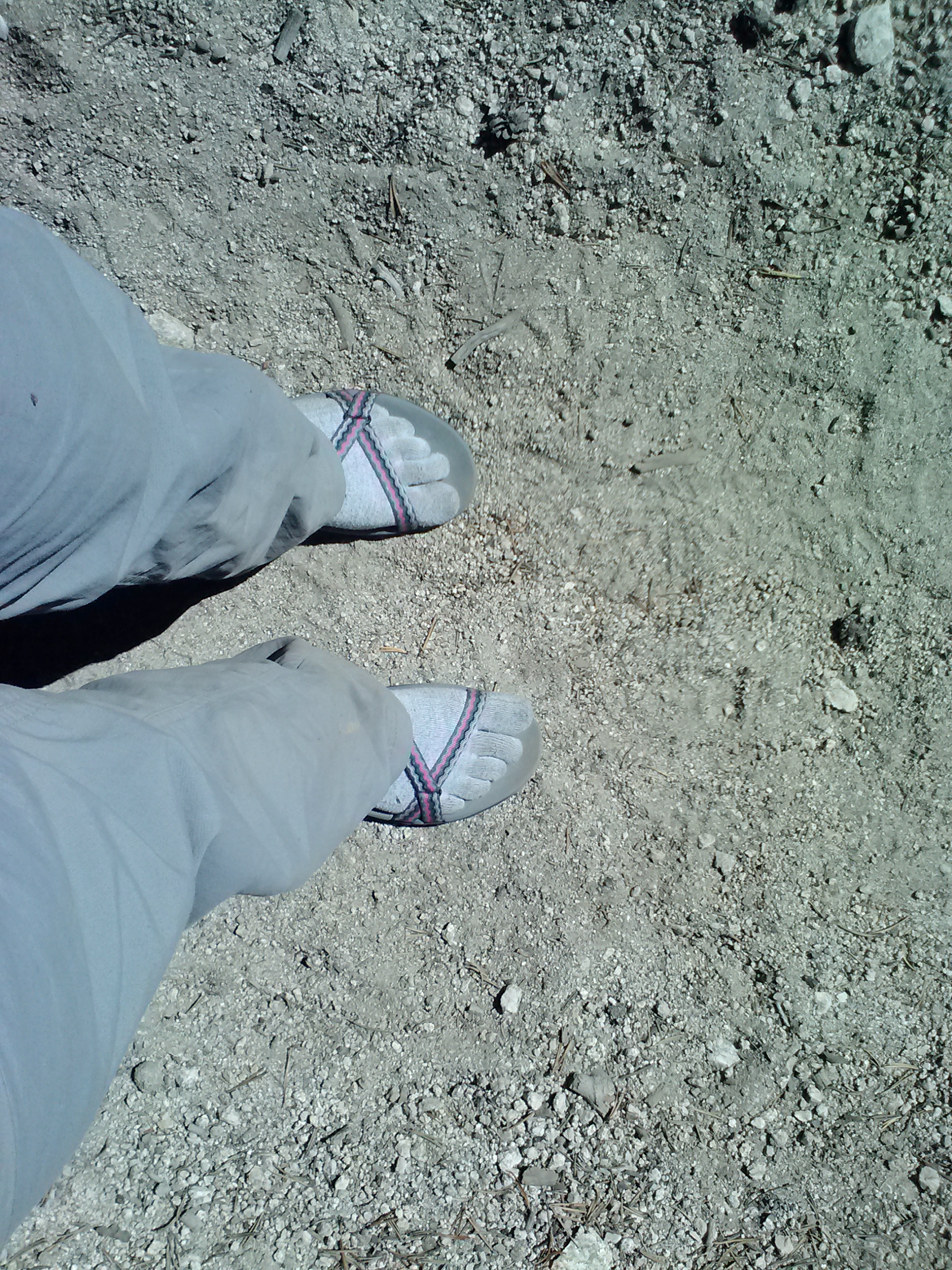
Teva’s Zirra Sandals with Injinji Toe Socks
As the day went on, my feet started to hurt, so I thought I’d try some sandal hiking for the first time ever. It was pretty awesome, and I think I might be hooked! Your feet do get exponentially dirtier hiking in sandals, but that just gives you an excuse to soak them at the creek. Just be extra mindful as you’re placing each step because a small slip can easily lead to a bloody toe.
Rocks stacked like library books
The afternoon turned out to be a lovely hike down into the Rock Creek area. There were more trees, grass, meadows, and little brooks feeding into the larger Rock Creek. I reached the campground in the late afternoon, and as I passed the first, totally sweet looking campsite, I spotted a Hennessy Hammock swinging in the trees. (Side note: I LOVE hammock camping and get super excited when I meet anyone on the same page.) Turns out the hammock belonged to a friendly Orange County kid named David who was hiking with his friend Danny. They were such a couple of kindred spirits, I promised to return for dinner that evening.
Rock Creek
Second night’s campsite at Rock Creek
I was absolutely entranced with Rock Creek. The creek itself was a spakling brown and the soft trees and grass surrounding gave the area a comforting ambiance. There are several campsites along the trail here and a bearbox near the creek crossing. I pulled EVERYTHING out of my pack and spread it all out as if I were in my living room at home. Making myself feel even MORE at home, I walked down the creek, stripped down past my skivvies, and took a very coooold bath.
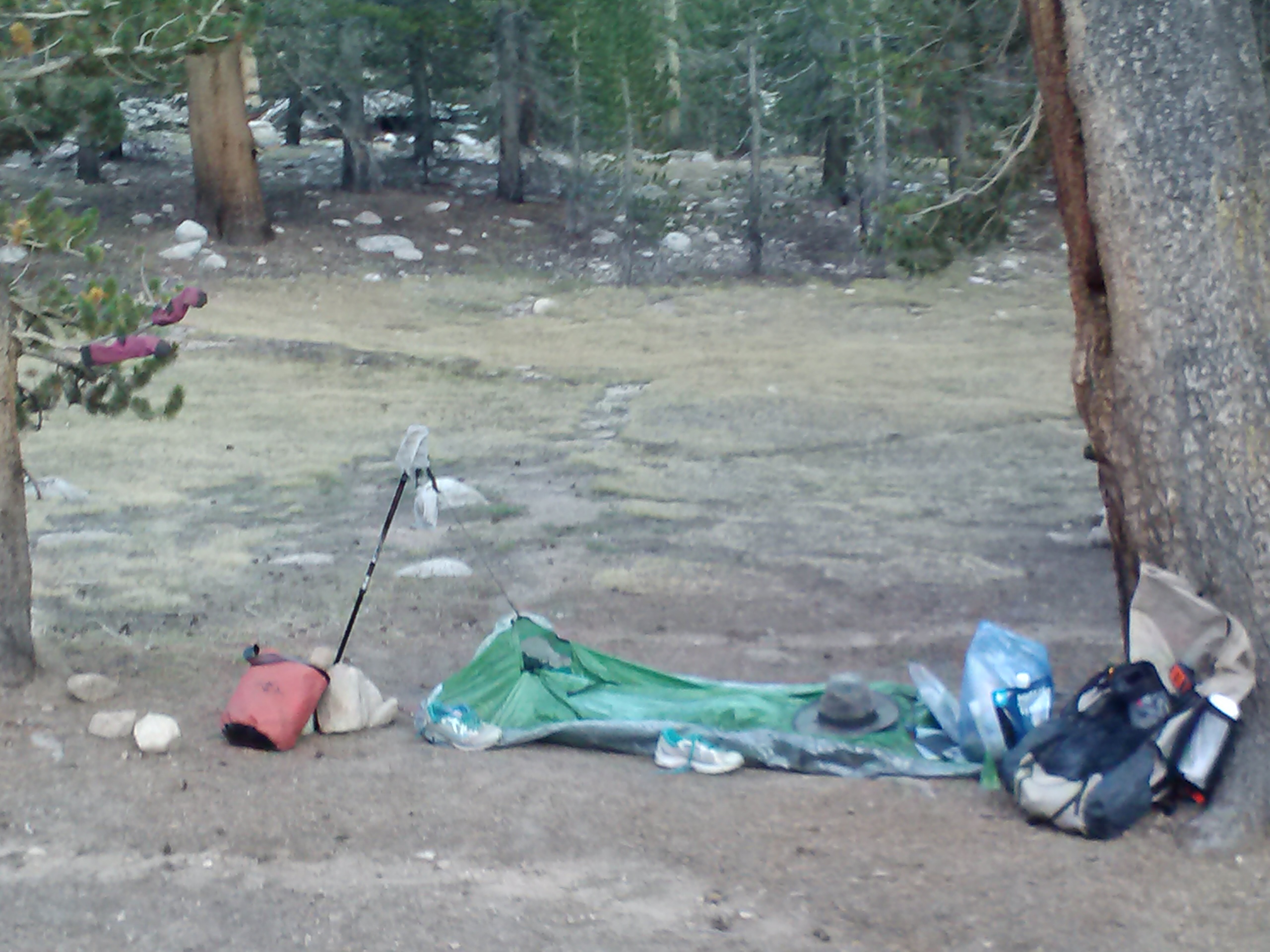
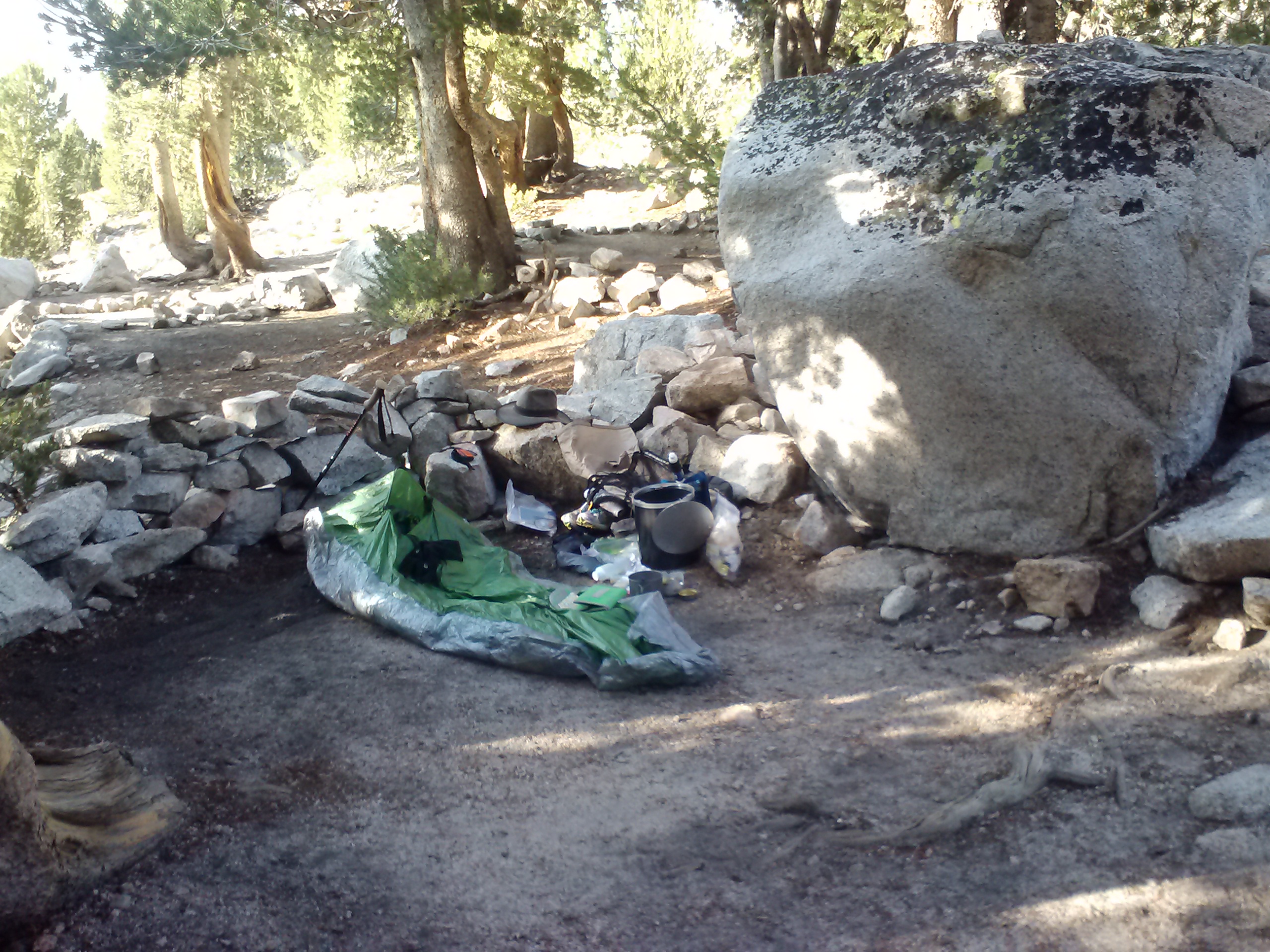
Zpacks bivy sack
Now that I was as clean as I could get, I boiled water to rehydrate some chicken couscous with veggies and reorganized my pack. With my couscous still cooking inside a cozy, I made my way back up the trail toward David and Danny for a bit of a dinner party. They were such fun! Danny was a vibrant soul with a neverending thirst to exchange information and stories. David was on the quiet and pensive side, but he and I definitely connected over the famous Shug’s Youtube hammock videos. (Check out one of Shug’s Whoooooo Buddy! Youtube videos here.) Since they had both just gotten back from summiting Mt. Whitney, they filled me in on all the details. Such as, get up to Guitar Lake early because all the good spots will be taken quickly! We shared some Trader Joe’s gummy penguins and other simple delights while the night darkened around us. Being the gentlemen they were, they both escorted me down the dark trail and past the other campers.
Day 3
I slept in the next morning until 8am. It seemed the sun was already high in the sky… must’ve been too much partying the night before. Speaking of the night, none of the demons from the previous evening visited me again, to my delight! I think it had much to do with the fact that other campers were mere yards away and I fell asleep to the bell-like sounds of Rock Creek.
Rock Creek crossing
Feeling behind schedule, I threw together my gear and, after nearly tottering into Rock Creek, pushed up the switchbacks that awaited me. As I reached the top of the switchbacks, I felt strong, I felt fast, I felt like Superwoman! … and then I felt hot. I reached over my pack to pull down my Sheila hat, but I was grasping at air. For almost a minute I couldn’t really believe it wasn’t there. I kept reaching around from different directions (probably looked quite funny!), then took off the pack to check, and finally eyeballed the trail below. It was NO WHERE. I had left it back at Rock Creek, waaaaaay below the switchbacks I had just powered up. After having lost my uber cute pink sunglasses on Day 1, I wasn’t about to loose my Sheila hat, too. Down into the trail dirt went my backpack, and down to Rock Creek I charged. Huffing and puffing, not with exhaustion, but with indignation.
On the way down, I passed the family of 6 I had been leapfrogging the day before. Not a word more than “howdy-do” was exchanged, but they seemed to have an idea of the situation; and they parted like the Red Sea for me. There, hanging on a slender, very Charlie-Brown-Christmas-Tree looking sort of pine, was my hat. I snatched it up and, with a few indecent words, crossed Rock Creek for the third time. The family and I had a good laugh at my expense as I hustled back to my pack. I told them, I’d probably see them over and over at the rate I was going.
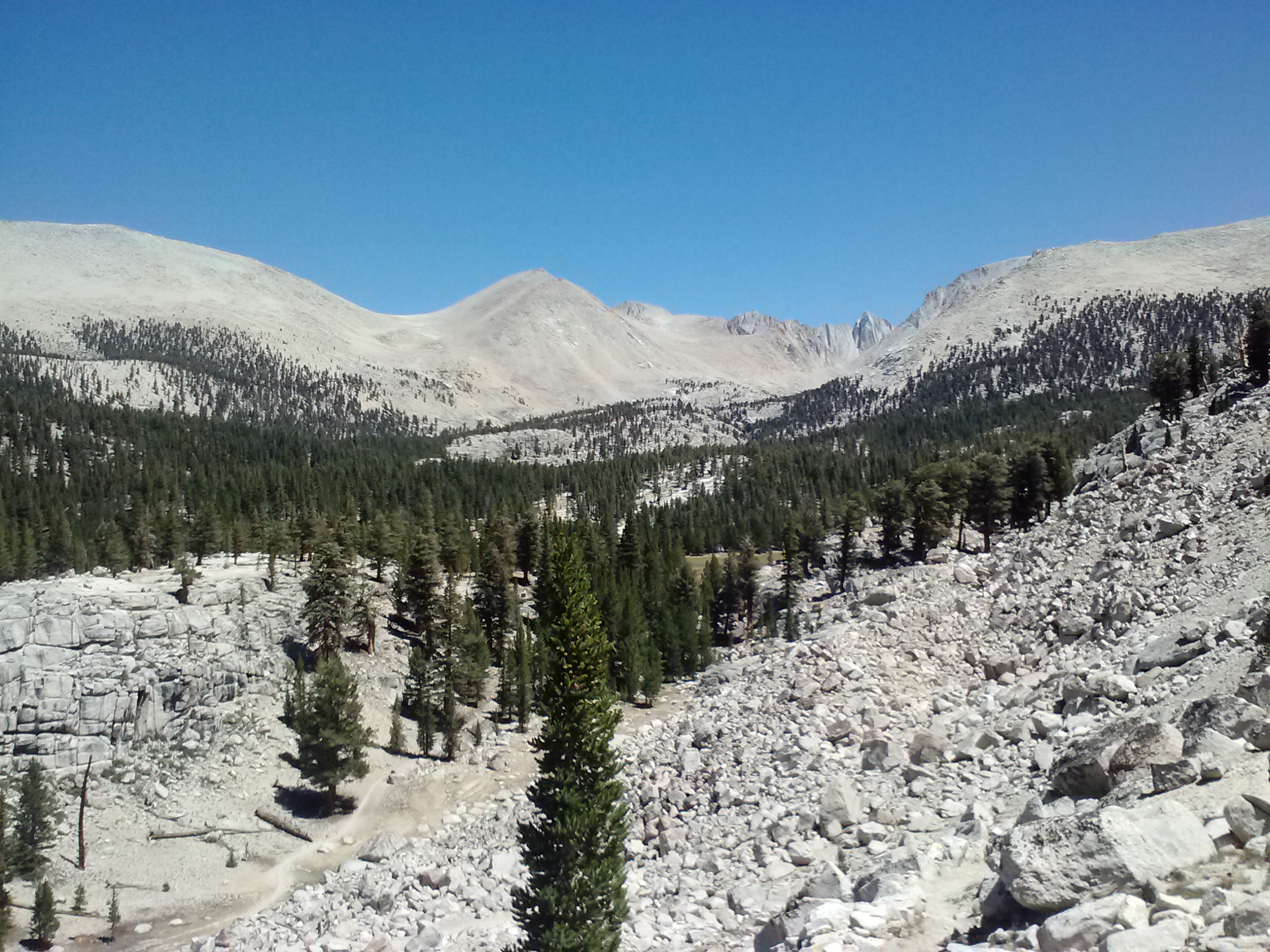
Guyot Flat, PCT mile 763.5-ish
View towards Crabtree Meadow, Mts. Hitchock, Russell, & Hale
It was a lovely day for hiking and the 8 miles went by quickly. Every corner I turned, every hill I topped was exciting. I kept humming “The Bear Went Over the Mountain…” over and over. It got old, but the views didn’t!
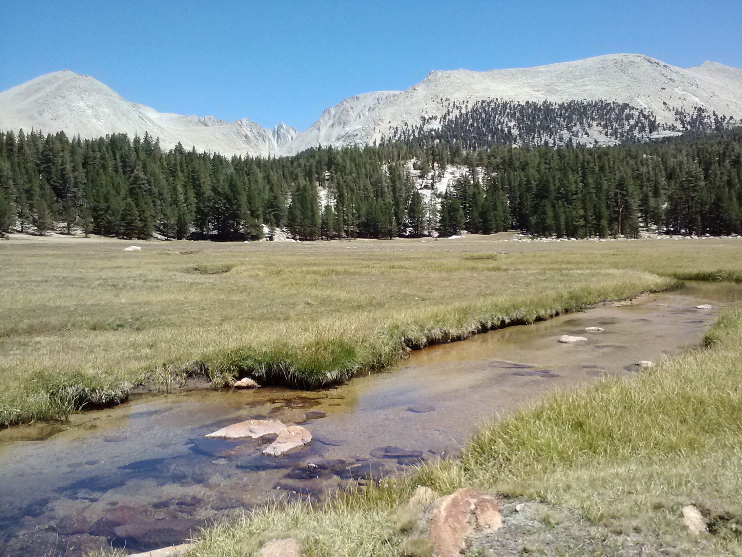
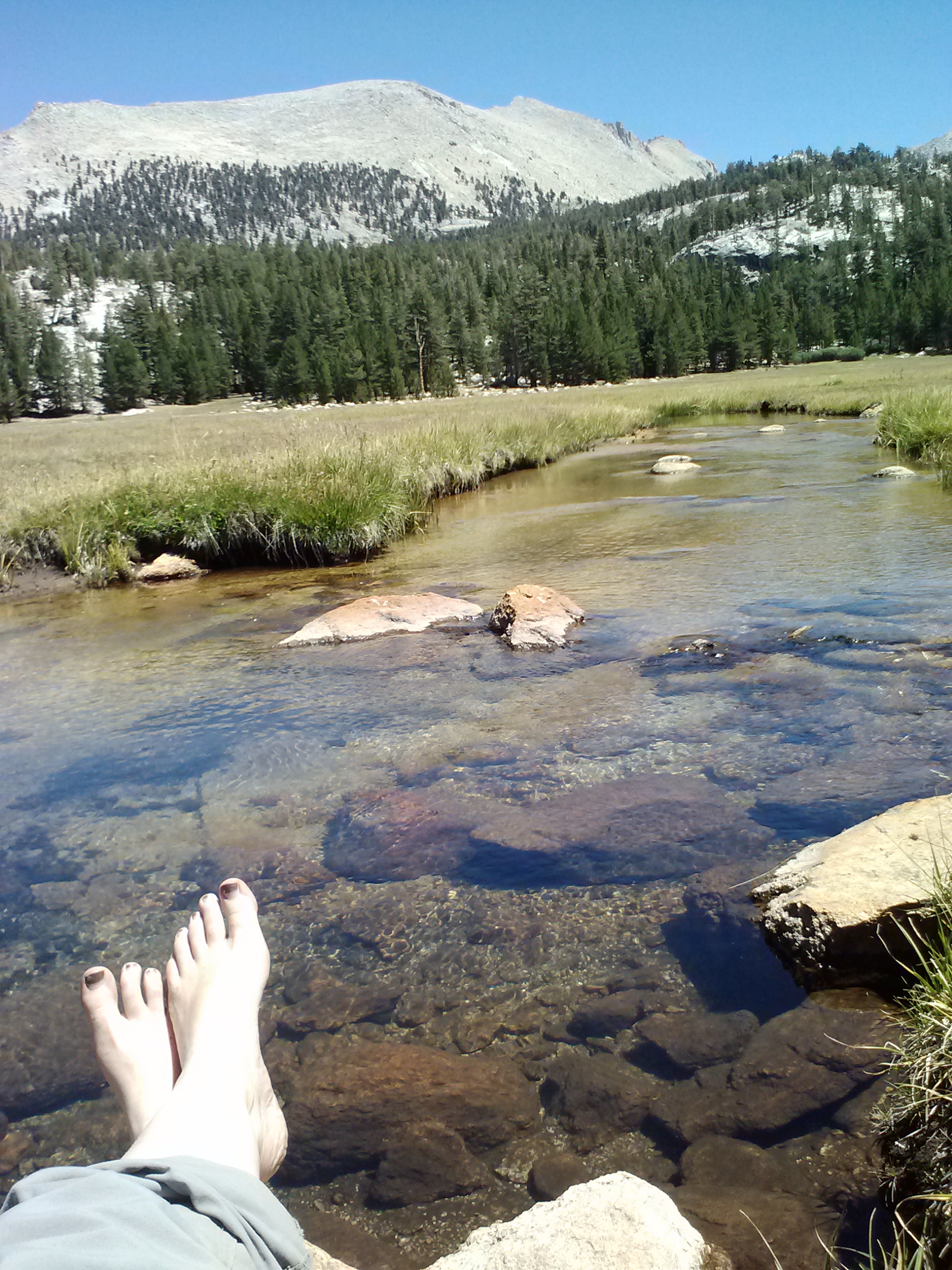
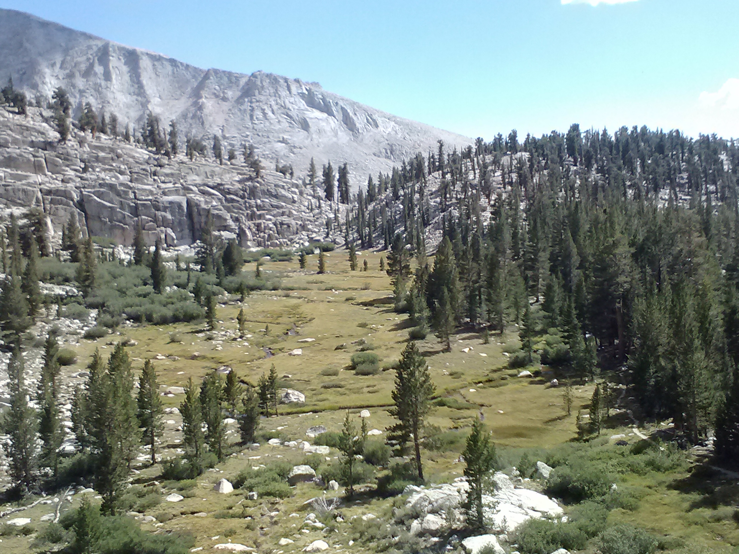
Lower Crabtree Meadow & Crabtree Creek
Stepping into lower Crabtree Meadow was a magical moment for me. It had the quintessential soft grass, green trees, mountain views, and babbling brook. The magic couldn’t even be broken by a very grumpy hiker who, according to his lady companions, hadn’t eaten enough that day.
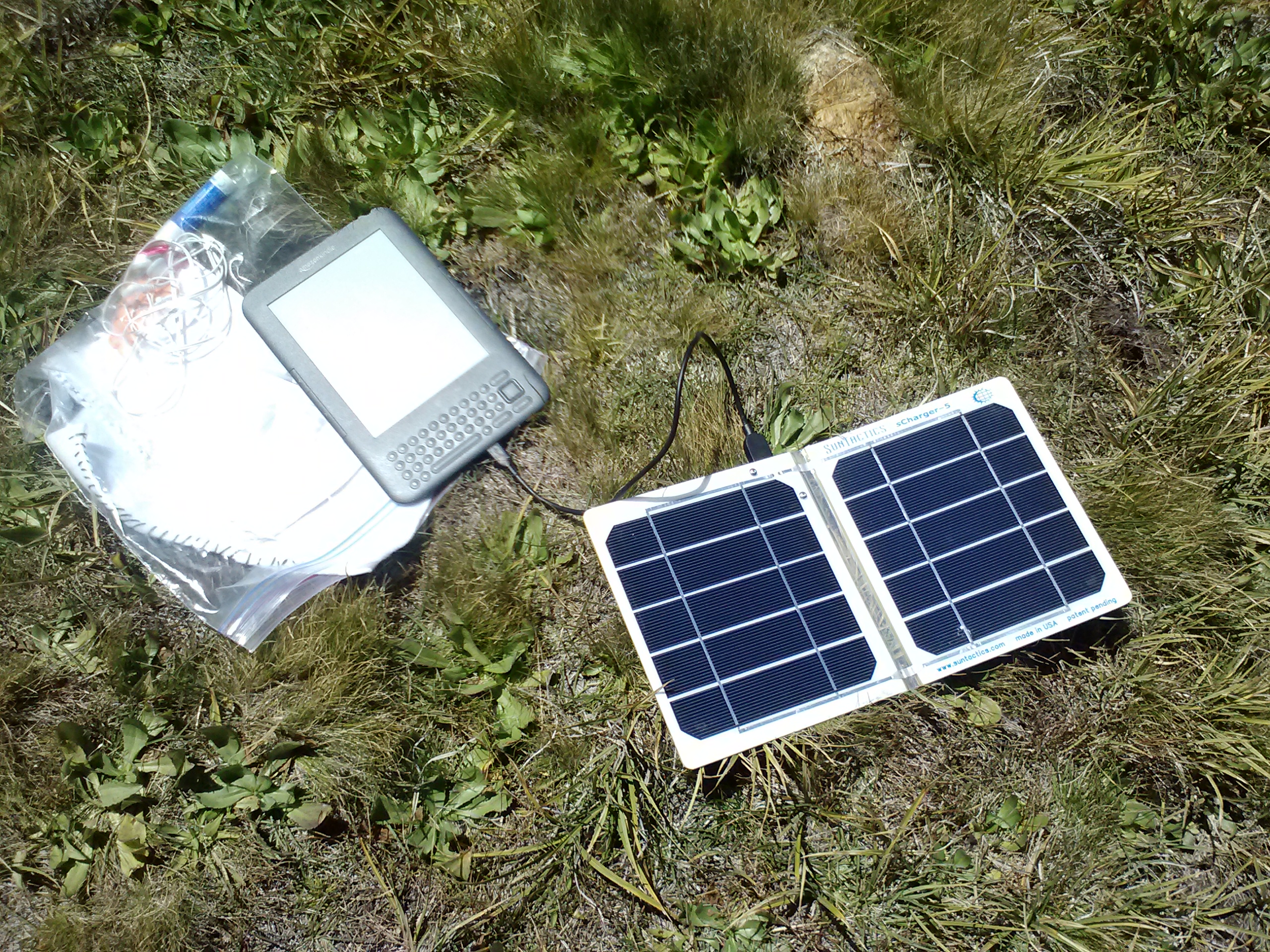
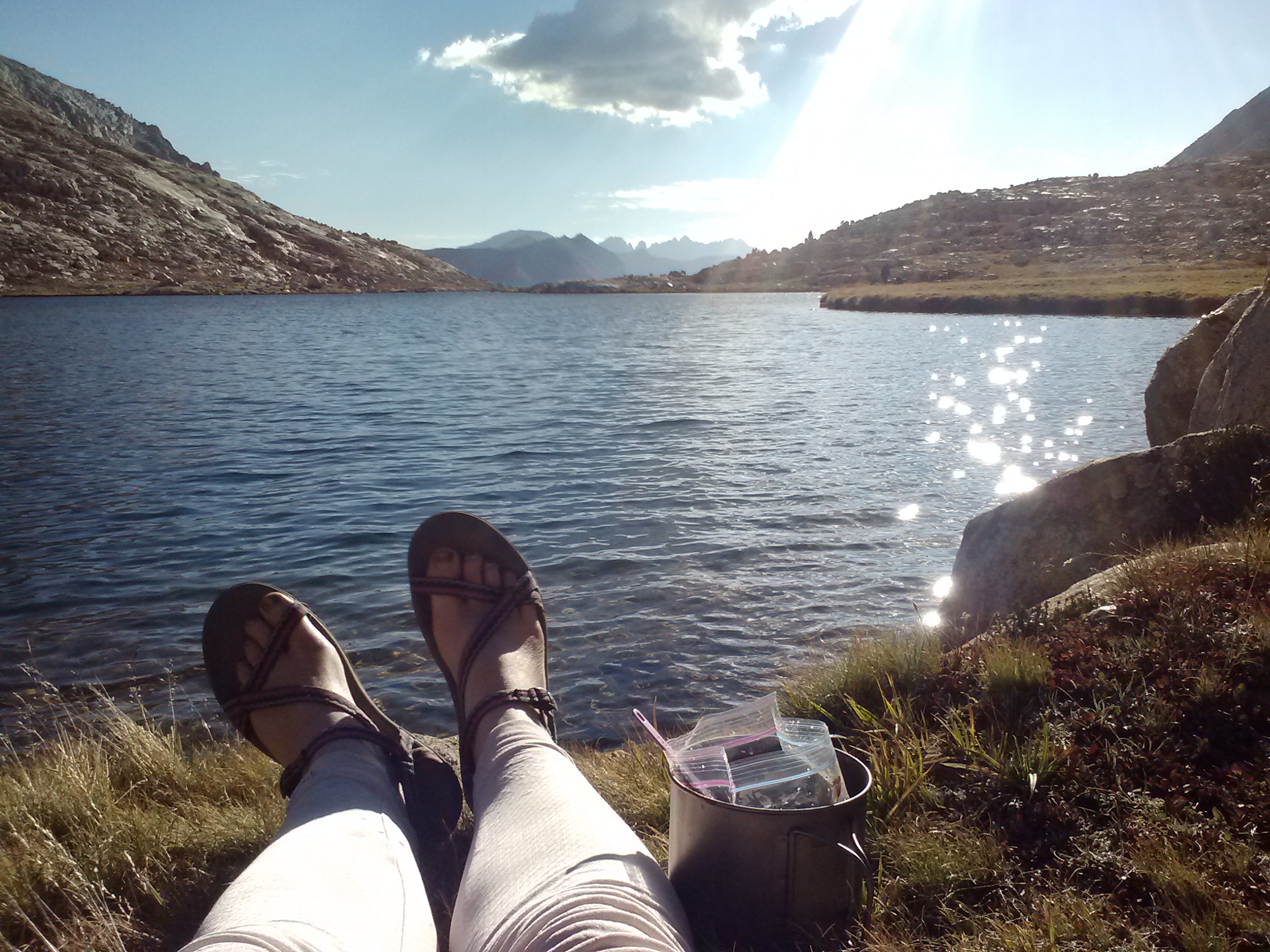
I stopped at the meadow for lunch and device charging. Next time, I need to rig up my pack so I can just charge my gear while I walk. I’m using a Suntactics solar charger and love it! It’s lightweight, right for the price, and hasn’t ever failed me.
Suntastics solar charger & Kindle
My new favorite spot on planet Earth
At that point, I temporarily departed the PCT and stepped onto the JMT, the trail I was so heartbroken to leave two years prior. The JMT pretty much follows the PCT all the way from Tuolumne Meadows in Yosemite to Crabtree Meadow, then breaks off and finishes at the summit of Whitney.
The “welcome” sign at Upper Crabtree Meadow
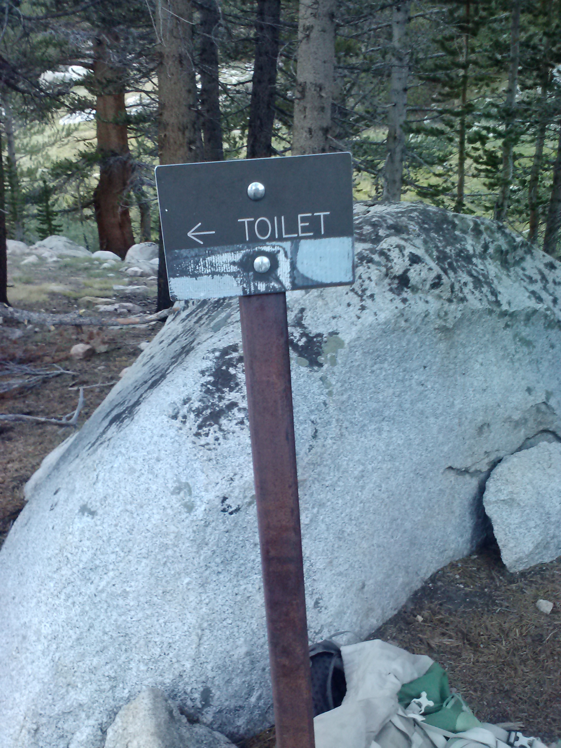
At Rock Creek Junction, there’s a famous box full of “wag bags” which you’re required to carry above that elevation for your… um… waste. I think most people fly through the junction, pick up their bag, and head on up. Seeing as I wanted to poke around Upper Crabtree Meadow, which was just across the creek from the junction, I was lucky enough to spot a peculiar sign to find in the wilderness: “Toilet.”
The outhouse was located at the end of the meadow on a raised platform and had just two walls. As you sat there, you looked straight out onto the meadow. It truly felt like a throne, and I had to laugh as I sat there.
Looking down on Lower Crabtree Meadow
All the way up to Guitar Lake, the trail follows Whitney Creek, which was just beautiful. Every time I happened upon a little beach or conventiently placed sitting rock next to the creek, I wanted to stop and absorb it all. I was careful not to dilly dally too much, as I remembered David and Danny’s advice about getting up to Guitar Lake early for a good campspot. And an excellent campspot I did find!
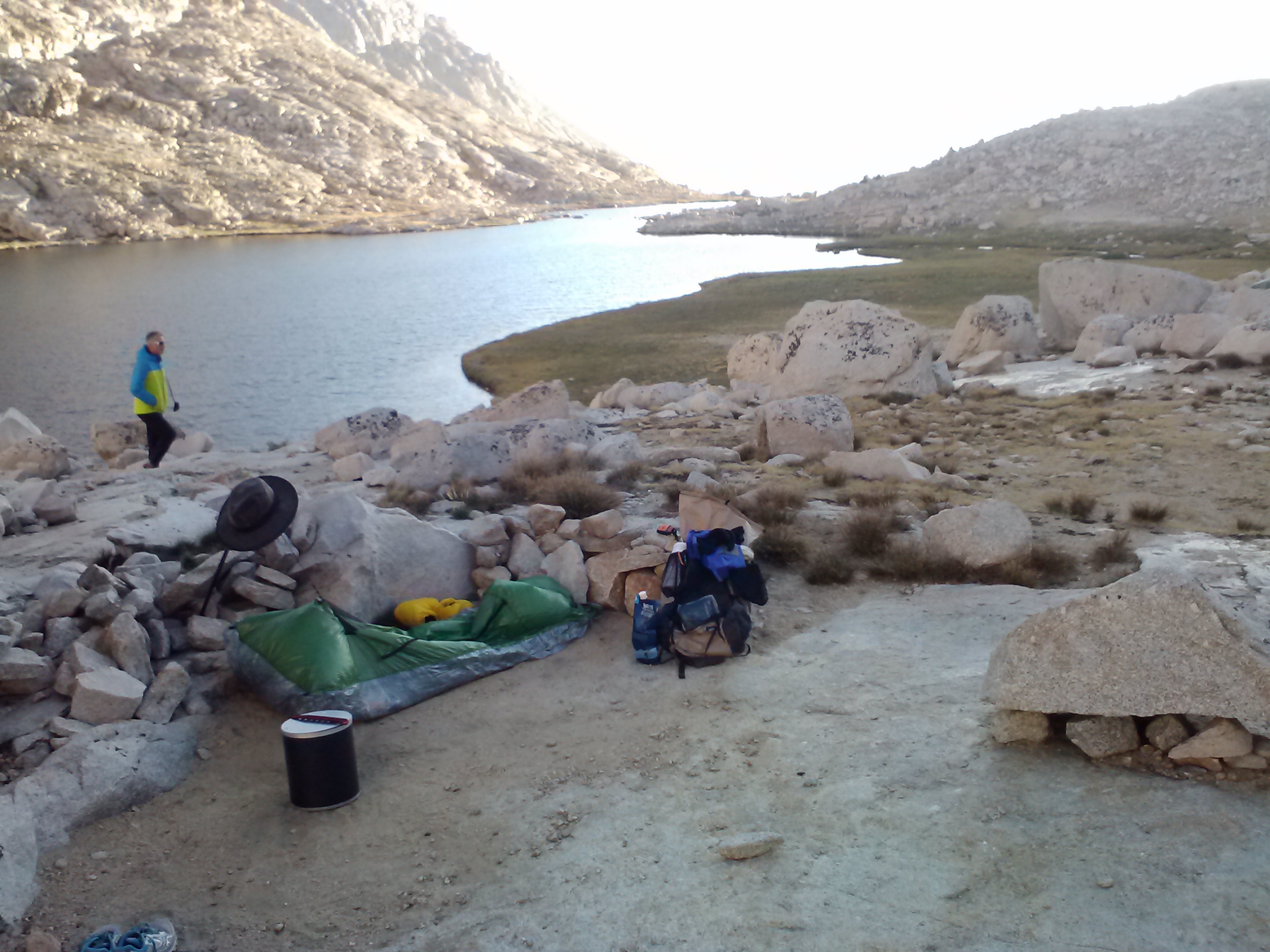
Third night’s campsite at Guitar Lake
Dinner by the lake
There must’ve been at least 30 campers at Guitar Lake that evening; and, yes, all the good spots were taken quickly! I had fun stacking rocks around my little home for the night. I knew there probably wouldn’t be any wind, but the inner Lincoln Log-lovin’ child in me couldn’t resist. Dinner that evening was ramen with chicken and veggies with a fabulous lakeside seat.
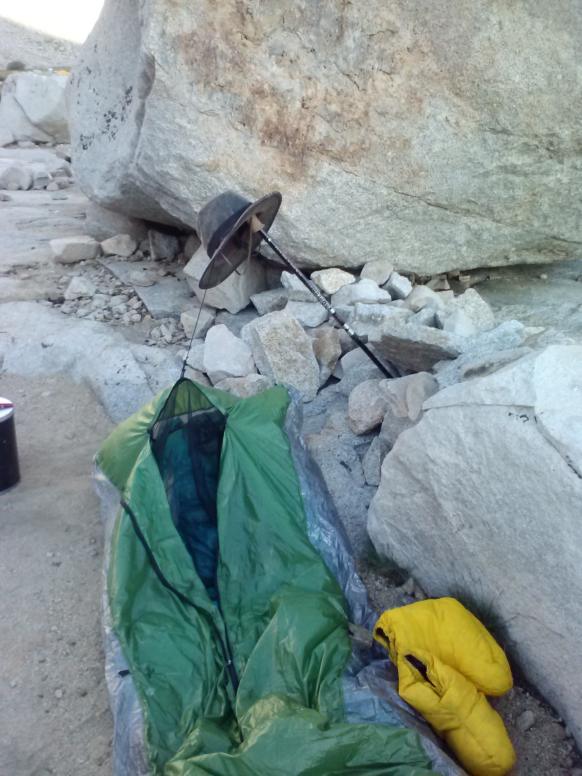
I chatted with a trio of Brits next door who were all very interesting and fun. One of them was a music critic from London, one of them had two knee replacements, and one of them helped me rig up my trekking pole to hold the bivy cord away from my face.
Bivy with rigged up trekking pole
Day 4
I expected it to be a cold night because we were at an elevation of 11,552 feet. Turns out the rocks gave off a fair amount of warmth and cold air likes to sink to the bottom of valleys. It was quite chilly at 4:00 in the morning when I woke up. I peeked out of my nest and saw a train of twinkling lights making its way up the side of Mt. Whitney. Turns out many hikers had started hiking at 2 a.m. to catch the sunrise at the summit. I thought how noble and awesome they all were, and then snuggled deeper into my bag. An hour later I was up and packing. I set off for the climb in the dark with the trail to myself. The Brits were up, too, but took their time making tea.
As I reached the tarns just above Guitar Lake I was already feeling winded and my pack felt heavy. Further up, an older gentleman caught me by surprise when he called from off the trail, “Last water source!” That got us talking and, since I was going to be coming back down the same way, he convinced me to leave all my gear right there on the side of the trail. At first I wasn’t sure it was a good idea. What if someone stole something? What would I do without a sleeping bag or my stove? Upon further consideration, I came to the conclusion no one in their right mind would want to carry any more gear either up Whitney or down it, so my gear was sure to be safe! Learning to trust other hikers was a new lesson for me that day.
Early morning light on Guitar Lake
The first beams of sunlight hitting the tips of the mountains
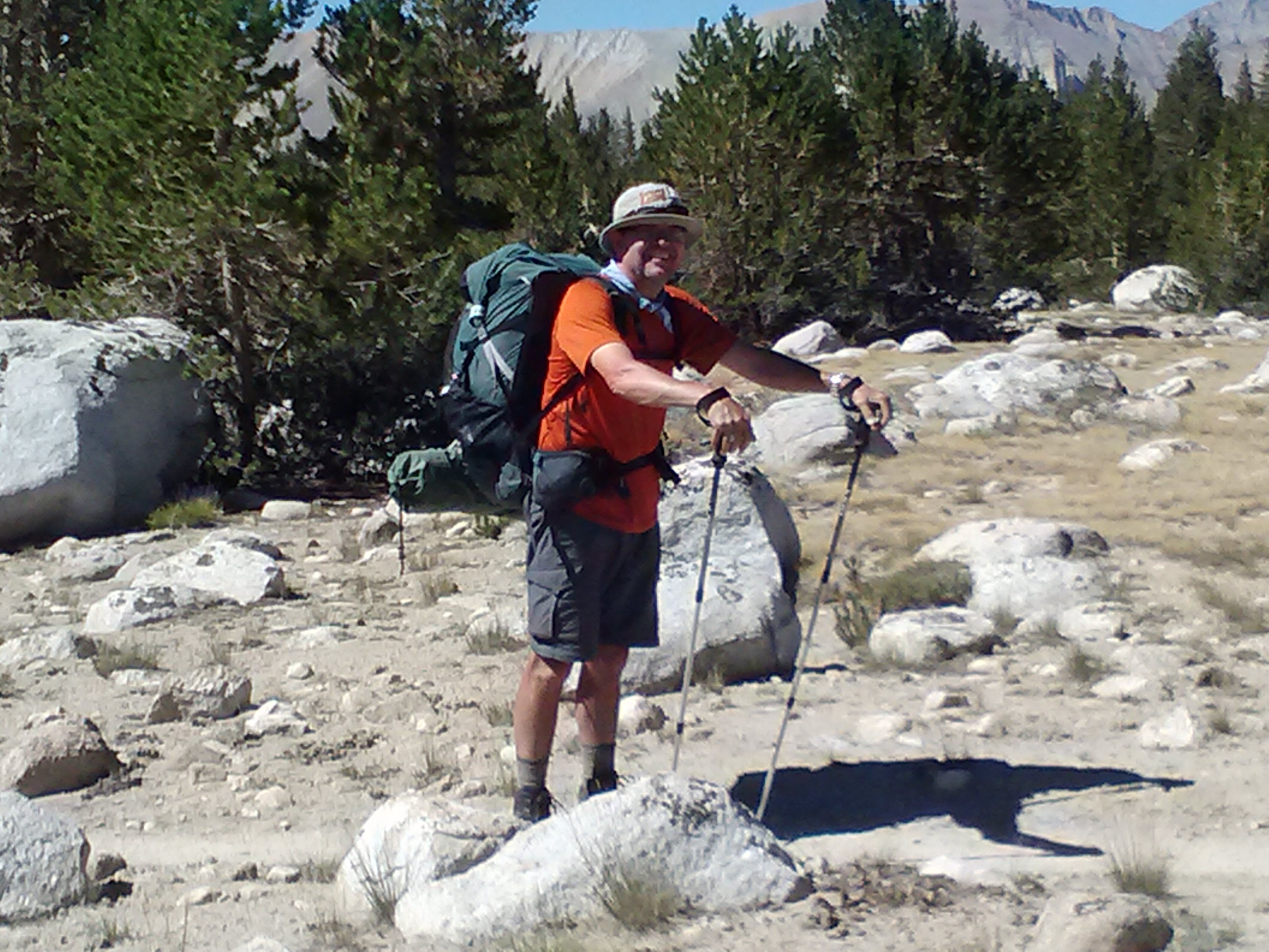
I felt kinda naked with only my lunch, water bottles, and camera/phone in my big backpack, but I also felt lighter! My new friend, Kellen, and I hiked all the way to the summit together. We had some good chats along the way about life back home (he’s an attorney from New Mexico, who does Shakespearean acting on the side) and pointing out cool views to each other.
Chilly morning!
Mt. Hitchock and reflection in it’s lakes, with Whitney’s shadow
Mt. Whitney switchbacks
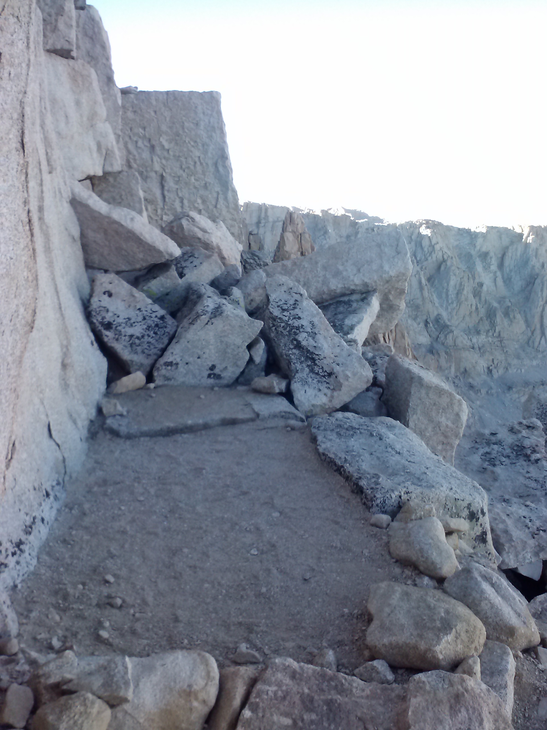
Small bivy campsite halfway up the switchbacks
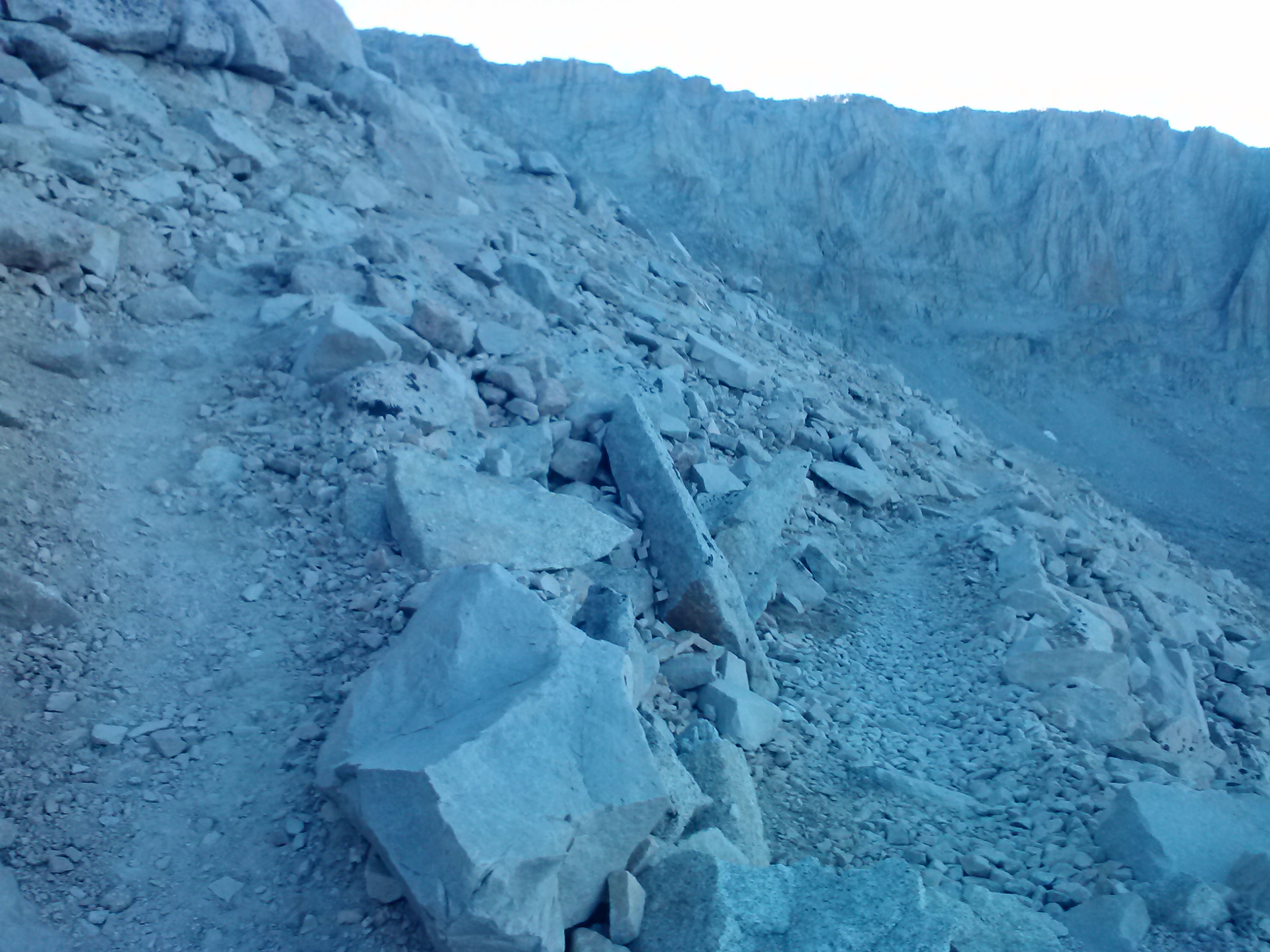
The switchbacks were really not so bad going up, plus the views were a great distraction from any physical discomfort. I do wonder, though, if there is possibly a rockier place in the universe that Mt. Whitney.
Halfway up the switchbacks, we came to a well known bivy campsite. It gave me the shivers just looking at the sheer drop off one side of the site. I knew that if I ever camped there, I’d be the goose who got up in the night for a pee and tumbled off the side!
Rockiest place in the universe
Passing Whitney Portal Trail Crest, it was just another 1.9 miles to the summit. The next portion of the trail was even rockier than the switchbacks, and scrambling over rocks with verticle drops to one side gave me a sense of mountaineering, rather than hiking.
Climbing an earthen wave
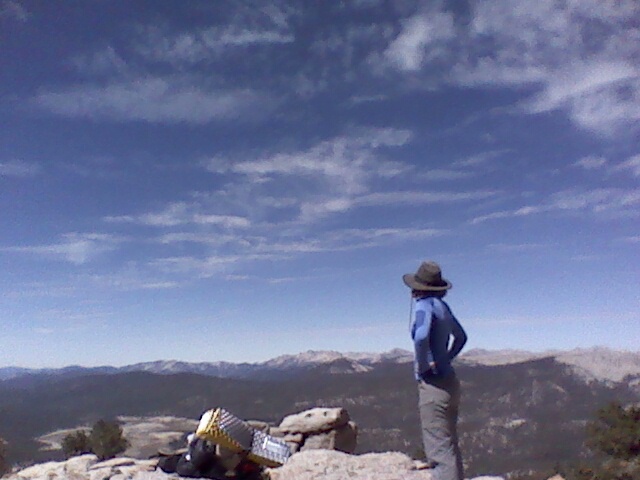
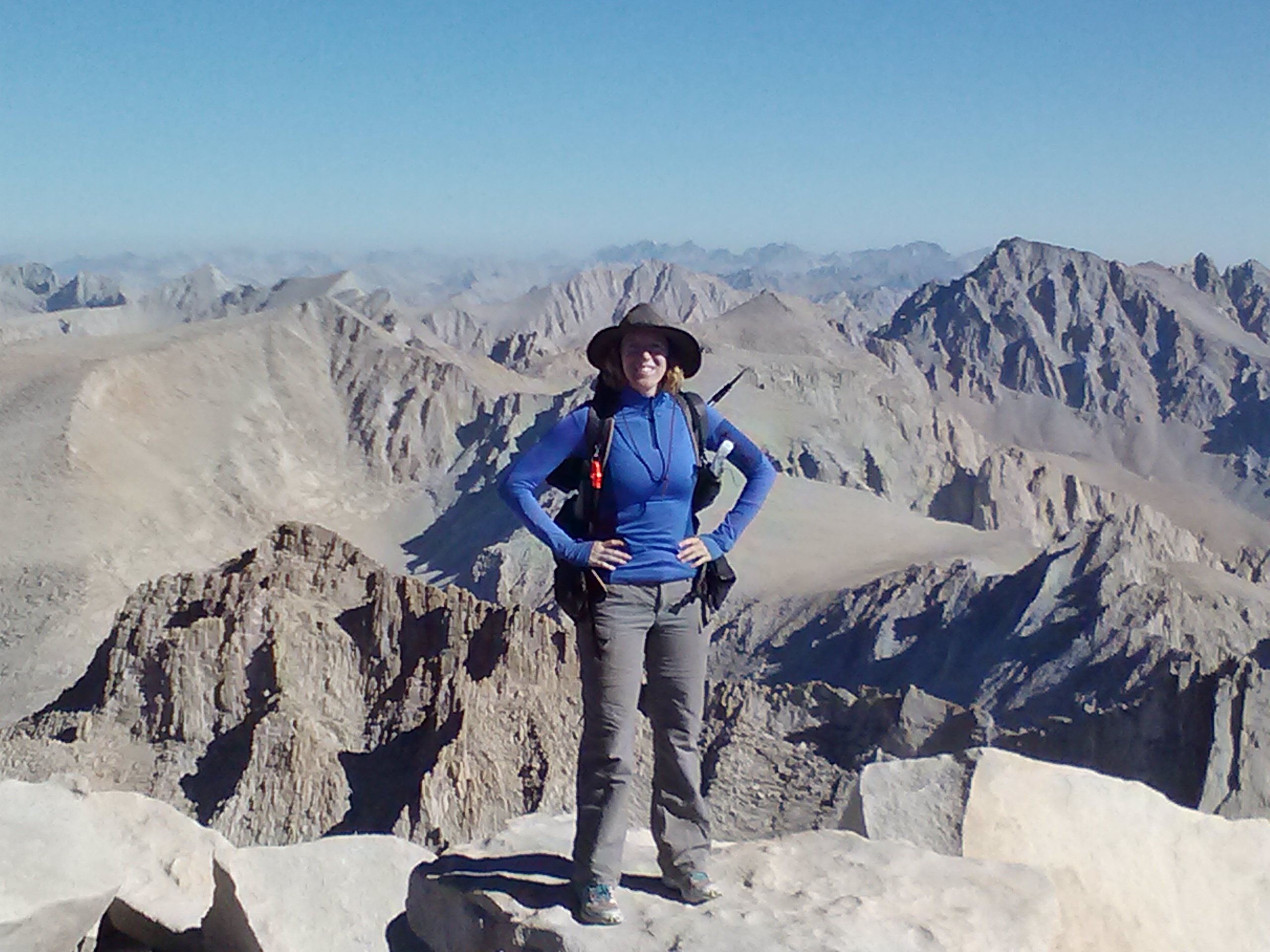
There were many moments of lightheadedness as I adjusted to the altitude, but I felt good nonetheless. Kellen and I reached the top just before the Brits and shortly after the sunrise crowd had left. We’d also beaten the crowd coming up from Whitney Portal, so we pretty much had the summit to ourselves. I sat there and ate my hummus and crackers, taking pictures, and counted how many weeks it’d been since my knee surgery. I didn’t cry for joy or anything, but I did feel really good about myself. I tried calling my parents, but didn’t get any reception. One of the Brits did, though. It was surreal listening to him talk to Delta about changing his return flight to the UK.
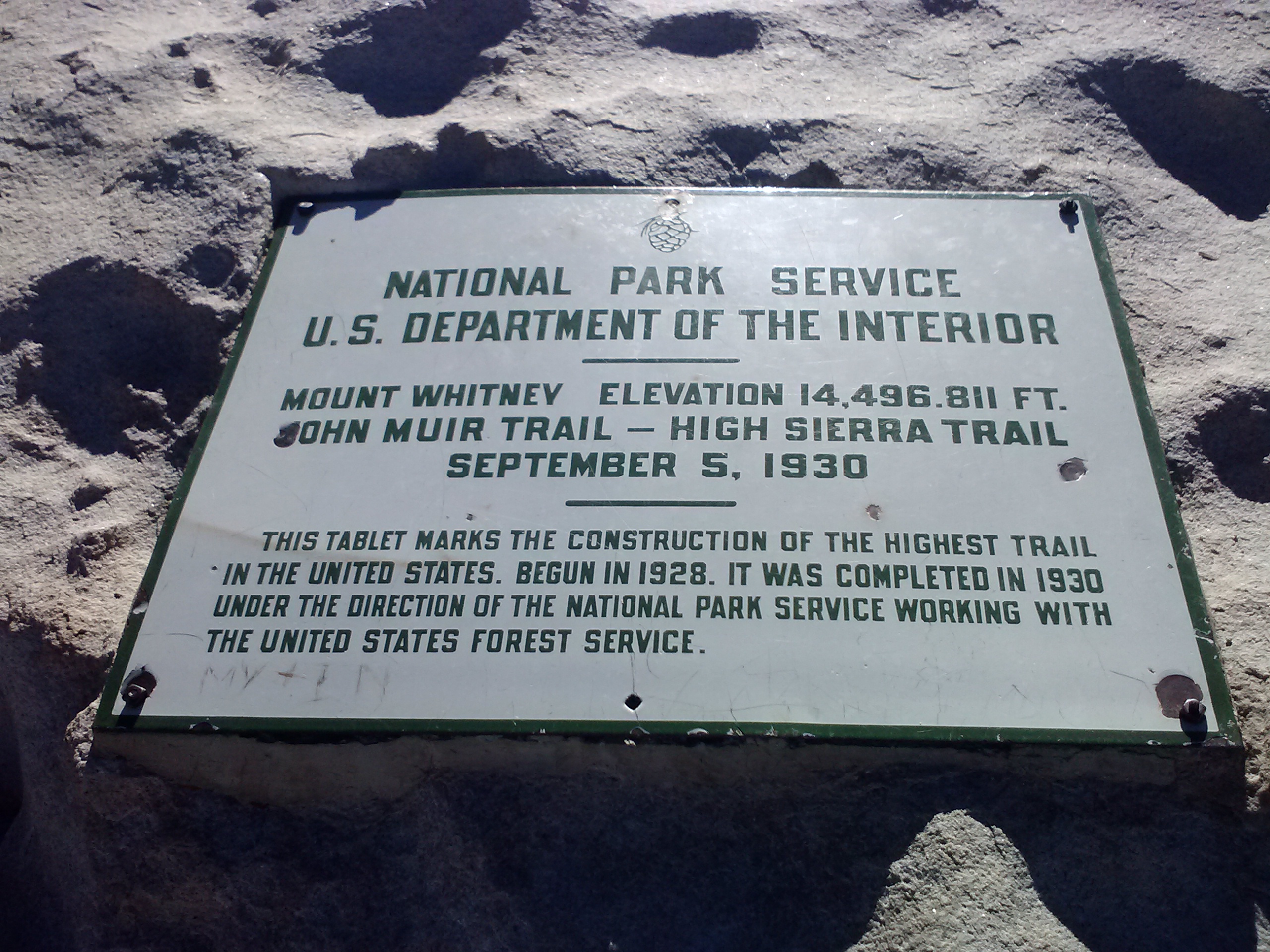
Actually, the height is now 14,505 ft.
Just as the Whitney Portal hiker pack started to trickle in, Kellen and I moved on out. He moved much faster than me down the mountain because my knees, which felt so great going up, were hurting on the way down- and what a long way down it was! I stopped at Guitar lake to eat lunch and soak my knees in the freezing cold water. In order to get my knees in the water, I had to actually SIT in the water. It was icy cold and I sat there for as long as I could stand it. As soon as a breeze kicked in, my whole body began shaking like my old Mazda on it’s last legs; I was outta there. Looking back, I think maybe I should’ve made a cup of hot tea to sip while soaking.
Earlier that day, I had thought I’d hike further down and camp at Wallace Creek, but my knees were saying “No, too much down hill!” I decided I’d aim for Upper Crabtree Meadow instead. It’d be nice to check out my friend, the outhouse, again, anyhow!
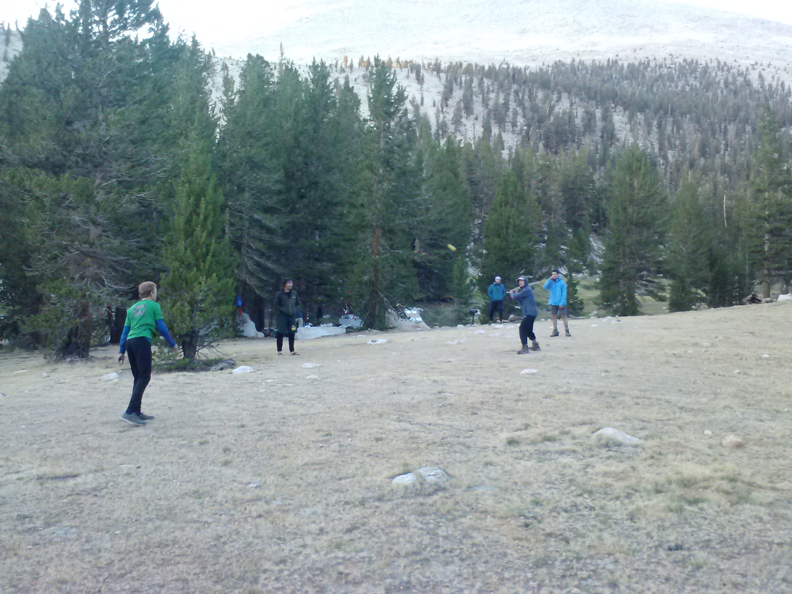
Upper Crabtree was overrun with a charming group of 12 year old Boy Scouts from Orange County and their dads. They were super friendly, and I couldn’t help but gawk at the amount of Mountainhouse and Backpacker’s Pantry meals they’d brought, not to mention the size of their stove. With all the gentlemen around, I had to be especially discreet about sponge bathing up the creek and changing into my pjs behind bushes. Kellen camped nearby and, with all the people that night, there was definitely a festive feeling in the air.
Boy Scouts playing stick ball…
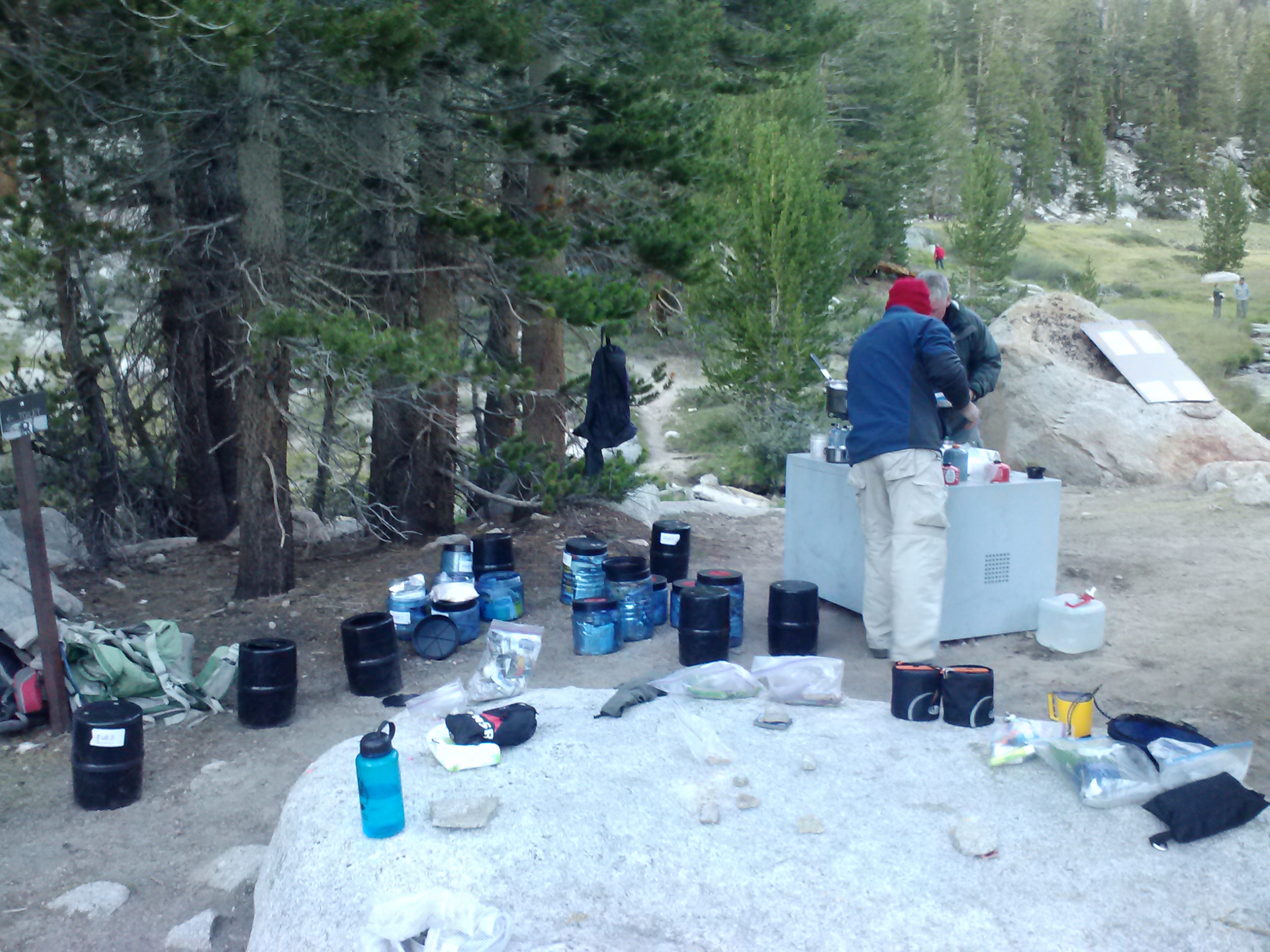
Dad scouts doing the dinner clean-up.
Fourth night’s campsite at Upper Crabtree Meadow
Day 5
It appeared to be true: the cold air definitely seemed to settle in the lower elevations because it was cold that night! I was up at 6 a.m. and sneaked out of camp before anyone else was awake. I wasn’t really sure where I might camp that evening, but my original goal had been Tyndall Creek below Forester Pass. I decided I’d just take it easy and see how my knees felt when I got there.
Kellen, the Shakespearean attorney from New Mexico
Two miles down the trail that morning, I stoped to change out of my pj’s and eat breakfast. As I dug through my pack, I had the feeling something was missing. Hat? Check. Spot GPS? Check. Bivy?Check. Kindle? … iPod? … solar charger? … Having taken out my electronics bag that morning to pack up my bear canister, I had left the bag on top of the bearbox. Again went the backpack into the dirt, and again began the huffing and puffing of indignation, only this time, it was surlier. A mile into my electronics bag recovery mission, I passed Kellen on his way up the trail. He offered to wait for me and I told him not to bother, that I’d catch-up. And catch-up I did! It was amazing how fast I could move without a backpack. With a quick “Good Morning!” to the Scouts, I scooped up my bag and dashed back to my waiting pack. Kellen must’ve been taking his sweet time because he was only a bit further up the trail after I grabbed my pack (now with all gear accounted for).
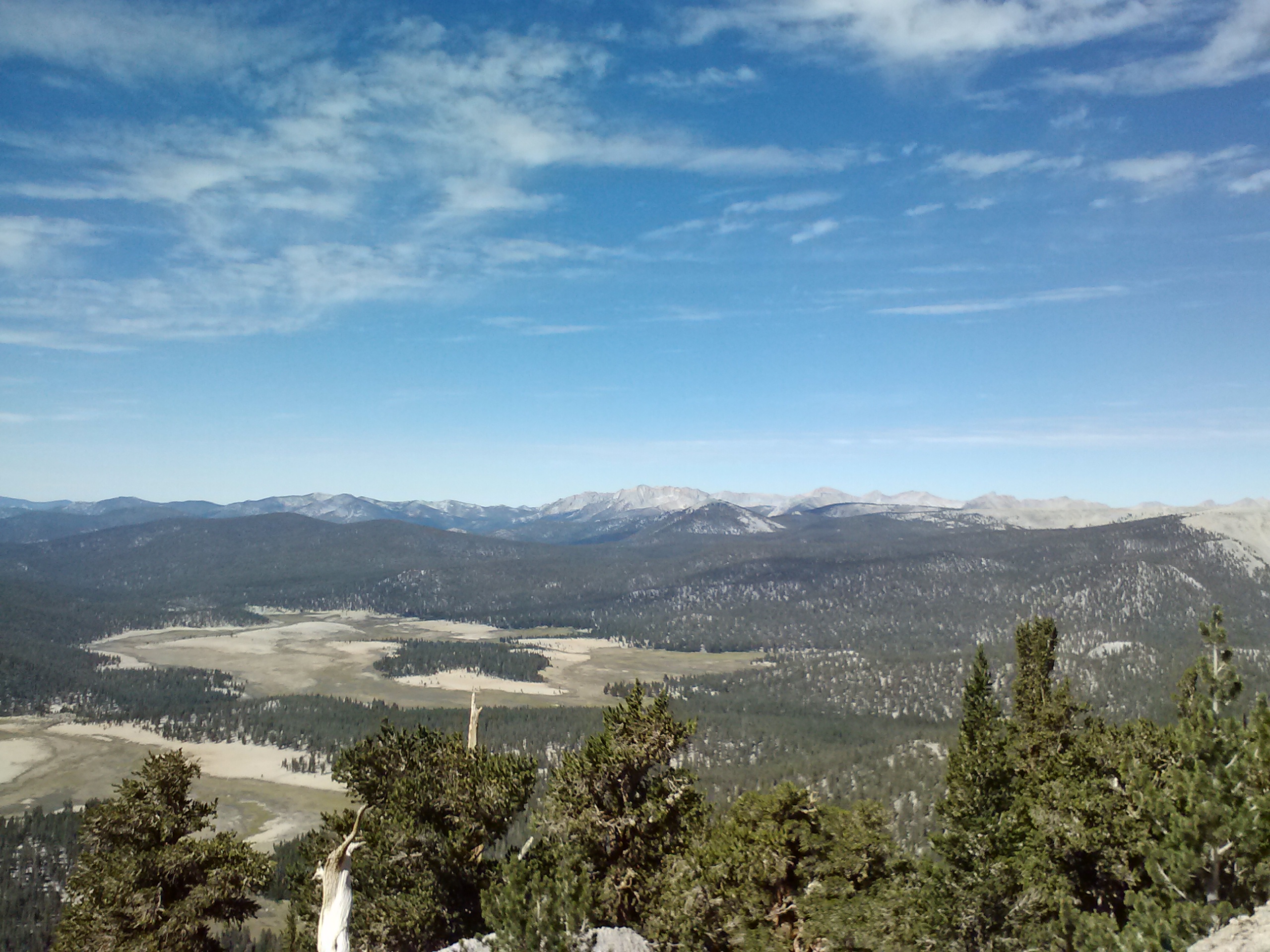
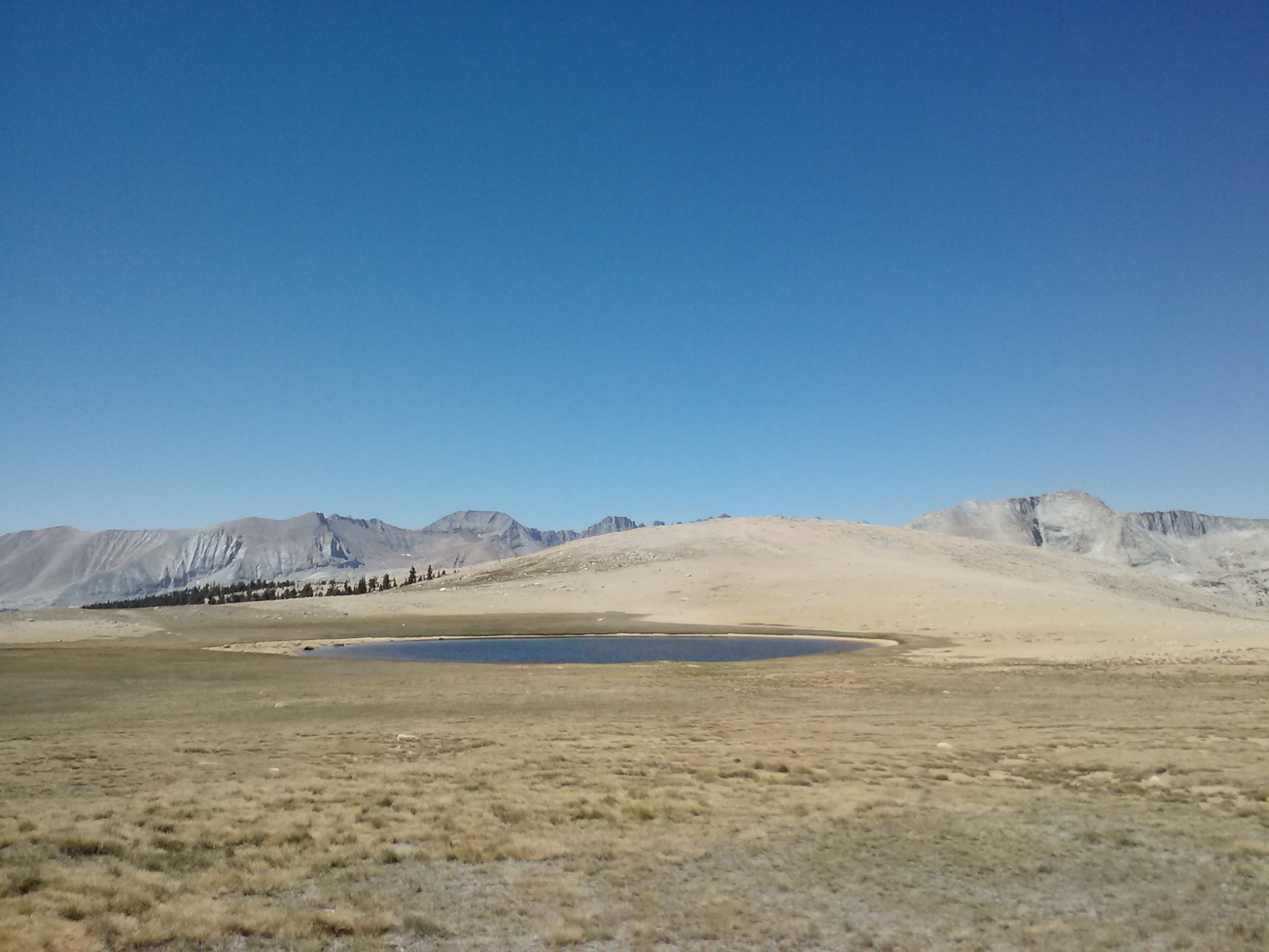
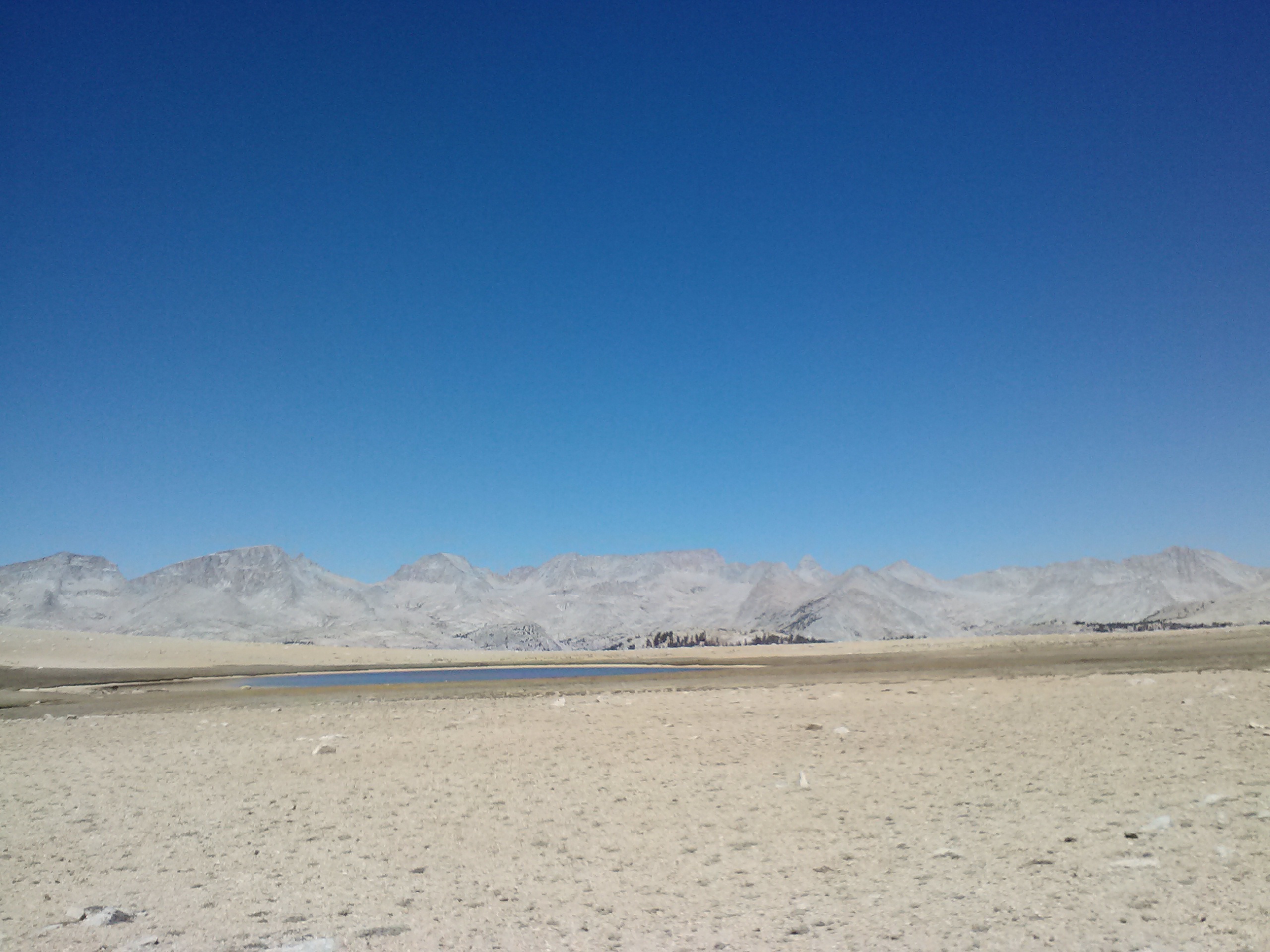
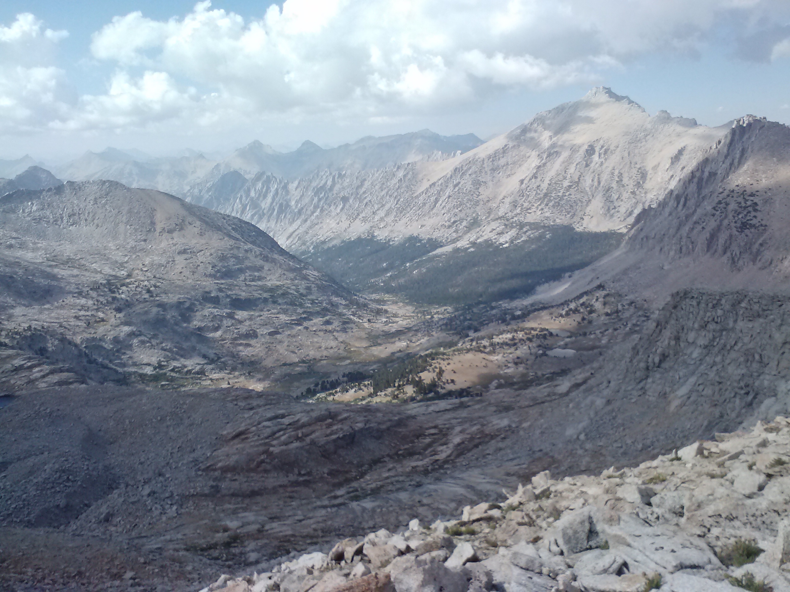
Wallace and Wright Creeks were the next crossings and both were lovely spots. Part of me regretted not being able to camp at Wallace Creek because it was so pretty. As I hiked along, I suddenly found myself in the middle of what looked very much like the surface of Mars. Turns out it was Bighorn Plateau and I had completely forgotten it was coming up! It’s striking and austere beauty took away my breath, and I repeatedly stopped to gaze around. My photos can do it no justice because the camera just couldn’t capture the sense of immense space and of earth meeting sky.
Bighorn Plateau
Bighorn Plateau
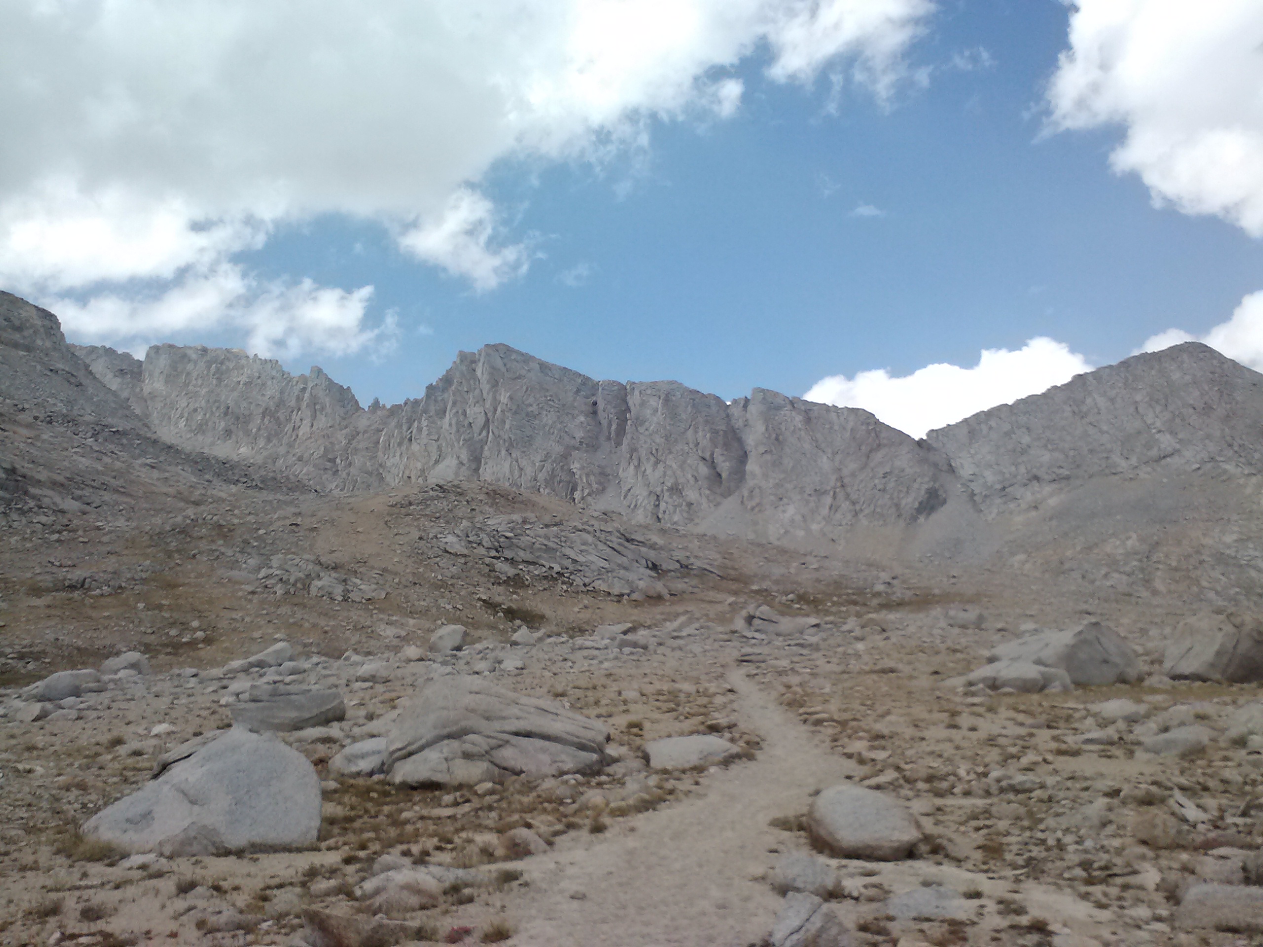
Kellen moved on ahead and I was left to my own devices on the trail. Coming upon Tyndall Creek, I seriously considered staying there for the night because it was so nice, but it was only 2:00 and my legs were feeling good. As I had chosen to wear sandals this day, my feet were also feeling great. The sun was warm, the grass was soft- I could’ve just napped! Kellen had mentioned that there really wasn’t a place to camp between Tyndall and the other side of Forester Pass. At 13,180 feet, Forester is the highest pass on the PCT. I did some math and figured out that if I chose to do Forester Pass that afternoon, I’d get home a day early, and that settled it!
Lunch by Tyndall Creek
Tyndall Creek
The trail leading up to Forester Pass is a long, slow climb. It’s hard to believe you’re at such a high elevation because the ascent is so gradual. The only thing that gave me any indication of the altitude was my breathing. The afternoon trickled on and I felt like I wasn’t making much progress at all. The pass still appeared to loom far ahead. Everytime I stopped for a break, I checked the map again. Even though Kellen had said there were no campsites between Tyndall and the other side of Forester, the map showed a small site right at the base of the pass’s switchbacks. I decided that if I couldn’t make it over Forester, I’d camp there for the night. That backup plan looked less and less like a backup and more like a reality as dark clouds pooled in the sky and I still felt so far from the pass.
Approaching Forester Pass
Forester Pass
Everyone I passed on the trail was heading down for the day. Reaching the last tarns before the switchbacks, I found the little bivy site. It looked cold and exposed, and with the threat of rain on my tarpless shelter set-up, I wasn’t feeling good about it. I looked up at the switchbacks, towering straight above like a skyscraper. There, halfway up, was a little red T-shirt I recognized. I yelled up to Kellen and asked if he thought I should stay put or heave on over. He said to go for it and he’d wait for me on the other side.
Swallowing a fruit leather and my fear of being struck by lightening, upward I charged. I was so determined to get over the pass before rain or thunder that I didn’t stop to take any pictures. Looking down was practically out of the question. It was a sheer drop to a very nasty end if I fell, and it made me dizzy peering over the side. The closer I got to the pass, the darker the clouds became. I kept wondering if my hair would get staticy and be shortly follow by Zeus aiming at me from above! As if the clouds knew I was nervous and wanted to see me get even jumpier, little snowflakes began to fall gently all around me.
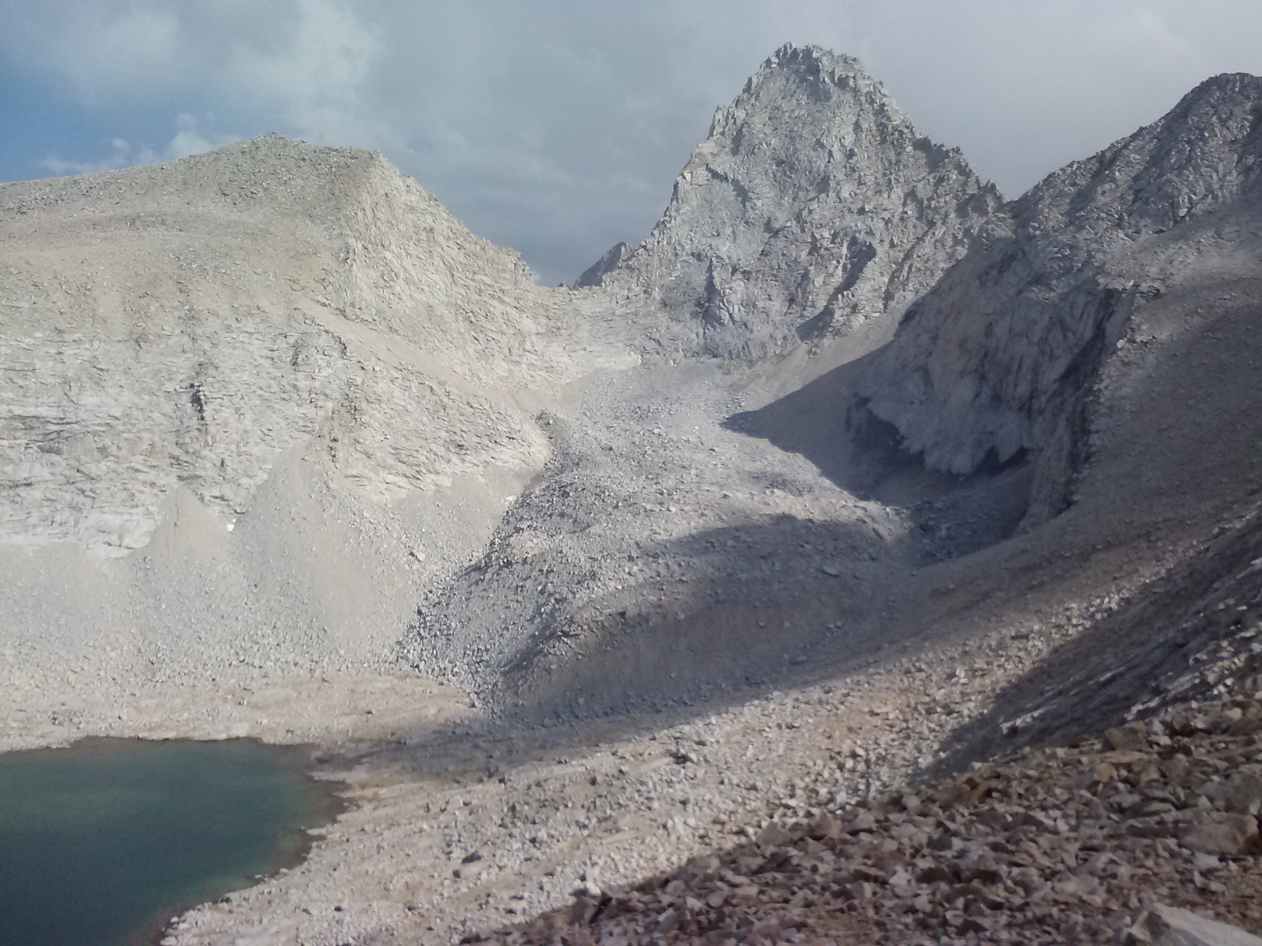
Evolution Valley just past Forester Pass, Kings Canyon NP
Since, the weather had been predicted to be rain free, I hadn’t bothered to bring any waterproof gear. It seemed that if I wasn’t going to be electrocuted, I was still going to be chilled in my wet clothes and sleeping bag. I hustled over the pass to catch up with Kellen and could hardly believe the beauty of the valley on the other side. It looked like a prehistoric secret valley straight out of The Land Before Time. Again, it seemed as if the clouds were having a good go at me for their own entertainment because just as I reached Kellen, they began to break up. The snowflakes were still falling, but things were looking up for the evening!
I tailed after Kellen far enough down the valley to reach a collection of incredible campsites among some trees. Each site seemed to be cut into the hillside like Mesa Verde, and the beginnings of Bubbs Creek wrapped around them all.
Fifth night’s campsite near PCT mile 783
An older couple were camped just above the site I picked. Hearing my plan of camping below the Forester switchbacks, the wife exclaimed it was good that I hadn’t. She said it was called Forester Base Camp and that she’d stayed there once only to find herself sinking into the damp earth all night long. I’m so glad I didn’t choose to bivy camp there! I felt VERY safe and cozy with the site I had for the night. I cooked up another qunioa and chicken soup and Kellen shared some of his leftover Mountain House Beef Chilli Mac. Checking the map, I couldn’t believe I’d actually put in 20 miles that day, especially with just my sandals. Without the electronics recovery mission, it would’ve only been 16 miles. Even though those 4 miles were done without a pack, I took pride in knowing it was the farthest I’d ever walked in a single day in my life. I fell asleep delighted at the thought of putting in more 20-miler days on the PCT and dreamed of having a burger in Lone Pine the following afternoon.
Day 6
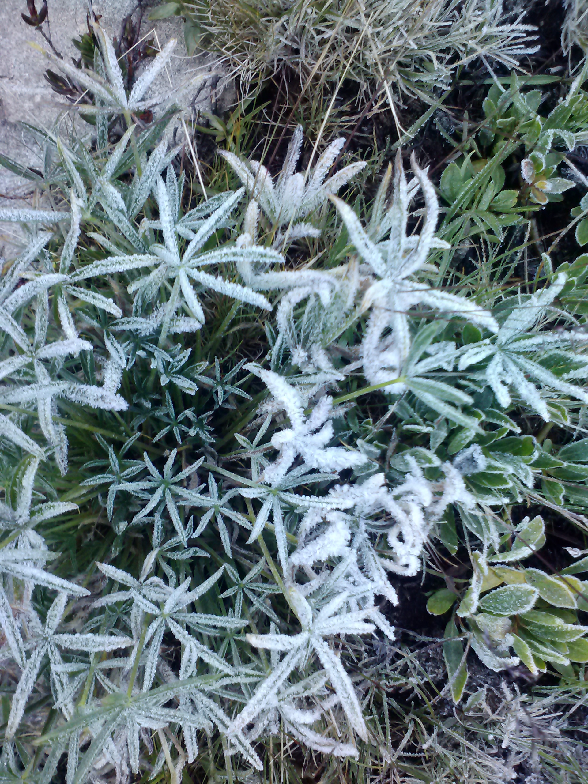
Frosty morning!
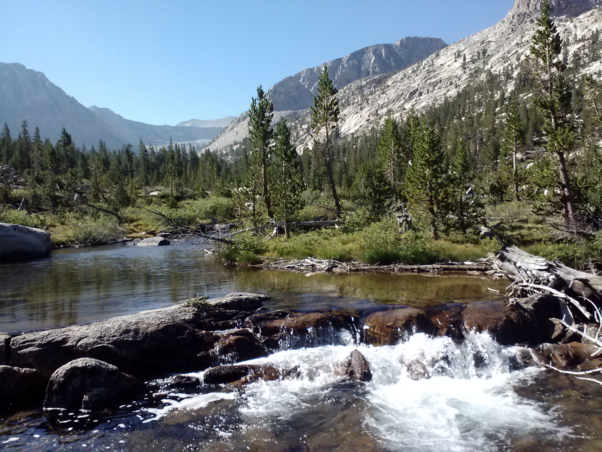
It was another cold night and I hiked the next morning amazed at all the frost around me. For most of the morning, the trail followed Bubbs Creek down into Evolution Valley. Bubbs must’ve been some guy to get such a beautiful, prominent creek named after him!
After a few miles of hiking together, Kellen needed to turn off onto a different trail. We said our goodbyes and congratulated each other on our Whitney summit. It was great having someone else for those moments of success and fear. And it’s those moments, which I know there will be more of, that make me hope to meet many more people like him on my PCT journey.
Bubbs Creek
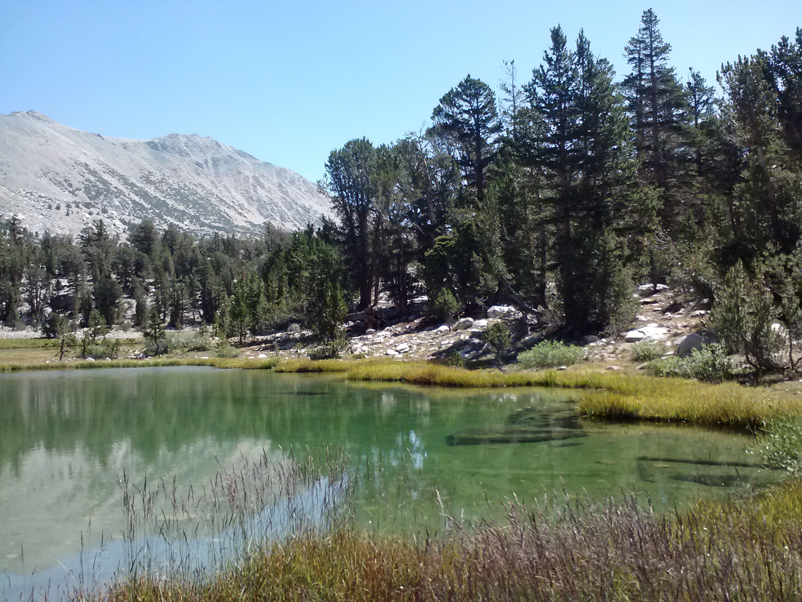
My own turn off from the PCT came up soon after Kellen departed. My exit trail would take me 7.1 miles over Kearsarge Pass and down into Onion Valley, where my car awaited me. They were surely some of the prettiest 7 miles I’d done on this trip. Or maybe they were just like all the other pretty spots I’d walked through, but these were extra special being, as they were, the final miles of the trip. The climb was difficult, but the lakes I passed were stunningly clear. I was tempted to relax for the afternoon by a couple of them, but the call of a Lone Pine burger was too strong! I made a mental note to come back to Bullfrog and Kearsarge Lakes for a little camping, exploring, and maybe fishing someday.
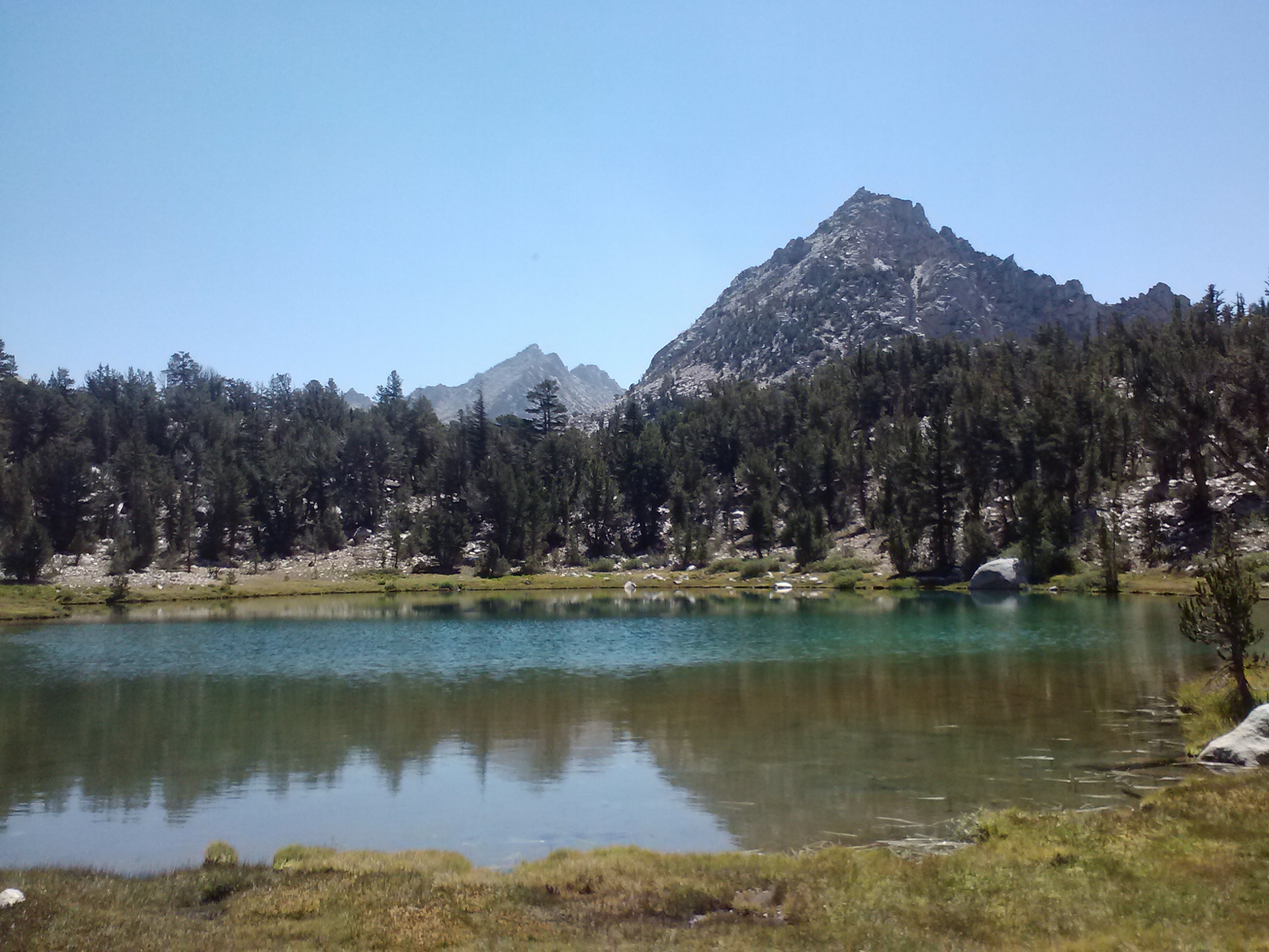
The pond below Bullfrog Lake
Crystal clear water
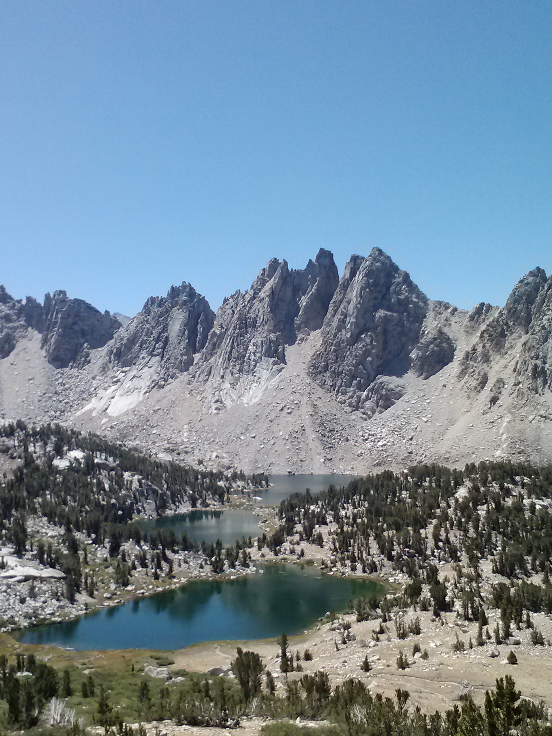
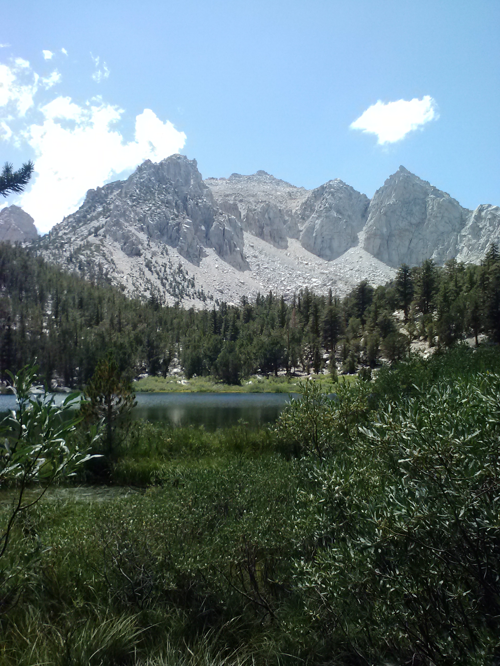
Kearsarge Pinnacles and Kearsarge Lakes
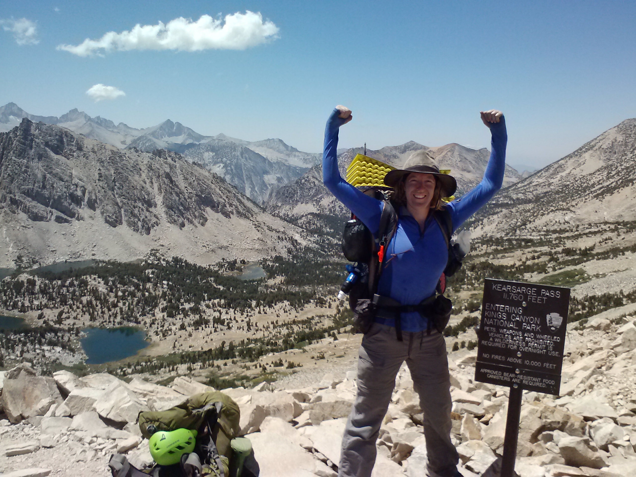
Kearsarge Pass
The long steep climb over Kearsarge was nothing compared to going down the other side. This trip taught me my knees would carry me uphill as far as I wanted, but downhill needed to be approached with TLC. I was really aching as I neared Onion Valley. Just as I was about to exit the trail, I saw a young hiker wearing a T-shirt from a school I where teach, and I stopped him to see if he’d been a student there. Indeed he had been! It was incredible to chat with him about mutual acquintances there at the end of Kearsarge Pass! It’s amazing to me how we can step out of our comfortable civilized bubbles, and still find people to connect with.
Gilbert Lake and Kearsarge Pass
Days 1-4; I traveled left to right on this chart from Halfmile’s maps.
There are a number of Facebook groups for the PCT worth checking out: section hikers, trail angels, the PCTA, and class of whatever year you want! Just type PCT into the Facebook search bar and they’ll all pop up.